Category:Belső-tó
Jump to navigation
Jump to search
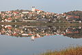
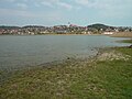
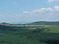
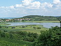
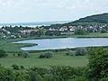
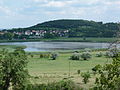
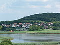
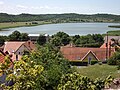
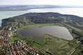
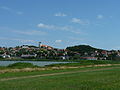
A Tihanyi félszigeten lévő Belső-tó keleti partja Tihany falu területére esik, ezért Tihany részének tekinthető.
| Object location | | View all coordinates using: OpenStreetMap |
|---|
lake in Hungary  | |||||
| Upload media | |||||
| Instance of | |||||
|---|---|---|---|---|---|
| Location | Veszprém County, Hungary | ||||
| Width |
| ||||
| Length |
| ||||
| Area |
| ||||
| Elevation above sea level |
| ||||
 | |||||
Media in category "Belső-tó"
The following 56 files are in this category, out of 56 total.
-
 A Belső-tó - panoramio.jpg 3,648 × 2,362; 2.89 MB
-
 A tihanyi félszigeten.jpg 4,608 × 3,456; 3.49 MB
-
 Belso to az apatsaggal 01.jpg 5,184 × 3,456; 5.98 MB
-
 Belso to az apatsaggal 02.jpg 5,184 × 3,456; 6.49 MB
-
 BelsoToTihany.jpg 4,000 × 3,000; 5.62 MB
-
 Belső lake, Cser Hill, Szarkádi forest. - Tihany Peninsula.JPG 2,272 × 1,704; 1.01 MB
-
 Belső Lake, Cser Hill. - Tihany Peninsula.JPG 2,272 × 1,704; 1.01 MB
-
 Belső-tó.jpg 2,848 × 2,134; 1.33 MB
-
 Belső-tó. Fortepan 11307.jpg 3,529 × 2,385; 4.53 MB
-
 Belső tó. Fortepan 19184.jpg 3,068 × 1,994; 3.68 MB
-
 Tihany - 2014.07.24 (47).JPG 4,320 × 3,240; 5.5 MB
-
 Tihany - 2014.07.24 (48).JPG 4,320 × 3,240; 5.4 MB
-
 Tihany - 2014.07.24 (49).JPG 4,320 × 3,240; 5.67 MB
-
 Tihany - 2014.07.24 (5).JPG 4,320 × 3,240; 5.29 MB
-
 Tihany - 2014.07.24 (50).JPG 4,320 × 3,240; 5.3 MB
-
 Tihany - 2014.07.24 (51).JPG 4,320 × 3,240; 5.53 MB
-
 Tihany - 2014.07.24 (52).JPG 4,320 × 3,240; 5.32 MB
-
 Tihany - 2014.07.24 (53).JPG 4,320 × 3,240; 5.23 MB
-
 Tihany - 2014.07.24 (54).JPG 4,320 × 3,240; 5.61 MB
-
 Tihany - 2014.07.24 (55).JPG 4,320 × 3,240; 5.61 MB
-
 Tihany - 2014.07.24 (56).JPG 4,320 × 3,240; 5.43 MB
-
 Tihany - 2014.07.24 (57).JPG 4,320 × 3,240; 5.47 MB
-
 Tihany - 2014.07.24 (58).JPG 4,320 × 3,240; 5.43 MB
-
 Tihany - 2014.07.24 (59).JPG 4,320 × 3,240; 5.35 MB
-
 Tihany - 2014.07.24 (6).JPG 4,320 × 3,240; 5.24 MB
-
 Tihany - 2014.07.24 (60).JPG 4,320 × 3,240; 5.65 MB
-
 Tihany - 2014.07.24 (61).JPG 4,320 × 3,240; 5.43 MB
-
 Tihany - 2014.07.24 (62).JPG 4,320 × 3,240; 5.73 MB
-
 Tihany - 2014.07.24 (63).JPG 4,320 × 3,240; 5.57 MB
-
 Tihany - 2014.07.24 (64).JPG 4,320 × 3,240; 5.14 MB
-
 Tihany - 2014.07.24 (65).JPG 4,320 × 3,240; 5.26 MB
-
 Tihany - 2014.07.24 (66).JPG 4,320 × 3,240; 5.26 MB
-
 Tihany - 2014.07.24 (67).JPG 4,320 × 3,240; 5.35 MB
-
 Tihany - 2014.07.24 (73).JPG 4,320 × 3,240; 5.41 MB
-
 Tihany - 2014.07.24 (75).JPG 4,320 × 3,240; 5.43 MB
-
 Tihany belső tó.jpg 1,103 × 606; 77 KB
-
 Tihany Cemetery View South to Inner Lake.jpg 1,712 × 2,560; 1.44 MB
-
 Tihany i Belső-tó.JPG 4,928 × 3,264; 7.11 MB
-
 Tihany inside lake.jpg 2,592 × 1,944; 1.03 MB
-
 Tihany látképe a Belső-tó felöl - panoramio.jpg 2,048 × 1,536; 699 KB
-
 Tihany légifotó1.jpg 480 × 311; 29 KB
-
 Tihany, 2008 - panoramio (1).jpg 1,500 × 910; 643 KB
-
 Tihany, Belső-tó.jpg 4,608 × 3,456; 2.61 MB
-
 Tihany, Lake Balaton, Hungary.jpg 1,536 × 2,048; 1.32 MB
-
 Tihanycivertanlegi3.jpg 600 × 400; 85 KB
-
 View of Belső-tó from Kis-erdő-tető.JPG 2,560 × 1,920; 3.19 MB
-
 View of Belső-tó.JPG 2,560 × 1,920; 3.15 MB
-
 View of Belső-tő and Kis-erdő-tető.JPG 2,560 × 1,920; 3.32 MB
-
 View of Kis-erdő-tető with Belső-tó.JPG 2,560 × 1,920; 3.15 MB
-
 View of Tihany with Belső-tó 01.JPG 2,560 × 1,920; 3.16 MB
-
 View of Tihany with Belső-tó 02.JPG 2,560 × 1,920; 3.16 MB
-
 View of Tihany with Belső-tó 03.JPG 2,560 × 1,920; 3.22 MB
-
 View of Tihany with donkeys.JPG 2,560 × 1,920; 3.18 MB
-
 View to Belső Lake from Tihany.JPG 2,272 × 1,704; 1.01 MB
-
 Wikitábor 2012 20120804 120520.JPG 3,648 × 2,736; 2.03 MB
-
 Wikitábor 2012 20120804 120526.JPG 3,648 × 2,736; 2.63 MB


.JPG)
.JPG)
.JPG)
.JPG)
.JPG)
.JPG)
.JPG)
.JPG)
.JPG)
.JPG)
.JPG)
.JPG)
.JPG)
.JPG)
.JPG)
.JPG)
.JPG)
.JPG)
.JPG)
.JPG)
.JPG)
.JPG)
.JPG)
.JPG)
.JPG)


.jpg)


