Category:Bellenden Ker Range
Jump to navigation
Jump to search
English: Bellenden Ker Range is a mountain range in the Cairns Region, Queensland, Australia
mountain range in Queensland, Australia  | |||||
| Upload media | |||||
| Instance of | |||||
|---|---|---|---|---|---|
| Location | Queensland, AUS | ||||
| Mountain range | |||||
| Highest point | |||||
| Elevation above sea level |
| ||||
 | |||||
Media in category "Bellenden Ker Range"
The following 26 files are in this category, out of 26 total.
-
 A new day (22729850485).jpg 5,184 × 3,456; 9.75 MB
-
 Crossing at harvey creek (12713460415).jpg 5,184 × 3,456; 14.5 MB
-
 CSIRO ScienceImage 1336 Rainforest Canopy.jpg 2,657 × 1,801; 5.78 MB
-
 CSIRO ScienceImage 1337 Rainforest Canopy.jpg 2,657 × 1,778; 5.21 MB
-
 CSIRO ScienceImage 1371 Rainforest Canopy.jpg 2,657 × 1,796; 5.21 MB
-
 CSIRO ScienceImage 1593 Rainforest Canopy.jpg 1,820 × 2,657; 4.99 MB
-
 CSIRO ScienceImage 1594 Rainforest Canopy.jpg 1,808 × 2,657; 4.63 MB
-
 CSIRO ScienceImage 1595 Rainforest Canopy.jpg 1,823 × 2,657; 5.38 MB
-
 CSIRO ScienceImage 1657 Rainforest landscape.jpg 1,773 × 2,657; 4.73 MB
-
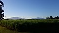
 Farm with Bellenden Ker Range in the background, Deeral, 2018.jpg 1,920 × 1,080; 476 KB
-
 Fast n slow (11944915944).jpg 5,184 × 3,456; 9.35 MB
-
 Harvey creek overflow (9848090276).jpg 5,184 × 3,456; 13.62 MB
-
 Harvey creek2 (14344358089).jpg 5,184 × 2,763; 11.47 MB
-
 Innisfail (Queensland) banner Mount Bellenden Ker from Sundown.jpg 5,312 × 759; 522 KB
-

-

-
 Morning (11560473106).jpg 5,184 × 3,456; 8.87 MB
-
 Mount Bellenden Ker summit and aerial cableway from Bruce Hwy.jpg 5,312 × 2,988; 1.92 MB
-
 Mount Bellenden Ker summit and aerial cableway from Telecom Rd.jpg 5,312 × 2,988; 2.84 MB
-

-

-

-
 Silhouette of Mount Bartle Frere and Mount Bellenden Ker from Sundown.jpg 5,312 × 2,988; 1.6 MB
-
 Silhouette of Mount Bellenden Ker from Sundown.jpg 5,312 × 2,988; 1.29 MB
-

-
 Sunrise at Bellenden Ker, Queensland.jpg 5,184 × 3,456; 12.4 MB
.jpg)
.jpg)


.jpg)
.jpg)
.jpg)


.jpg)


_banner_Mount_Bellenden_Ker_from_Sundown.jpg)