Category:Belize photographs taken on 2006-02-06
Jump to navigation
Jump to search
Countries of North America: Belize · Canada · Mexico · United States of America‡
‡: partly located in North America
‡: partly located in North America
| ← | 6 February 2006 | → | ||
| ← | February 2006 | → | ||

Belize photographs taken on 6 February 2006.
Image files should be categorized here automatically using {{taken on}} template. Direct categorisation is also possible, if automatic is impossible.
Media in category "Belize photographs taken on 2006-02-06"
The following 39 files are in this category, out of 39 total.
-
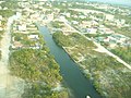
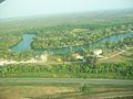
 Belize River - panoramio (1).jpg 2,848 × 2,132; 1.22 MB
-
 Belize River - panoramio.jpg 2,848 × 2,132; 1.23 MB
-
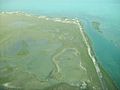
 Cangrejo Cay - panoramio (1).jpg 2,848 × 2,132; 1.39 MB
-
 Cangrejo Cay - panoramio (2).jpg 2,848 × 2,132; 1.43 MB
-
 Cangrejo Cay - panoramio.jpg 2,848 × 2,132; 1.15 MB
-
 Caye just offshore - panoramio (1).jpg 2,848 × 2,132; 1.24 MB
-
 Caye just offshore - panoramio.jpg 2,848 × 2,132; 1.24 MB
-
 Coast of Belize - panoramio (1).jpg 2,132 × 2,848; 1.04 MB
-
 Coast of Belize - panoramio (2).jpg 2,848 × 2,132; 1.35 MB
-
 Coast of Belize - panoramio (3).jpg 2,132 × 2,848; 1.05 MB
-
 Coast of Belize - panoramio.jpg 2,848 × 2,132; 1.21 MB
-
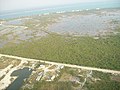
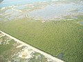
 Forest south of Ladyville - panoramio.jpg 2,848 × 2,132; 1.24 MB
-
 Houses in San Pedro - panoramio (1).jpg 2,848 × 2,132; 1.31 MB
-
 Houses in San Pedro - panoramio (2).jpg 2,848 × 2,132; 1.32 MB
-
 Houses in San Pedro - panoramio (3).jpg 2,848 × 2,132; 1.14 MB
-
 Houses in San Pedro - panoramio (4).jpg 2,848 × 2,132; 1.08 MB
-
 Houses in San Pedro - panoramio (5).jpg 2,848 × 2,132; 1.15 MB
-
 Houses in San Pedro - panoramio.jpg 2,848 × 2,132; 1.25 MB
-
 Houses next to Philip S. W. Goldson International Airport - panoramio.jpg 2,848 × 2,132; 1.15 MB
-
 Ladyville - panoramio.jpg 2,848 × 2,132; 1.18 MB
-
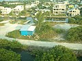
 Manmade ponds near San Pedro - panoramio.jpg 2,848 × 2,132; 1.2 MB
-
 Peninsula on Cangrejo Cay. - panoramio (1).jpg 2,848 × 2,132; 1.19 MB
-
 Peninsula on Cangrejo Cay. - panoramio.jpg 2,848 × 2,132; 1.31 MB
-
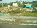
 Road near San Pedro - panoramio.jpg 2,848 × 2,132; 1.38 MB
-
 Road Near San Pedro - panoramio.jpg 2,848 × 2,132; 1.34 MB
-
 Shore of Cangrejo Cay - panoramio.jpg 2,848 × 2,132; 1.32 MB
-
 Shore of Cangrejo Cay. - panoramio.jpg 2,848 × 2,132; 1.27 MB
-
 South corner of Cangrejo Cay - panoramio.jpg 2,848 × 2,132; 1.39 MB
-
 Tarmac at Philip S. W. Goldson International Airport - panoramio.jpg 2,848 × 2,132; 1.26 MB
-
 The Belize River - panoramio (1).jpg 2,848 × 2,132; 1.31 MB
-
 The Belize River - panoramio (2).jpg 2,848 × 2,132; 1.19 MB
-
 The Belize River - panoramio.jpg 2,848 × 2,132; 1.33 MB
-
 The Shoreline - panoramio (1).jpg 2,848 × 2,132; 1.37 MB
-
 The Shoreline - panoramio.jpg 2,848 × 2,132; 1.32 MB
-
 Tip of a Caye - panoramio.jpg 2,848 × 2,132; 1.49 MB
-
 Trees next to Philip S. W. Goldson International Airport - panoramio.jpg 2,848 × 2,132; 1.36 MB
-
 Tropical Forest ^ Mudflat - panoramio.jpg 2,848 × 2,132; 1.25 MB
-
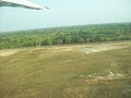
 View from runway while landing at San Pedro Airport - panoramio.jpg 2,848 × 2,132; 1.38 MB
-
 View near the Runway at San Pedro Airport - panoramio.jpg 2,848 × 2,132; 1.25 MB
.jpg)

.jpg)
.jpg)

.jpg)

.jpg)
.jpg)
.jpg)


.jpg)
.jpg)
.jpg)
.jpg)
.jpg)


.jpg)


.jpg)
.jpg)

.jpg)


