Category:Belgium-Netherlands boundary stone no. 67 (Kanne/Maastricht)
Jump to navigation
Jump to search
_(3).jpg) | |||||
| Upload media | |||||
| Instance of | |||||
|---|---|---|---|---|---|
| Part of | |||||
| Location |
| ||||
| Located in or next to body of water | |||||
| Follows | |||||
| Followed by | |||||
 | |||||
Media in category "Belgium-Netherlands boundary stone no. 67 (Kanne/Maastricht)"
The following 9 files are in this category, out of 9 total.
-
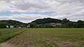
 Cannerberg 2010 1.jpg 2,816 × 2,112; 2.51 MB
-
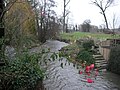
 Kanne-Maastricht-Grenspaal 65 (BE-NL) (1).jpg 4,032 × 2,268; 3.53 MB
-
 Kanne-Maastricht-Grenspaal 65 (BE-NL) (2).jpg 4,032 × 2,268; 3.27 MB
-
 Kanne-Maastricht-Grenspaal 65 (BE-NL) (3).jpg 4,032 × 2,268; 2.06 MB
-
 Kanne-Maastricht-Grenspaal 66 (BE-NL) (1).jpg 4,032 × 2,268; 4.83 MB
-
 Kanne-Maastricht-Grenspaal 67 (BE-NL) (1).jpg 4,032 × 2,268; 4.91 MB
-
 Kanne-Maastricht-Grenspaal 67 (BE-NL) (2).jpg 4,032 × 2,268; 4.12 MB
-
 Kanne-Maastricht-Grenspaal 67 (BE-NL) (3).jpg 4,032 × 2,268; 2.67 MB
-
 Kanne-Maastricht-Grenspaal 67 (BE-NL) (4).jpg 4,032 × 2,268; 4.19 MB

_(1).jpg)
_(2).jpg)
_(3).jpg)
_(1).jpg)
_(1).jpg)
_(2).jpg)
_(4).jpg)