Category:Beinn Thrasda
Jump to navigation
Jump to search
Beinn Thrasda is a 262 metres (860 ft) elevation in the north of Islay, the central peak of a row of three visible from a distance. To the southwest, beyond the pass, Bealach Gaoth' Niar, is Sgarbh Breac. On the northeast, beyond the pass, Bealach Gaoth' Near, is Sgarbh Beag.
Media in category "Beinn Thrasda"
The following 16 files are in this category, out of 16 total.
-
 Allt na h-Uamha Mhòire - geograph.org.uk - 990051.jpg 640 × 480; 103 KB
-
 Ardnave Point - geograph.org.uk - 756684.jpg 640 × 480; 67 KB
-
 Ardnave Point - geograph.org.uk - 756687.jpg 640 × 430; 36 KB
-
 Ardnave View - geograph.org.uk - 1163276.jpg 640 × 394; 70 KB
-
 Bealach Gaoth' Niar - geograph.org.uk - 990069.jpg 640 × 480; 86 KB
-
 Bunnahabhain Bay - geograph.org.uk - 1476420.jpg 640 × 427; 57 KB
-
 Bunnahabhain View - geograph.org.uk - 1165269.jpg 640 × 426; 107 KB
-
 Bunnahabhainn Bay - geograph.org.uk - 1419397.jpg 640 × 427; 349 KB
-
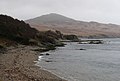
 Coastline near Port an Sruthain - geograph.org.uk - 1365510.jpg 640 × 426; 71 KB
-
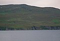
 Coir' Odhar - geograph.org.uk - 761492.jpg 640 × 480; 78 KB
-
 Loch nam Ban, Islay - geograph.org.uk - 341056.jpg 640 × 428; 193 KB
-
 Rubh'a' Mhàil from Sgarbh Breac - geograph.org.uk - 990420.jpg 640 × 480; 92 KB
-
-
 Sgarbh Breac - geograph.org.uk - 761765.jpg 640 × 480; 83 KB
-
 Sgarbh Breac from Jura - geograph.org.uk - 1016433.jpg 640 × 480; 94 KB
-
 The shore at Bunnahabhain - geograph.org.uk - 759111.jpg 640 × 430; 53 KB


