Category:Beinn Bhreac, Waternish
Jump to navigation
Jump to search

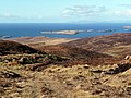
North of Dunvegan, Beinn Bhreac has two peaks, of 314 metres (1,030 ft) and 329 metres (1,079 ft). These are the basis for a promontory of a promontory, Rubha Maol, which projects from the base of Waternish peninsula on the Loch Dunvegan side.
mountain on the Waternish peninsula of the Isle of Skye, in Highland, Scotland, UK  | |||||
| Upload media | |||||
| Instance of | |||||
|---|---|---|---|---|---|
| Location | |||||
 | |||||
Media in category "Beinn Bhreac, Waternish"
The following 47 files are in this category, out of 47 total.
-
 A burn meets the sea - geograph.org.uk - 1615974.jpg 480 × 640; 141 KB
-
 A850 - B886 Fairy Bridge junction - geograph.org.uk - 1269020.jpg 640 × 480; 81 KB
-
 Allt na Buaile Duibh - geograph.org.uk - 740244.jpg 640 × 403; 57 KB
-
 Beinn Bhreac - geograph.org.uk - 740226.jpg 640 × 418; 45 KB
-
 Bog on Beinn Bhreac - geograph.org.uk - 1197940.jpg 640 × 480; 172 KB
-
 Burn towards the forest - geograph.org.uk - 1268989.jpg 640 × 480; 135 KB
-
 Cairn on Beinn Bhreac - geograph.org.uk - 1268945.jpg 640 × 480; 120 KB
-
 Cattle grid in forestry road - geograph.org.uk - 1623263.jpg 640 × 480; 85 KB
-
 Craggy summit of Beinn Bhreac - geograph.org.uk - 1268981.jpg 640 × 480; 139 KB
-
 Creag-a' Ghuail - geograph.org.uk - 1198052.jpg 640 × 450; 209 KB
-
 East from Beinn Bhreac - geograph.org.uk - 1198016.jpg 640 × 480; 177 KB
-
 East from Lampay - geograph.org.uk - 1228593.jpg 600 × 450; 175 KB
-
 East from the cairn - geograph.org.uk - 1268955.jpg 640 × 480; 115 KB
-
 Eastern slopes of Beinn Bhreac - geograph.org.uk - 1197999.jpg 640 × 480; 198 KB
-
 Fairy Bridge from Beinn Bhreac - geograph.org.uk - 1197995.jpg 640 × 480; 193 KB
-
 Fanks at Claigan - geograph.org.uk - 1197931.jpg 640 × 480; 191 KB
-
 Hillside above Lovaig Bay - geograph.org.uk - 1615986.jpg 640 × 480; 99 KB
-
 Loch Bay - geograph.org.uk - 1233081.jpg 450 × 600; 333 KB
-
 Mystery mounds (1) - geograph.org.uk - 1615994.jpg 640 × 480; 132 KB
-
 Nearly the top - geograph.org.uk - 1268938.jpg 640 × 480; 133 KB
-
 New forestry road - geograph.org.uk - 1268720.jpg 640 × 480; 100 KB
-
 Old wall on Beinn Bhreac - geograph.org.uk - 1198028.jpg 640 × 480; 184 KB
-
 Peat haggs on summit of Beinn Bhreac - geograph.org.uk - 1268968.jpg 640 × 480; 113 KB
-
 Peat hags on Beinn Bhreac - geograph.org.uk - 1197948.jpg 640 × 480; 186 KB
-
 Primroses above the burn - geograph.org.uk - 1268997.jpg 480 × 640; 164 KB
-
 Sgurr a' Bhagh - geograph.org.uk - 763008.jpg 640 × 480; 144 KB
-
 South eastern slope of Beinn Bhreac - geograph.org.uk - 1268902.jpg 640 × 480; 86 KB
-
 South eastern slope of Beinn Bhreac - geograph.org.uk - 1268911.jpg 640 × 480; 105 KB
-
 South over Healaval Forest - geograph.org.uk - 1268920.jpg 640 × 480; 87 KB
-
 South west from Beinn Bhreac - geograph.org.uk - 1268931.jpg 640 × 480; 88 KB
-
 Stacan Sgurr a' Bhaigh - geograph.org.uk - 762990.jpg 640 × 480; 169 KB
-
 Tough little creatures - geograph.org.uk - 1615944.jpg 640 × 480; 128 KB
-
 Track above Claigan - geograph.org.uk - 1198068.jpg 640 × 480; 193 KB
-
 Track towards Beinn Bhreac - geograph.org.uk - 1197930.jpg 640 × 480; 203 KB
-
 Unnamed burn close to Lovaig Bay - geograph.org.uk - 1615977.jpg 480 × 640; 142 KB
-
 Waterfall in unnamed burn - geograph.org.uk - 1615982.jpg 480 × 640; 168 KB
-
 Waterfall on Beinn Bhreac - geograph.org.uk - 1615980.jpg 480 × 640; 162 KB
-
 West from Beinn Bhreac - geograph.org.uk - 1198039.jpg 640 × 480; 152 KB
-
 West from the cairn - geograph.org.uk - 1268962.jpg 640 × 480; 78 KB
-
 Beinn Bhreac - geograph.org.uk - 134565.jpg 640 × 480; 105 KB
-
 Beinn Bhreac - geograph.org.uk - 740232.jpg 640 × 426; 74 KB
-
 Beinn Bhreac - The Marilyn Summit - geograph.org.uk - 134566.jpg 640 × 480; 69 KB
-
 Beinn Bhreac Trigpoint - geograph.org.uk - 134564.jpg 640 × 480; 70 KB
-
 Burn on Beinn Bhreac - geograph.org.uk - 134563.jpg 640 × 480; 109 KB
-

-
 Moorland south of Beinn Bhreac - geograph.org.uk - 652612.jpg 640 × 480; 129 KB
-
 North East Slopes of Beinn Bhreac - geograph.org.uk - 134567.jpg 640 × 480; 102 KB


_-_geograph.org.uk_-_1615994.jpg)


