Category:Bei der Liebethaler Kirche
Jump to navigation
Jump to search
| Object location | | View all coordinates using: OpenStreetMap |
|---|
street in Pirna, Saxony, Germany | |||||
| Upload media | |||||
| Instance of | |||||
|---|---|---|---|---|---|
| Location | Pirna, Sächsische Schweiz-Osterzgebirge, Saxony, Germany | ||||
 | |||||
Subcategories
This category has only the following subcategory.
B
- Bei der Liebethaler Kirche 2-4 (14 F)
Media in category "Bei der Liebethaler Kirche"
The following 3 files are in this category, out of 3 total.
-
 Bei der Liebethaler Kirche 1 Liebethal Pirna.JPG 4,320 × 2,432; 4.72 MB
-
 Bei der Liebethaler Kirche 19 Liebethal Pirna.JPG 4,320 × 2,432; 4.51 MB
-
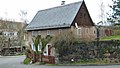
 Scheune Bei der Liebethaler Kirche 5 Liebethal Pirna 1.JPG 3,232 × 3,232; 3.99 MB


