Category:Begraafplaats Zeist
Jump to navigation
Jump to search
| Object location | | View all coordinates using: OpenStreetMap |
|---|
 | |||||
| Upload media | |||||
| Instance of | |||||
|---|---|---|---|---|---|
| Part of | |||||
| Location | Zeist, Utrecht, Netherlands | ||||
| Street address |
| ||||
| Heritage designation |
| ||||
 | |||||
|
This is a category about rijksmonument number 40408
|
| Address |
|
Media in category "Begraafplaats Zeist"
The following 22 files are in this category, out of 22 total.
-
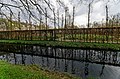
 Exterieur OVERZICHT - Zeist - 20311680 - RCE.jpg 1,200 × 1,197; 467 KB
-
 Exterieur OVERZICHT - Zeist - 20311681 - RCE.jpg 1,186 × 1,200; 461 KB
-
 Exterieur OVERZICHT FRUITMUUR - Zeist - 20311682 - RCE.jpg 1,200 × 1,190; 434 KB
-
 Exterieur OVERZICHT FRUITMUUR - Zeist - 20311683 - RCE.jpg 1,188 × 1,200; 408 KB
-
 Exterieur OVERZICHT FRUITMUUR - Zeist - 20311684 - RCE.jpg 1,200 × 1,199; 424 KB
-
 Exterieur OVERZICHT FRUITMUUR - Zeist - 20311685 - RCE.jpg 1,200 × 1,190; 488 KB
-
 Exterieur TOEGANGSHEK - Zeist - 20311678 - RCE.jpg 1,200 × 1,185; 420 KB
-
 Exterieur TOEGANGSHEK - Zeist - 20311679 - RCE.jpg 1,188 × 1,200; 508 KB
-
 RM40408 Begraafplaats bij Zusterplein (hek).JPG 4,320 × 3,240; 2.98 MB
-
 RM40408 Begraafplaats bij Zusterplein.JPG 3,240 × 4,320; 2.34 MB
-
-

-

-

-
-

-

-

-

-

-

-


.JPG)
_-_Hernhutter_(Moravian_Brethren,_Unitas_Fratrum)_Cemetery_1.jpg)
_-_Hernhutter_(Moravian_Brethren,_Unitas_Fratrum)_Cemetery_2.jpg)
_-_Hernhutter_(Moravian_Brethren,_Unitas_Fratrum)_Cemetery_3.jpg)
_-_Hernhutter_(Moravian_Brethren,_Unitas_Fratrum)_Cemetery_4.jpg)
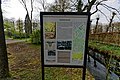
_Cemetery_-_Info.jpg)
_-_Hernhutter_(Moravian_Brethren)_Cemetery_Entrance_1.jpg)
_-_Hernhutter_(Moravian_Brethren)_Cemetery_Entrance_2.jpg)
_by_Jacobus_Roman_-_360%C2%B0_Panorama_1.jpg)
_by_Jacobus_Roman_-_360%C2%B0_Panorama_3.jpg)
_by_Jacobus_Roman_-_360%C2%B0_Panorama_4.jpg)
_-_Hernhutter_(Moravian_Brethren)_Cemetery_-_360%C2%B0_Panorama_1.jpg)
_-_Hernhutter_(Moravian_Brethren)_Cemetery_-_360%C2%B0_Panorama_2.jpg)