Category:Begelly
Jump to navigation
Jump to search
village in Pembrokeshire, United Kingdom  | |||||
| Upload media | |||||
| Instance of | |||||
|---|---|---|---|---|---|
| Location | Pembrokeshire, Wales | ||||
 | |||||
English: Begelly ( and a web of small settlements associated with the 19th century anthracite mining industry. The parish, together with the parish of Reynalton and part (Kilgetty) of St. Issells, constitutes the community and ward of Kilgetty-Begelly, which had a population of 2001 in 2001, with 11% Welsh speakers.
Subcategories
This category has the following 2 subcategories, out of 2 total.
B
- St Mary's, Begelly (10 F)
F
Media in category "Begelly"
The following 17 files are in this category, out of 17 total.
-
 Approaching Winfield - geograph.org.uk - 1414716.jpg 640 × 480; 215 KB
-
 Cows, clouds and a pylon near Begelly - geograph.org.uk - 213647.jpg 640 × 480; 86 KB
-
 Dead Telephone Box, Begelly - geograph.org.uk - 1413186.jpg 640 × 480; 186 KB
-

-
 Former Railway Bridge Abutment - geograph.org.uk - 1413184.jpg 640 × 480; 221 KB
-
 Pub In Begelly - geograph.org.uk - 1413175.jpg 640 × 480; 176 KB
-
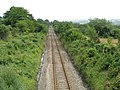 Straight Line To Saundersfoot - geograph.org.uk - 1414704.jpg 640 × 480; 232 KB
-
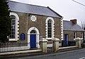
 Thomas Chapel, Begelly - geograph.org.uk - 47563.jpg 640 × 480; 136 KB
-
 Village Pond and Green, Thomas Chapel - geograph.org.uk - 1414748.jpg 640 × 480; 189 KB
-
 Approaching The Roundabout - geograph.org.uk - 1413167.jpg 640 × 480; 145 KB
-
 Ash Park - Main Section - geograph.org.uk - 1413140.jpg 640 × 480; 172 KB
-
 Ash Park - Top Section - geograph.org.uk - 1413135.jpg 640 × 480; 170 KB
-
 Entrance To Ryelands Caravan Park - geograph.org.uk - 1414702.jpg 640 × 480; 191 KB
-
 Fields Near Thomas Chapel - geograph.org.uk - 1414745.jpg 640 × 480; 176 KB
-
 Fields west of Pentlepoir - geograph.org.uk - 523959.jpg 640 × 480; 128 KB
-
 Hillside Near Trewern - geograph.org.uk - 1414706.jpg 640 × 480; 183 KB
-
 Zion Chapel, Begelly - geograph.org.uk - 47561.jpg 640 × 447; 104 KB


.jpg)


