Category:Beeskower Platte
Jump to navigation
Jump to search

 | |||||
| Upload media | |||||
| Instance of | |||||
|---|---|---|---|---|---|
| Named after | |||||
| Location | Oder-Spree District, Brandenburg, Germany | ||||
| Highest point |
| ||||
 | |||||
Deutsch: Die Beeskower Platte ist eine weitgehend geschlossene Hochfläche und eine Naturräumliche Haupteinheit in der Haupteinheitengruppe Ostbrandenburgisches Heide- und Seengebiet. Das glaziale Plateau liegt im Brandenburger Landkreis Oder-Spree und ist nach der Kreisstadt Beeskow benannt.
English: The Beeskower Platte is a plateau and a natural region in the district Oder-Spree, Brandenburg, Germany. The glacial landform is named after the town Beeskow.
Subcategories
This category has the following 4 subcategories, out of 4 total.
Media in category "Beeskower Platte"
The following 32 files are in this category, out of 32 total.
-
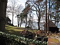
 Ahrensdorf (Rietz-Neuendorf) 05.jpg 3,312 × 2,484; 2.98 MB
-
 Ahrensdorf (Rietz-Neuendorf) 08.jpg 3,533 × 2,650; 3.6 MB
-
 Ahrensdorfer See 05.jpg 3,533 × 2,650; 4.87 MB
-
 Bahnstrecke Grunow–Königs Wusterhausen bei Glienicke.jpg 3,533 × 2,650; 3.09 MB
-
 Beeskower Platte Schwenow 01.jpg 3,533 × 2,650; 3.39 MB
-
 Beeskower Platte Schwenow 02.jpg 3,533 × 2,650; 2.96 MB
-
 Beeskower Platte Schwenow 03.jpg 3,533 × 2,650; 3.06 MB
-
 Beeskower Platte Schwenow 04.jpg 3,533 × 2,650; 4.68 MB
-
 Beeskower Platte Wulfersdorf 01.jpg 3,533 × 2,650; 3.78 MB
-
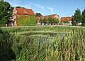
 Behrensdorf Rietz-Neuendorf 01.jpg 3,533 × 2,650; 3.92 MB
-
 Behrensdorf Rietz-Neuendorf 02.jpg 3,533 × 2,650; 4.85 MB
-
 Blabbergraben Blabbermühle 02.jpg 3,533 × 2,650; 4.09 MB
-
 Blabbergrabenrinne nördlich vom Drobschsee.jpg 4,416 × 2,510; 3.69 MB
-
 Buckow (Rietz-Neuendorf) Kirchfriedhof mit Burgwall 2019-04-19.jpg 3,852 × 2,216; 2.43 MB
-
 Buckow (Rietz-Neuendorf) Wall.jpg 4,320 × 3,240; 3.76 MB
-
 Bundesstraße 246 Blabbergraben.jpg 3,533 × 2,650; 3.24 MB
-
 Godnasee 04.jpg 3,533 × 2,650; 4.6 MB
-
 Godnasee 07.jpg 3,533 × 2,650; 4.3 MB
-
 Godnasee 08.jpg 3,533 × 2,650; 5.67 MB
-
 Görsdorf-Wulfersdorfer Fließ 01.jpg 3,533 × 2,650; 3.17 MB
-
 Lindenberger Viadukt um 1910 01.jpg 399 × 246; 47 KB
-
 Naturentwicklungsgebiet Guschluch 01.jpg 3,533 × 2,650; 5.12 MB
-
 Osthang Blabbergrabenrinne Drobschseerinne.jpg 3,533 × 2,650; 4.08 MB
-
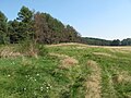
 Rapsfeld Werder Tauche.jpg 3,533 × 2,650; 4.09 MB
-
 Rietz-Neuendorf Lamitsch Anger.jpg 3,872 × 2,592; 706 KB
-
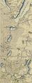 Schmettau Scharmützelsee-Glubigseen-Kette.jpg 1,317 × 3,412; 2.7 MB
-
 Sommerhaus Uferweg 13 Diensdorf-Radlow 02.jpg 3,533 × 2,650; 4.41 MB
-
 Sonnenblumenfeld in Glienicke 02.jpg 3,533 × 2,650; 4.18 MB
-
 Sonnenblumenfeld in Glienicke.jpg 3,533 × 2,650; 3.73 MB
-
 Teich Anger Görsdorf (Tauche) 01.jpg 3,754 × 2,703; 4.72 MB
-
 Uebersicht Brandenburg.png 1,315 × 1,518; 367 KB
-
 Wiese Görsdorf Tauche.jpg 3,533 × 2,650; 4.21 MB
_05.jpg)
_08.jpg)


_Kirchfriedhof_mit_Burgwall_2019-04-19.jpg)
_Wall.jpg)


_01.jpg)

