Category:Bedford Shale maps
Jump to navigation
Jump to search
Media in category "Bedford Shale maps"
The following 10 files are in this category, out of 10 total.
-
 Bedford shale ohio.jpg 466 × 702; 118 KB
-
 Berea Delta.png 505 × 608; 433 KB
-
 CuyahogaValleyNationalPark geologic map.png 1,010 × 592; 1.62 MB
-
 Extent of Bedford Shale and Berea Sandstone - Ohio and N Kentucky.jpg 9,750 × 13,550; 17.12 MB
-
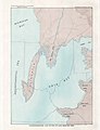
 Ontario Paleoriver and the Bedford Shale.jpg 743 × 590; 93 KB
-
 Paleographic map of beginning Bedford Time in eastern North America.jpg 3,400 × 4,450; 436 KB
-
 Paleographic map of early Bedford Time in eastern North America.jpg 3,400 × 4,450; 485 KB
-
 Paleographic map of end Bedford Time in eastern North America.jpg 3,400 × 4,450; 477 KB
-
 Paleographic map of late Bedford Time in eastern North America.jpg 3,400 × 4,450; 507 KB
-
 Red Bedford Delta and sand bars.jpg 578 × 834; 91 KB


