Category:Beckwithshaw
Jump to navigation
Jump to search
village and civil parish in the Harrogate district of North Yorkshire, England  | |||||
| Upload media | |||||
| Instance of | |||||
|---|---|---|---|---|---|
| Location | Harrogate, North Yorkshire, Yorkshire and the Humber, England | ||||
| Population |
| ||||
 | |||||
English: Beckwithshaw is a village in the Harrogate district of North Yorkshire, England about south-west of Harrogate.
Subcategories
This category has the following 3 subcategories, out of 3 total.
Media in category "Beckwithshaw"
The following 200 files are in this category, out of 369 total.
(previous page) (next page)-
 A small pond - geograph.org.uk - 4830458.jpg 640 × 426; 134 KB
-
 A very Yorkshire sign - geograph.org.uk - 6357779.jpg 1,024 × 768; 180 KB
-
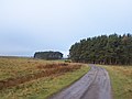
 Access road to Scargill reservoir - geograph.org.uk - 6353549.jpg 1,024 × 768; 115 KB
-
 Along Norwood Lane - geograph.org.uk - 4782760.jpg 640 × 427; 102 KB
-
 Along Norwood Lane - geograph.org.uk - 6798482.jpg 1,024 × 683; 486 KB
-
 Approaching Beckwithshaw - geograph.org.uk - 3951383.jpg 1,920 × 1,259; 511 KB
-
 At Shaw Green - geograph.org.uk - 3948673.jpg 1,920 × 1,320; 424 KB
-
 Autumn in Cardale Woods - geograph.org.uk - 3194461.jpg 4,320 × 3,240; 5.68 MB
-
 B6161 - geograph.org.uk - 4830477.jpg 640 × 426; 53 KB
-
 B6161 - geograph.org.uk - 4837105.jpg 640 × 426; 88 KB
-
 B6161 approaching Beckwithshaw - geograph.org.uk - 3152464.jpg 1,024 × 682; 240 KB
-
 B6161 approaching Pot Bank - geograph.org.uk - 3347110.jpg 1,024 × 682; 237 KB
-

-
 B6161 at Shawfield Head - geograph.org.uk - 3950269.jpg 1,920 × 1,440; 599 KB
-
 B6161 at Shawfield Head - geograph.org.uk - 3950278.jpg 1,920 × 1,426; 599 KB
-
 B6161 by Beckwithshaw Cricket Club - geograph.org.uk - 5365257.jpg 640 × 480; 80 KB
-
 B6161 descending Pot Bank - geograph.org.uk - 5365262.jpg 640 × 480; 86 KB
-
 B6161 near Shawfield Head - geograph.org.uk - 3133971.jpg 1,024 × 682; 228 KB
-
 B6161, Beckwithshaw - geograph.org.uk - 4830514.jpg 640 × 426; 85 KB
-
 B6161, Otley Rd - geograph.org.uk - 4830467.jpg 640 × 426; 65 KB
-
 B6161, Pot Bank - geograph.org.uk - 4837023.jpg 640 × 426; 68 KB
-
 B6162 - geograph.org.uk - 4830566.jpg 640 × 426; 101 KB
-
 Barn, Beechfield Farm - geograph.org.uk - 4830411.jpg 640 × 426; 49 KB
-
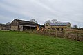
 Barns, Beckwith Farm - geograph.org.uk - 4820785.jpg 640 × 426; 56 KB
-
 Baths near Lund House Green - geograph.org.uk - 5828079.jpg 2,848 × 4,288; 2.22 MB
-
 Beckside Farm - geograph.org.uk - 3949198.jpg 1,920 × 1,302; 492 KB
-
 Beckwith Cottage Farm - geograph.org.uk - 2079988.jpg 640 × 480; 80 KB
-
 Beckwith Cottage Farm - geograph.org.uk - 4820787.jpg 640 × 426; 95 KB
-
 Beckwith Cottages - geograph.org.uk - 4820789.jpg 640 × 426; 115 KB
-
 Beckwith Farm - geograph.org.uk - 4820782.jpg 640 × 426; 57 KB
-
 Beckwith Farm - geograph.org.uk - 4820790.jpg 640 × 426; 65 KB
-
 Beckwith Head Rd - geograph.org.uk - 4815953.jpg 640 × 426; 67 KB
-
 Beckwith Head Rd - geograph.org.uk - 4815967.jpg 640 × 426; 45 KB
-
 Beckwith Head Road - geograph.org.uk - 2167036.jpg 640 × 480; 171 KB
-
 Beckwith Lodge Farm - geograph.org.uk - 4820780.jpg 640 × 426; 113 KB
-
 Beckwith Lodge Farm - geograph.org.uk - 4820783.jpg 640 × 426; 61 KB
-
 Beckwith Lodge Farm - geograph.org.uk - 4820784.jpg 640 × 426; 85 KB
-
 Beckwith, near Harrogate - geograph.org.uk - 69922.jpg 640 × 480; 73 KB
-
 Access Track to Haverah Park - geograph.org.uk - 101750.jpg 640 × 480; 67 KB
-
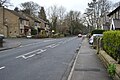
 Beckwithshaw - geograph.org.uk - 4782752.jpg 640 × 427; 87 KB
-
 Beckwithshaw - geograph.org.uk - 4830489.jpg 640 × 426; 75 KB
-
 Beckwithshaw Community Primary School - geograph.org.uk - 6357721.jpg 1,024 × 768; 148 KB
-
 Beckwithshaw Community School - geograph.org.uk - 4830520.jpg 640 × 426; 95 KB
-
 Beckwithshaw Community School - geograph.org.uk - 4830554.jpg 640 × 426; 65 KB
-
 Beckwithshaw Cricket Club - geograph.org.uk - 2316956.jpg 3,397 × 2,485; 2 MB
-
 Beckwithshaw Cricket Club - geograph.org.uk - 3951581.jpg 1,920 × 1,440; 583 KB
-
 Beckwithshaw Cricket Club - geograph.org.uk - 3951582.jpg 1,920 × 1,323; 490 KB
-
 Beckwithshaw Cricket Club - geograph.org.uk - 6357702.jpg 1,024 × 768; 149 KB
-
 Beckwithshaw Cricket Club, Beckwithshaw - geograph.org.uk - 3290505.jpg 4,608 × 3,072; 1.02 MB
-
 Beckwithshaw Cricket Clubhouse - geograph.org.uk - 4837020.jpg 640 × 426; 85 KB
-
 Beckwithshaw Village Hall - geograph.org.uk - 2167063.jpg 640 × 480; 141 KB
-
 Beckwithshaw Village Hall - geograph.org.uk - 6357724.jpg 1,024 × 768; 143 KB
-
 Beechfield Farm - geograph.org.uk - 4830417.jpg 640 × 426; 59 KB
-
 Beechfield Farmhouse - geograph.org.uk - 4830413.jpg 640 × 426; 85 KB
-
 Blue Coat Farm - geograph.org.uk - 2079976.jpg 640 × 449; 68 KB
-
 Blue Coat Farm - geograph.org.uk - 3778981.jpg 1,600 × 1,200; 457 KB
-
 Bluecoat Farm - geograph.org.uk - 4820867.jpg 640 × 426; 61 KB
-
 Bluecoat Farm - geograph.org.uk - 4820869.jpg 640 × 426; 54 KB
-
 Bluecoat Farmhouse - geograph.org.uk - 4820875.jpg 640 × 426; 85 KB
-
 Boundary Stone, Penny Pot Lane (2) - geograph.org.uk - 1085838.jpg 375 × 640; 79 KB
-
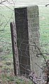
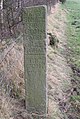 Boundary Stone, Penny Pot Lane - geograph.org.uk - 1085830.jpg 429 × 640; 112 KB
-
 Bridge in the woods - geograph.org.uk - 5569141.jpg 640 × 427; 333 KB
-
 Bridge over the infant River Crimple - geograph.org.uk - 181723.jpg 640 × 480; 141 KB
-
 Bridleway near Norwood Lane - geograph.org.uk - 3388398.jpg 640 × 428; 81 KB
-
 Broad Dubb Road - geograph.org.uk - 2167347.jpg 480 × 640; 104 KB
-
 Broad Dubb Road - geograph.org.uk - 5269939.jpg 640 × 480; 41 KB
-
 Building and Mast beside track across Scargill Pasture - geograph.org.uk - 4046303.jpg 4,000 × 3,000; 1.97 MB
-
 Buildings on Otley Rd - geograph.org.uk - 4830600.jpg 640 × 426; 53 KB
-
 Cardale Estate - geograph.org.uk - 4837022.jpg 640 × 426; 89 KB
-
 Cardale Woodland - geograph.org.uk - 4837026.jpg 640 × 426; 104 KB
-
 Cardale Woodland - geograph.org.uk - 4837164.jpg 640 × 426; 126 KB
-
 Cardale Woodland - geograph.org.uk - 4837167.jpg 640 × 374; 98 KB
-
 Cardale Woodland - geograph.org.uk - 4837171.jpg 640 × 426; 121 KB
-
 Cardale Woodland - geograph.org.uk - 4837173.jpg 640 × 426; 119 KB
-
 Cardale Woodland - geograph.org.uk - 4837185.jpg 640 × 426; 121 KB
-
 Cardale Woodland - geograph.org.uk - 4837186.jpg 640 × 426; 115 KB
-
 Cardale Woodland - geograph.org.uk - 4837188.jpg 640 × 426; 126 KB
-
 Cardale Woodland - geograph.org.uk - 4837195.jpg 640 × 426; 121 KB
-
 Cardale Woodland - geograph.org.uk - 5569161.jpg 640 × 427; 316 KB
-
 Cardale Woodland - geograph.org.uk - 6649477.jpg 2,000 × 1,333; 2.48 MB
-
 Cardale Woods - geograph.org.uk - 1823624.jpg 480 × 640; 239 KB
-
 Care home construction - geograph.org.uk - 6718391.jpg 1,024 × 683; 398 KB
-
 Care Home under construction - geograph.org.uk - 6718393.jpg 1,024 × 683; 426 KB
-
 Cattle Grid and Gate, Scargill Reservoir - geograph.org.uk - 3559259.jpg 1,024 × 682; 187 KB
-
 Cattle grid on the road to Scargill Reservoir - geograph.org.uk - 6357604.jpg 1,024 × 768; 226 KB
-
 Church Hall, Beckwithshaw - geograph.org.uk - 4830549.jpg 640 × 394; 65 KB
-
 Church of St Michael and All Angels - geograph.org.uk - 4830498.jpg 640 × 426; 95 KB
-
 Church of St Michael and All Angels - geograph.org.uk - 4830502.jpg 426 × 640; 76 KB
-
 Communication Mast off Norwood Lane - geograph.org.uk - 2167331.jpg 480 × 640; 69 KB
-
 Communications mast off Norwood Lane - geograph.org.uk - 5269946.jpg 640 × 480; 47 KB
-
 Conifers, Cardale Woodland - geograph.org.uk - 4837189.jpg 640 × 426; 112 KB
-
 Conifers, Cardale Woodland - geograph.org.uk - 4837190.jpg 640 × 426; 106 KB
-
 Construction beside Beckwith Head Road - geograph.org.uk - 6718384.jpg 1,024 × 683; 464 KB
-
 Construction site on Beckwith Head Road - geograph.org.uk - 6794950.jpg 2,000 × 1,333; 1.86 MB
-
 Coppice and Plantation near Keepers Cottage - geograph.org.uk - 3290518.jpg 4,608 × 3,072; 1,005 KB
-
 Cottage in Beckwithshaw - geograph.org.uk - 4830496.jpg 640 × 426; 70 KB
-
 Cottages, Beckwith - geograph.org.uk - 4820799.jpg 640 × 426; 83 KB
-
 Countryside at Beckwith - geograph.org.uk - 2079999.jpg 640 × 480; 86 KB
-
 Crimple Beck - geograph.org.uk - 3950121.jpg 4,000 × 3,000; 2.18 MB
-
 Crimple Beck - geograph.org.uk - 5828168.jpg 4,288 × 2,848; 1.71 MB
-
 Crimple Beck - geograph.org.uk - 5828174.jpg 2,848 × 4,288; 2.32 MB
-
 Crossroads near Beckwith Head - geograph.org.uk - 6718387.jpg 1,024 × 683; 465 KB
-
 Crossroads west of Lund House - geograph.org.uk - 2167024.jpg 640 × 480; 107 KB
-
 Crossroads, Beckwith Head - geograph.org.uk - 2080021.jpg 640 × 480; 74 KB
-
 Daffodils along Otley Road - geograph.org.uk - 6798466.jpg 1,024 × 683; 624 KB
-
 Daffodils in Beckwithshaw - geograph.org.uk - 6798469.jpg 1,024 × 683; 674 KB
-
 Dandelions, Shaw Green - geograph.org.uk - 3948682.jpg 1,920 × 2,560; 1.38 MB
-
 Descending the B6161 - geograph.org.uk - 4837108.jpg 640 × 426; 81 KB
-
 Distant golf balls - geograph.org.uk - 1010045.jpg 640 × 284; 25 KB
-
 Down to Oak Beck - geograph.org.uk - 1823610.jpg 480 × 640; 232 KB
-
 Drive to Beechfield Farm - geograph.org.uk - 6798467.jpg 1,024 × 683; 444 KB
-
 Dwellings above Pot Bridge - geograph.org.uk - 3194845.jpg 4,320 × 3,240; 3.71 MB
-
 East Lodge, Moor Park - geograph.org.uk - 4830574.jpg 640 × 426; 99 KB
-
 End of Road, Beckwith - geograph.org.uk - 4820792.jpg 640 × 426; 109 KB
-
 Entering Beckwithshaw - geograph.org.uk - 2149041.jpg 800 × 600; 272 KB
-
 Entrance to Cardale Estate - geograph.org.uk - 3951655.jpg 1,920 × 1,440; 623 KB
-
 Entrance to Haverah Park - geograph.org.uk - 2167342.jpg 640 × 480; 99 KB
-
 Entrance to Moor Park - geograph.org.uk - 2167330.jpg 626 × 468; 112 KB
-
 Entrance to Moor Park - geograph.org.uk - 4830599.jpg 640 × 426; 83 KB
-
 Farm buildings at Blue Coat Farm - geograph.org.uk - 6718366.jpg 1,024 × 683; 491 KB
-
 Farmland beside Lady Lane - geograph.org.uk - 6718369.jpg 1,024 × 683; 473 KB
-
 Farmland by Beckwith Head Rd - geograph.org.uk - 4815949.jpg 640 × 426; 53 KB
-
 Farmland by Whinney Lane - geograph.org.uk - 5828044.jpg 4,109 × 2,378; 1.65 MB
-
 Feeding sheep in Haverah Park - geograph.org.uk - 6353165.jpg 1,024 × 768; 145 KB
-
 Fence and moorland - geograph.org.uk - 6798481.jpg 1,024 × 683; 440 KB
-
 Field beside B6162 - geograph.org.uk - 100904.jpg 640 × 480; 75 KB
-
 Field beside Howhill Quarry Road - geograph.org.uk - 3948385.jpg 1,920 × 1,440; 808 KB
-
 Field boundary by Otley Road - geograph.org.uk - 3951289.jpg 2,951 × 3,520; 2.28 MB
-
 Field boundary by Otley Road - geograph.org.uk - 3951329.jpg 1,920 × 1,253; 662 KB
-
 Field boundary south of Shaw Green - geograph.org.uk - 3949189.jpg 1,920 × 2,560; 1.35 MB
-
 Field boundary, Howhill Quarry Road - geograph.org.uk - 2080013.jpg 640 × 480; 102 KB
-
 Field by Beckwith Head Rd - geograph.org.uk - 4815963.jpg 640 × 426; 51 KB
-
 Field by Pot Bank - geograph.org.uk - 3951681.jpg 3,449 × 1,942; 1.63 MB
-
 Field by Pot Bank - geograph.org.uk - 3951706.jpg 1,920 × 1,009; 414 KB
-
 Field by Whinney Lane - geograph.org.uk - 5881049.jpg 4,288 × 2,848; 2.31 MB
-
 Field entrance off Norwood Lane - geograph.org.uk - 5269942.jpg 640 × 480; 58 KB
-
 Field near Beckside Farm - geograph.org.uk - 3949203.jpg 1,920 × 1,440; 520 KB
-
 Field near Beckwithshaw - geograph.org.uk - 4830454.jpg 640 × 426; 58 KB
-
 Field near Howe House Farm - geograph.org.uk - 4820853.jpg 640 × 426; 53 KB
-
 Field on slopes of Crimple valley - geograph.org.uk - 5881276.jpg 4,243 × 2,417; 1.69 MB
-
 Field south of Shaw Green - geograph.org.uk - 3949120.jpg 1,920 × 1,440; 727 KB
-
 Fields beside Lady Lane - geograph.org.uk - 6718360.jpg 1,024 × 683; 429 KB
-
 Fields beside Lady Lane - geograph.org.uk - 6718381.jpg 1,024 × 683; 453 KB
-
 Fields, Beckwith - geograph.org.uk - 3603304.jpg 1,024 × 682; 207 KB
-
 Follow the drystone wall - geograph.org.uk - 4830439.jpg 640 × 426; 65 KB
-
 Footbridge over a woodland stream - geograph.org.uk - 4837201.jpg 640 × 426; 115 KB
-
 Footbridge over Crimple Beck - geograph.org.uk - 3949216.jpg 1,920 × 1,440; 823 KB
-
 Footbridge over Crimple Beck - geograph.org.uk - 5881402.jpg 2,716 × 4,059; 2.44 MB
-
 Footbridge over Oak Beck - geograph.org.uk - 1823639.jpg 480 × 640; 252 KB
-
 Footpath by The Rash - geograph.org.uk - 4820800.jpg 640 × 426; 75 KB
-
 Footpath descending towards Crimple Beck - geograph.org.uk - 3330335.jpg 4,320 × 3,240; 5.03 MB
-
 Footpath in Cardale Woods - geograph.org.uk - 3194451.jpg 4,320 × 3,240; 4.83 MB
-
 Footpath leading to Hill Top Hall - geograph.org.uk - 3330339.jpg 4,320 × 3,240; 4.48 MB
-
 Footpath signpost - geograph.org.uk - 4820856.jpg 640 × 426; 58 KB
-
 Footpath to Beckwithshaw - geograph.org.uk - 4830437.jpg 640 × 426; 95 KB
-
 Footpath to Beechfield Farm - geograph.org.uk - 4820880.jpg 640 × 426; 53 KB
-
 Footpath to Beechfield Farm - geograph.org.uk - 4830409.jpg 640 × 426; 69 KB
-
 Footpath to Howe House Farm - geograph.org.uk - 4820826.jpg 640 × 426; 107 KB
-
 Footpath to Low House Farm - geograph.org.uk - 4820811.jpg 640 × 426; 69 KB
-
 Footpath, Lund House Green - geograph.org.uk - 5881167.jpg 4,288 × 2,848; 2.4 MB
-
 Forked tree - geograph.org.uk - 4830444.jpg 640 × 426; 63 KB
-
 From Little Alms Cliff - geograph.org.uk - 2046613.jpg 640 × 480; 233 KB
-
 Gate beside Norwood Lane - geograph.org.uk - 6798474.jpg 1,024 × 683; 400 KB
-
 Gatepost near Beckside Farm - geograph.org.uk - 3949192.jpg 1,920 × 2,395; 1.06 MB
-
 Gateway and East Lodge, Moor Park - geograph.org.uk - 4830528.jpg 640 × 426; 109 KB
-
 Grass field west of Bluecoat Farm - geograph.org.uk - 6794947.jpg 2,000 × 1,333; 1.76 MB
-
 Gravelled drive, Howe House Farm - geograph.org.uk - 4820831.jpg 640 × 426; 85 KB
-
 Grazing and drain, Stainburn Moor - geograph.org.uk - 5269940.jpg 640 × 480; 53 KB
-
 Grazing land, Bluecoat Farm - geograph.org.uk - 4830407.jpg 640 × 426; 53 KB
-
 Grazing north of Norwood Lane - geograph.org.uk - 5269948.jpg 640 × 480; 51 KB
-
 Grazing towards woodland - geograph.org.uk - 5269949.jpg 640 × 480; 43 KB
-
 Grazing, Beckwithshaw - geograph.org.uk - 5269953.jpg 640 × 480; 38 KB
-
 Group of four disused huts in Haverah Park - geograph.org.uk - 6353170.jpg 1,024 × 768; 128 KB
-
-
 Hill Top Lane - geograph.org.uk - 5828058.jpg 4,288 × 2,848; 1.81 MB
-
 Hill Top Lane, Pannal - geograph.org.uk - 2166551.jpg 640 × 480; 100 KB
-
 Hole in the wall - geograph.org.uk - 4820494.jpg 640 × 426; 113 KB
-
 Home Farm - geograph.org.uk - 4830470.jpg 640 × 426; 63 KB
-
 Home Farm, Beckwithshaw - geograph.org.uk - 3951340.jpg 1,920 × 1,321; 378 KB
-
 Horses, Lady Lane - geograph.org.uk - 4815969.jpg 640 × 426; 75 KB
-
 House at Pot Bank - geograph.org.uk - 1823621.jpg 640 × 480; 148 KB
-
 House near Beechfield Farm - geograph.org.uk - 4830404.jpg 640 × 426; 45 KB
-
 House on Otley Road - geograph.org.uk - 5269955.jpg 640 × 480; 81 KB
-
 House on Pot Bank - geograph.org.uk - 4837112.jpg 640 × 426; 76 KB
-
 House on the B6162 - geograph.org.uk - 4830588.jpg 640 × 388; 60 KB
-
 House, Beckwithshaw - geograph.org.uk - 3951415.jpg 1,920 × 999; 328 KB
-
 Howe House Farm - geograph.org.uk - 4820833.jpg 640 × 426; 126 KB
-
 Howe House Farm - geograph.org.uk - 4820848.jpg 640 × 409; 73 KB
-
 Howhill Quarry Rd - geograph.org.uk - 4820822.jpg 640 × 426; 98 KB
-
 Howhill Quarry Rd - geograph.org.uk - 4820825.jpg 640 × 426; 102 KB
-
 Howhill Quarry Road - geograph.org.uk - 2056261.jpg 640 × 480; 134 KB
-
 Howhill Quarry Road, Beckwith - geograph.org.uk - 3603306.jpg 1,024 × 682; 274 KB
-
 Huts and mast, Scargill Pasture - geograph.org.uk - 2770409.jpg 3,132 × 2,260; 1,002 KB
-
 In the Crimple valley - geograph.org.uk - 5828166.jpg 2,848 × 4,288; 2.02 MB
-
 In the Crimple valley - geograph.org.uk - 5881206.jpg 4,288 × 2,848; 2.57 MB
-
 In the Crimple valley - geograph.org.uk - 5881355.jpg 2,848 × 4,288; 3.17 MB
-
 In the Crimple valley - geograph.org.uk - 5881363.jpg 4,288 × 2,848; 2.24 MB
-
 Indistinct path along the wall - geograph.org.uk - 4830602.jpg 640 × 426; 71 KB
-
 Junction of Howhill Road and Otley Road - geograph.org.uk - 2167054.jpg 640 × 480; 145 KB
-
 Keepers Cottage - geograph.org.uk - 101757.jpg 640 × 480; 80 KB


_-_geograph.org.uk_-_1085838.jpg)


