Category:Bearpark
Jump to navigation
Jump to search
English: Bearpark is a village and civil parish in County Durham in England. It is situated a few miles west of Durham, and a short distance to the north of Ushaw Moor.
village in County Durham, England, UK  | |||||
| Upload media | |||||
| Instance of | |||||
|---|---|---|---|---|---|
| Location | County Durham, North East England, England | ||||
| Population |
| ||||
 | |||||
Subcategories
This category has the following 2 subcategories, out of 2 total.
B
- Beaurepaire Manor House (5 F)
Media in category "Bearpark"
The following 80 files are in this category, out of 80 total.
-
 Aldin Grange House in Bearpark - geograph.org.uk - 3286030.jpg 3,648 × 2,736; 2.4 MB
-
 Aldin Grange, Bearpark - geograph.org.uk - 4985185.jpg 640 × 480; 58 KB
-
 Ancient Aldin Grange Bridge - geograph.org.uk - 3285028.jpg 3,648 × 2,736; 3.47 MB
-
 Auton Stile, Bearpark - geograph.org.uk - 4985219.jpg 3,264 × 2,593; 2.02 MB
-
 Auton Stile, Bearpark - geograph.org.uk - 4987263.jpg 640 × 480; 59 KB
-
 Bearpark Colliery Road, Bearpark - geograph.org.uk - 2086801.jpg 640 × 480; 52 KB
-
 Bearpark Hall Farm - geograph.org.uk - 2798852.jpg 3,264 × 2,448; 1.47 MB
-
 Bearpark News ^ Booze - geograph.org.uk - 4987269.jpg 640 × 480; 66 KB
-
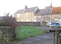
 Bearpark village centre.jpg 640 × 480; 114 KB
-

-
 Bungalows, Bearpark - geograph.org.uk - 4987251.jpg 640 × 480; 82 KB
-

-
 Bus stop and shelter, Aldin Grange - geograph.org.uk - 4987282.jpg 640 × 480; 95 KB
-
 Bus stop on Auton Stile - geograph.org.uk - 4987278.jpg 640 × 414; 65 KB
-

-
 Cottages, Aldin Grange - geograph.org.uk - 4987279.jpg 640 × 480; 72 KB
-
 Cottages, Aldin Grange - geograph.org.uk - 4987284.jpg 640 × 480; 96 KB
-

-
 Dog ^ Gun, Bearpark - geograph.org.uk - 2086818.jpg 640 × 480; 56 KB
-
 Durham Community Business College - geograph.org.uk - 4987259.jpg 640 × 480; 60 KB
-
 Durham Fire Station - geograph.org.uk - 4812798.jpg 1,499 × 844; 1.07 MB
-

-
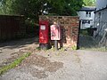 Elizabeth II postbox, Bearpark - geograph.org.uk - 4985182.jpg 640 × 480; 97 KB
-
 Entering Bearpark - geograph.org.uk - 4987249.jpg 640 × 480; 57 KB
-

-
 Farm track down Moorsley Banks also a footpath - geograph.org.uk - 3286102.jpg 3,648 × 2,736; 2.76 MB
-
 Farmers bridge carrying a footpath over the River Browney - geograph.org.uk - 3286093.jpg 3,221 × 2,485; 3.73 MB
-
 Farmhouse at Lodge Farm - geograph.org.uk - 3286069.jpg 3,511 × 2,550; 3.53 MB
-
 Farmhouse at Red House Farm - geograph.org.uk - 3603319.jpg 3,648 × 2,736; 3.15 MB
-
 Footpath leading from the Lanchester Valley Railway Walk - geograph.org.uk - 3286226.jpg 3,648 × 2,736; 2.39 MB
-
 Ford over the River Browney - geograph.org.uk - 272970.jpg 640 × 480; 91 KB
-
 Garage, Bearpark - geograph.org.uk - 4987275.jpg 640 × 480; 42 KB
-
 Grazing and hedgerow - geograph.org.uk - 4987874.jpg 640 × 480; 73 KB
-
 Grazing near Red House Farm - geograph.org.uk - 4987247.jpg 640 × 480; 93 KB
-
 Grazing towards Arbour House Farm - geograph.org.uk - 4987875.jpg 640 × 480; 80 KB
-
 Lanchester Valley Path at Baxter Wood - geograph.org.uk - 340507.jpg 640 × 480; 82 KB
-
 Lanchester Valley Railway Path - geograph.org.uk - 5755672.jpg 4,608 × 3,456; 6.28 MB
-
 Lanchester Valley Railway Path - geograph.org.uk - 6396272.jpg 4,608 × 3,456; 7.39 MB
-
 Lanchester Valley Railway Walk - geograph.org.uk - 3228672.jpg 1,500 × 1,125; 1.76 MB
-

-
 Lane leading down from Bearpark Hall - geograph.org.uk - 2798874.jpg 3,264 × 2,448; 2.22 MB
-
 Looking across to Usher College - geograph.org.uk - 3396557.jpg 4,608 × 3,456; 4.54 MB
-
 Looking along to Park Wood - geograph.org.uk - 3396560.jpg 4,608 × 3,456; 4.63 MB
-
 Looking down the hedge line - geograph.org.uk - 3396543.jpg 4,608 × 3,456; 5.17 MB
-
 Looking down Whitehouse Lane, Bearpark - geograph.org.uk - 3597477.jpg 3,648 × 2,736; 2.93 MB
-
 Mine memorial, Bearpark - geograph.org.uk - 4987273.jpg 640 × 480; 114 KB
-
 Minor road towards Durham - geograph.org.uk - 4987285.jpg 640 × 480; 97 KB
-
 Minor road towards Durham - geograph.org.uk - 4987877.jpg 640 × 480; 69 KB
-
 Moorsley Banks Farm - geograph.org.uk - 4987290.jpg 640 × 480; 75 KB
-
 Multi-sports court at Bearpark - geograph.org.uk - 3286064.jpg 3,648 × 2,736; 1.82 MB
-
 Old hay barn - geograph.org.uk - 2798863.jpg 3,264 × 2,448; 1.97 MB
-
 Old steps - geograph.org.uk - 2798824.jpg 3,264 × 2,448; 1.5 MB
-
 Ordnance Survey Cut Mark - geograph.org.uk - 5913866.jpg 1,024 × 849; 266 KB
-
 Ordnance Survey Cut Mark - geograph.org.uk - 5913870.jpg 1,024 × 758; 327 KB
-
 Ordnance Survey Cut Mark - geograph.org.uk - 5913877.jpg 1,024 × 772; 237 KB
-
 Ordnance Survey Rivet - geograph.org.uk - 5913894.jpg 542 × 1,024; 203 KB
-
 Ordnance Survey Rivet - geograph.org.uk - 5913902.jpg 586 × 1,024; 216 KB
-
 Ordnance Survey Rivet - geograph.org.uk - 5913905.jpg 663 × 1,024; 258 KB
-
 Park Wood - geograph.org.uk - 3229586.jpg 1,500 × 1,125; 1.5 MB
-
 Path north from Park Wood - geograph.org.uk - 3603348.jpg 3,648 × 2,736; 3.21 MB
-
 Public footpath at edge of stubble field - geograph.org.uk - 3649296.jpg 1,500 × 1,000; 1.37 MB
-
 River Browney - geograph.org.uk - 272966.jpg 640 × 480; 115 KB
-
 River Browney, Aldin Grange - geograph.org.uk - 4987287.jpg 640 × 480; 127 KB
-
 Riverside fields - geograph.org.uk - 2799409.jpg 3,264 × 2,448; 1.31 MB
-

-
 Ruins of Beaurepaire - geograph.org.uk - 3228827.jpg 1,500 × 1,125; 1.43 MB
-

-
 Stubble field near Bearpark - geograph.org.uk - 3228704.jpg 1,500 × 1,125; 1.32 MB
-
 Terraced housing, Bearpark - geograph.org.uk - 4987255.jpg 640 × 480; 80 KB
-
 The Church of St. Edmund, Bearpark - geograph.org.uk - 3228886.jpg 1,500 × 1,125; 2.13 MB
-
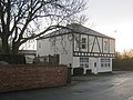
 The Dog ^ Gun public house, Bearpark - geograph.org.uk - 4987265.jpg 640 × 480; 55 KB
-
 Toll House Road - geograph.org.uk - 3193036.jpg 640 × 480; 47 KB
-
 Track, Aldin Grange Farm - geograph.org.uk - 4987281.jpg 640 × 480; 83 KB
-
 Two crows in a muddy field - geograph.org.uk - 4885735.jpg 1,500 × 817; 876 KB
-
 View East near Whitestocks - geograph.org.uk - 2798835.jpg 3,264 × 2,448; 1.51 MB
-
 View north towards Sacriston - geograph.org.uk - 3396547.jpg 4,608 × 3,456; 5.01 MB
-
 View of the river Browney - geograph.org.uk - 2799403.jpg 3,264 × 2,448; 2.07 MB
-
 Whitehouse Farm, Bearpark - geograph.org.uk - 3597469.jpg 3,648 × 2,736; 2.98 MB
-
 Woodland Road - geograph.org.uk - 4987243.jpg 640 × 480; 73 KB
-
 Woodland Road, Bearpark - geograph.org.uk - 2086809.jpg 640 × 480; 55 KB


.jpg)


_near_Moorsley_Banks_Farm_-_geograph.org.uk_-_4987298.jpg)


