Category:Beaches of the Shetland Islands
Jump to navigation
Jump to search

Subcategories
This category has the following 7 subcategories, out of 7 total.
B
- Bain's Beach, Lerwick (9 F)
- Banna Minn (25 F)
L
- Lang Ayre (20 F)
M
- Meal Beach (15 F)
R
- Rerwick beach (8 F)
Media in category "Beaches of the Shetland Islands"
The following 177 files are in this category, out of 177 total.
-
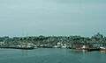
 Abandoned fishing village - geograph.org.uk - 629938.jpg 640 × 466; 350 KB
-
 After the storm IMG 3713 (12369634714).jpg 4,148 × 2,166; 4.89 MB
-
 Afternoon Stroll IMG 7234 (30963581455).jpg 4,262 × 2,422; 4.2 MB
-
 Airport by Day MG 7107 (32234743745).jpg 5,184 × 2,758; 3.56 MB
-
 Ayre at North Roe (geograph 2076946).jpg 2,560 × 1,920; 2.21 MB
-

-
 Beach at Clett - geograph.org.uk - 547835.jpg 640 × 429; 103 KB
-
 Beach at Head of Sand Wick - geograph.org.uk - 2092530.jpg 2,560 × 1,920; 1.79 MB
-
-
 Beach at Melby - geograph.org.uk - 934126.jpg 640 × 402; 48 KB
-
 Beach at Reawick - geograph.org.uk - 342992.jpg 640 × 434; 47 KB
-
 Beach at Sandsayre - geograph.org.uk - 1811314.jpg 800 × 411; 91 KB
-
 Beach at Sandsayre Wick - geograph.org.uk - 760922.jpg 640 × 326; 63 KB
-
 Beach at the head of Pund Voe - geograph.org.uk - 3573845.jpg 640 × 480; 204 KB
-
 Beach at the Sletts - geograph.org.uk - 573056.jpg 426 × 640; 47 KB
-
 Beach at Toft - geograph.org.uk - 1301727.jpg 640 × 481; 106 KB
-
 Beach at Ugasta, near Brough Lodge - geograph.org.uk - 3478988.jpg 1,024 × 682; 210 KB
-
 Beach at Virdibreck - geograph.org.uk - 632428.jpg 640 × 480; 90 KB
-
 Beach at West Ham - geograph.org.uk - 2091813.jpg 2,560 × 1,920; 1.68 MB
-
 Beach at Wester Netlar, Whalsay. - geograph.org.uk - 633600.jpg 640 × 374; 71 KB
-
 Beach below Brough - geograph.org.uk - 560236.jpg 640 × 427; 74 KB
-
 Beach below Burki Hill - geograph.org.uk - 3557629.jpg 640 × 324; 176 KB
-
 Beach Breaker IMG 7289 (30927992346).jpg 4,264 × 2,387; 3.23 MB
-
 Beach Breakers IMG 6188 (23897908771).jpg 4,259 × 2,302; 3.23 MB
-
 Beach Debris IMG 3501 (20494717465).jpg 4,272 × 2,541; 5.81 MB
-
 Beach Debris IMG 3506 (20500992081).jpg 4,237 × 2,368; 3.71 MB
-
 Beach Debris IMG 3811 (12597008033).jpg 4,027 × 2,330; 4.33 MB
-
 Beach Departure MG 6503 (31294608970).jpg 5,098 × 2,873; 3.93 MB
-
 Beach Gateway IMG 1194 (14669209821).jpg 4,195 × 2,369; 3.76 MB
-
 Beach in West Yell - geograph.org.uk - 2374065.jpg 800 × 534; 240 KB
-
 Beach of Mail, Cunningsburgh - geograph.org.uk - 1700762.jpg 800 × 534; 232 KB
-

-
 Beach stroll IMG 1460 (16918511837).jpg 4,259 × 2,457; 4.77 MB
-
 Beach Stroll IMG 7695 (24683191029).jpg 4,017 × 2,177; 3.65 MB
-
 Beach stroll IMG 8274 (13928802944).jpg 4,250 × 2,557; 1.63 MB
-
 Beach Sundown IMG 2114 (17547027934).jpg 4,272 × 2,372; 4.15 MB
-
 Beach, Nesti Voe - geograph.org.uk - 3810550.jpg 640 × 480; 259 KB
-
 Beach, South Ham - geograph.org.uk - 3831553.jpg 640 × 480; 249 KB
-
 Beach, South Voxter, Cunningsburgh - geograph.org.uk - 888133.jpg 640 × 480; 60 KB
-
 Beach, Stenness - geograph.org.uk - 3558728.jpg 640 × 480; 310 KB
-
 Beadies - geograph.org.uk - 2056699.jpg 1,200 × 1,600; 291 KB
-
 Boats on Levenwick Beach - geograph.org.uk - 483863.jpg 640 × 480; 150 KB
-
 Breakers at Silder Skerry (13819668065).jpg 4,264 × 2,390; 2.49 MB
-
 Breaking Seas IMG 6437 (23769865250).jpg 4,272 × 2,253; 3.83 MB
-
 Breaking Seas IMG 6439 (23982947591).jpg 4,264 × 2,225; 2.54 MB
-
 Breaking Seas IMG 6440 (23769871710).jpg 4,245 × 2,290; 2.55 MB
-
 Breaking Seas IMG 6441 (23697728439).jpg 4,233 × 2,212; 2.39 MB
-
 Breaking Seas IMG 6442 (23769877990).jpg 4,254 × 2,322; 2.77 MB
-
 Breaking Seas IMG 6444 (23437325664).jpg 4,272 × 2,197; 3.41 MB
-
 Breaking Seas IMG 6446 (23438776773).jpg 4,183 × 2,217; 3.08 MB
-
 Breaking Seas IMG 6449 (23438780563).jpg 4,263 × 2,347; 2.8 MB
-
 Breaking Seas IMG 6454 (23438784403).jpg 4,264 × 2,394; 3.11 MB
-
 Breaking Seas IMG 6455 (23957422292).jpg 4,264 × 2,389; 4.16 MB
-
 Breaking Seas IMG 6457 (23437345284).jpg 4,233 × 2,384; 2.77 MB
-
 Breaking Seas IMG 6458 (23438750653).jpg 4,272 × 2,413; 3.86 MB
-
 Breaking Vaakels IMG 6268 (24024452675).jpg 4,272 × 2,564; 4.53 MB
-
 Breiwick Bay IMG 3024 (11455695415).jpg 4,210 × 2,267; 2.92 MB
-
 Breiwick Bay IMG 3029 (11455794996).jpg 4,140 × 2,273; 2.58 MB
-
 Breiwick IMG 1759 (14816659487).jpg 4,247 × 2,354; 3.6 MB
-
 Breiwick MG 7223 (32173492872).jpg 5,184 × 2,872; 5.45 MB
-
 Breiwick Seas IMG 6396 (16290750601).jpg 4,203 × 2,246; 3.09 MB
-
 Breiwick Seas IMG 6397 (16106407449).jpg 4,266 × 2,296; 3.46 MB
-
 Breiwick Seas IMG 6401 (16105009478).jpg 4,264 × 2,278; 3.55 MB
-
 Breiwick Seas IMG 6407 (15670127794).jpg 4,219 × 2,315; 3.49 MB
-
 Breiwick Seas IMG 6413 (16290749521).jpg 4,272 × 2,385; 3.84 MB
-
 Bus Run IMG 8630 (17196270649).jpg 4,202 × 2,202; 3.42 MB
-
 Culswick, Stead of Culswick - geograph.org.uk - 3736620.jpg 640 × 480; 64 KB
-
 East Ham and its stony beach - geograph.org.uk - 2706658.jpg 1,333 × 1,000; 1.24 MB
-
 Eastern Bay at Fethaland (geograph 2075208).jpg 2,560 × 1,920; 1.7 MB
-
 Ebb Tide MG 4758 (29840538985).jpg 5,184 × 2,815; 5.75 MB
-
 Empty beach IMG 9325 (15449298350).jpg 4,149 × 2,216; 3.26 MB
-
 Empty Beach MG 0201 (25023129981).jpg 5,147 × 2,804; 4.41 MB
-
 Evie Sands - geograph.org.uk - 3197475.jpg 1,600 × 1,066; 287 KB
-
 Fore Wick - geograph.org.uk - 184331.jpg 640 × 381; 200 KB
-
 From the Beach IMG 7950 (24804464219).jpg 4,233 × 2,209; 3.36 MB
-
 G-LGND IMG 8387 (30961050063).jpg 4,272 × 2,480; 3.86 MB
-
 Geomorphology in miniature - geograph.org.uk - 578378.jpg 640 × 426; 61 KB
-
 Grutness Beach IMG 1190 (14649399746).jpg 4,221 × 2,400; 3.1 MB
-
 Hoswick beach - geograph.org.uk - 1702573.jpg 800 × 534; 258 KB
-
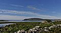
 Isle of Fethaland (geograph 4311508).jpg 1,024 × 751; 181 KB
-

-
 Lagoon at Braewick - geograph.org.uk - 342985.jpg 640 × 438; 60 KB
-
 Levenwick Beach - geograph.org.uk - 148163.jpg 640 × 427; 70 KB
-
 Levenwick Beach, Shetland (7334065640).jpg 3,224 × 2,008; 4.38 MB
-
 Loch of Beith, North Roe (geograph 3348969).jpg 1,024 × 681; 178 KB
-
 May Wick - geograph.org.uk - 5288699.jpg 1,600 × 1,200; 341 KB
-
 Melby - geograph.org.uk - 346578.jpg 640 × 402; 50 KB
-
 Moast Beach IMG 5492 (12987845184).jpg 4,244 × 2,390; 4.53 MB
-
 Moonlit shack IMG 5894 (14633718175).jpg 3,725 × 2,208; 3.22 MB
-
 Muckle Ayre - geograph.org.uk - 3832078.jpg 640 × 480; 269 KB
-
 Muckle Ayre bay, Muckle Roe - geograph.org.uk - 5022945.jpg 2,592 × 1,944; 1.38 MB
-
 Muckle Ayre Beach, Muckle Roe, Shetland.jpg 640 × 480; 96 KB
-
 Muckle Ayre, North Roe (geograph 3348962).jpg 1,024 × 681; 171 KB
-
 Norby (41389379760).jpg 1,422 × 969; 426 KB
-
 Norby (42295603635).jpg 1,399 × 785; 510 KB
-
 Norby (42295623585).jpg 3,983 × 2,661; 2.55 MB
-
 Norby (42481618644).jpg 1,426 × 932; 388 KB
-
 Norby (43150389082).jpg 1,392 × 911; 265 KB
-
 Norby (43150389992).jpg 1,065 × 749; 283 KB
-
 On the Alert MG 0420 (25260715505).jpg 5,181 × 2,917; 4.12 MB
-
 On the Beach IMG 0221 (18710202348).jpg 4,272 × 2,348; 5.03 MB
-
 On the Beach IMG 0225 (18277237213).jpg 4,272 × 2,277; 4.82 MB
-
 On the Beach IMG 4612 (22124961298).jpg 4,244 × 2,386; 3.21 MB
-
 On the Beach IMG 4613 (22299752302).jpg 4,212 × 2,362; 3.06 MB
-
 On The Beach IMG 6030 (23617304100).jpg 4,264 × 2,368; 4.14 MB
-
 On The Beach IMG 8831 (15344637032).jpg 4,229 × 2,324; 3.71 MB
-
 On the Beach IMG 8938 (15251363807).jpg 4,240 × 2,370; 3.45 MB
-
 On the Beach IMG 8942 (15437911645).jpg 4,247 × 2,291; 3.62 MB
-
 On the Beach IMG 8944 (15251441458).jpg 4,272 × 2,405; 4.04 MB
-
 On the Beach IMG 8948 (15438062035).jpg 4,272 × 2,369; 3.51 MB
-
 On the Beach IMG 8950 (15437724572).jpg 4,272 × 2,384; 3.93 MB
-
 On the Beach IMG 8954 (15251313479).jpg 4,226 × 2,351; 3.26 MB
-
 On the Beach IMG 8955 (15251536667).jpg 4,272 × 2,309; 3.88 MB
-
 On the Beach IMG 8957 (15414955236).jpg 4,230 × 2,415; 3.54 MB
-
 On The Beach IMG 9519 (15721979482).jpg 3,848 × 2,159; 2.83 MB
-
 Pebble beach - geograph.org.uk - 550515.jpg 640 × 480; 78 KB
-
 Pebble beach just west of Melby Pier - geograph.org.uk - 102386.jpg 640 × 480; 73 KB
-
 Quendale Sands - geograph.org.uk - 1307518.jpg 640 × 481; 95 KB
-
 Railsbrough beach - geograph.org.uk - 538474.jpg 640 × 380; 79 KB
-
 Rea Wick beach on a cold February day - geograph.org.uk - 600967.jpg 640 × 480; 65 KB
-
 Reawick Beach - geograph.org.uk - 146736.jpg 640 × 431; 65 KB
-
 Riskaness - geograph.org.uk - 148366.jpg 640 × 430; 74 KB
-
-
 RRobertson At the Beach IMG 3024 (19321210623).jpg 4,212 × 2,345; 3.26 MB
-
 RRobertson Evening Stroll IMG 0560 (32310140063).jpg 4,176 × 2,223; 3.5 MB
-
 RRobertson The Beach IMG 2226 (18189202858).jpg 4,254 × 2,402; 4.05 MB
-
 RRobertson Voar Work IMG 7154 (24524748960).jpg 4,259 × 2,406; 3.85 MB
-
 RRobertson Voar Work IMG 7164 (24820270475).jpg 4,259 × 2,284; 3.04 MB
-
 Sand bar at Bight of Haggrister - geograph.org.uk - 534931.jpg 640 × 480; 73 KB
-
 Sand beach - geograph.org.uk - 578411.jpg 640 × 426; 57 KB
-
 Sand Wick - geograph.org.uk - 3717390.jpg 2,048 × 1,536; 838 KB
-

-
 Sandsound - geograph.org.uk - 4927959.jpg 1,024 × 682; 153 KB
-
 Sandy beach at Melby - geograph.org.uk - 354918.jpg 640 × 438; 58 KB
-

-
 Scord Beach IMG 1633 (14865964256).jpg 4,236 × 2,794; 4.28 MB
-
 Scousburgh Sands, Shetland - geograph.org.uk - 95492.jpg 640 × 464; 36 KB
-
 Sewage outfall at West Voe beach - geograph.org.uk - 3474647.jpg 640 × 480; 82 KB
-
 SHET-LW01.jpg 600 × 360; 34 KB
-
 Shoreline Walk MG 5921 (31068008285).jpg 4,984 × 2,533; 2.8 MB
-
 Sil Wick beach - geograph.org.uk - 532869.jpg 640 × 480; 67 KB
-
 Spiggie and Colsa IMG 1458 (16938344980).jpg 4,255 × 2,370; 3.81 MB
-
 Spiggie Beach IMG 1343 (14759707172).jpg 4,272 × 2,397; 3.19 MB
-
 Spiggie Beach IMG 1344 (14739993952).jpg 4,230 × 2,450; 3.03 MB
-
 Spume and walkers on Sand beach - geograph.org.uk - 578392.jpg 426 × 640; 46 KB
-
 Stones and seaweed - geograph.org.uk - 467214.jpg 640 × 480; 158 KB
-
 Tangled Beach IMG 3716 (12386225853).jpg 4,075 × 2,188; 4.84 MB
-
 Tangled Beach IMG 3720 (12386494524).jpg 4,269 × 2,229; 5.13 MB
-
 Tangles in the Sand MG 4680 (29097518384).jpg 5,184 × 2,867; 5.7 MB
-
 The beach at Muckle Ayre - geograph.org.uk - 5810038.jpg 1,024 × 575; 143 KB
-
 The beach at Scousburgh, Shetland - geograph.org.uk - 116617.jpg 640 × 480; 85 KB
-

-
 The Beach IMG 2653 (19235258922).jpg 4,260 × 2,387; 3.03 MB
-
 The Beach IMG 2757 (19220055410).jpg 4,208 × 2,191; 2.69 MB
-
 The Beach IMG 2765 (19401432132).jpg 4,244 × 2,159; 3.21 MB
-
 The Beach IMG 2770 (19220063368).jpg 4,263 × 2,306; 3.2 MB
-
 The Beach IMG 5083 (28292412143).jpg 4,262 × 2,554; 2.94 MB
-
 The Beach IMG 5660 (23602388816).jpg 4,272 × 2,352; 3.19 MB
-
 The Beach IMG 5678 (23000279434).jpg 4,212 × 2,517; 3.54 MB
-
 The Beach IMG 5856 (31598817774).jpg 4,272 × 2,386; 3.79 MB
-
 The Beach IMG 6071 (23619401470).jpg 4,272 × 2,508; 4.04 MB
-
 The Beach IMG 6714 (13040430415).jpg 4,202 × 2,219; 4.68 MB
-
 The Beach IMG 7279 (30875238841).jpg 4,212 × 2,358; 2.83 MB
-
 The Beach IMG 9513 (15533910069).jpg 4,247 × 2,309; 2.9 MB
-
 The Beach MG 0275 (25062135071).jpg 5,090 × 2,782; 4.92 MB
-
 The Beach MG 2956 (27966081220).jpg 5,169 × 2,807; 4.06 MB
-
 The Beach MG 3152 (28236163386).jpg 5,112 × 2,784; 4.3 MB
-
 The Bench MG 0284 (25037118932).jpg 4,729 × 2,585; 3.87 MB
-
 The Calm MG 2746 (27310392493).jpg 5,169 × 2,864; 4.38 MB
-
 The log IMG 4396 (13519785064).jpg 4,210 × 2,237; 3.79 MB
-
 Uyeanorthmavine.jpg 640 × 439; 61 KB
-

-
 West Voe beach - geograph.org.uk - 3474644.jpg 640 × 480; 62 KB
-
 Western end of Scousburgh beach - geograph.org.uk - 3927582.jpg 1,400 × 1,050; 592 KB
-
 Western end of the Bay of Scousburgh - geograph.org.uk - 3474396.jpg 640 × 480; 79 KB
-
 Western end of the Bay of Scousburgh - geograph.org.uk - 3474433.jpg 640 × 480; 65 KB
-
 Wheeltracks on beach at Bigton - geograph.org.uk - 342987.jpg 580 × 393; 110 KB

.jpg)
.jpg)
.jpg)
.jpg)


.jpg)
.jpg)
.jpg)
.jpg)
.jpg)
.jpg)
.jpg)


.jpg)
.jpg)
.jpg)
.jpg)


.jpg)
.jpg)
.jpg)
.jpg)
.jpg)
.jpg)
.jpg)
.jpg)
.jpg)
.jpg)
.jpg)
.jpg)
.jpg)
.jpg)
.jpg)
.jpg)
.jpg)
.jpg)
.jpg)
.jpg)
.jpg)
.jpg)
.jpg)
.jpg)


.jpg)
.jpg)


.jpg)
.jpg)

.jpg)

.jpg)


.jpg)
.jpg)


.jpg)
.jpg)


.jpg)
.jpg)
.jpg)
.jpg)
.jpg)
.jpg)
.jpg)
.jpg)
.jpg)
.jpg)
.jpg)
.jpg)
.jpg)
.jpg)
.jpg)
.jpg)
.jpg)
.jpg)
.jpg)
.jpg)
.jpg)
.jpg)
.jpg)


.jpg)
.jpg)
.jpg)
.jpg)
.jpg)


.jpg)


.jpg)

.jpg)
.jpg)
.jpg)


.jpg)
.jpg)
.jpg)


.jpg)
.jpg)
.jpg)
.jpg)
.jpg)
.jpg)
.jpg)
.jpg)
.jpg)
.jpg)
.jpg)
.jpg)
.jpg)
.jpg)
.jpg)
.jpg)
.jpg)
.jpg)


.jpg)
.jpg)