Category:Beaches of the East Riding of Yorkshire
Jump to navigation
Jump to search
Wikimedia category | |||||
| Upload media | |||||
| Instance of | |||||
|---|---|---|---|---|---|
| |||||
Subcategories
This category has the following 22 subcategories, out of 22 total.
A
B
- Barmston Sands (44 F)
- Bridlington North Sands (49 F)
- Bridlington South Sands (44 F)
C
- Cowden Sands (15 F)
F
- Fraisthorpe Sands (20 F)
H
K
- Kilnsea beach (102 F)
L
- Long Bank, Easington (9 F)
M
- Mappleton Sands (65 F)
R
- Rolston Sands (6 F)
S
- Skipsea Sands (39 F)
- Spurn Head beach (139 F)
U
- Ulrome Sands (41 F)
W
- Withernsea Beach (200 F)
Media in category "Beaches of the East Riding of Yorkshire"
The following 200 files are in this category, out of 257 total.
(previous page) (next page)-
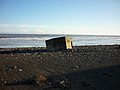
 A pill box by the sea - geograph.org.uk - 926327.jpg 640 × 424; 185 KB
-
 A pill box by the sea - geograph.org.uk - 926336.jpg 640 × 427; 153 KB
-
 A WW2 Pill Box on the beach (geograph 2200441).jpg 800 × 600; 268 KB
-
 Access to the beach - geograph.org.uk - 804874.jpg 640 × 431; 195 KB
-
 An expanse of limestone pavement^ - geograph.org.uk - 1358683.jpg 640 × 480; 92 KB
-
 Approach to Hartendale Gutter - geograph.org.uk - 1387762.jpg 640 × 480; 116 KB
-
 Beach and cliffs at Danes Dyke - geograph.org.uk - 645129.jpg 640 × 480; 77 KB
-
 Beach and stream - geograph.org.uk - 666656.jpg 640 × 480; 43 KB
-
 Beach at Hollym.jpg 404 × 640; 277 KB
-
 Beach at North Landing (geograph 5483146).jpg 2,000 × 1,500; 648 KB
-
 Beach debris, Old Hive - geograph.org.uk - 1048596.jpg 640 × 427; 341 KB
-
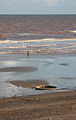
 Beach Near Beacon Ponds - geograph.org.uk - 393375.jpg 640 × 471; 99 KB
-
 Beach near Tunstall - geograph.org.uk - 1743035.jpg 800 × 600; 74 KB
-
 Boulder clay cliff south of Withernsea (geograph 6054962).jpg 3,461 × 2,585; 1.28 MB
-
 Brick Beach - geograph.org.uk - 286923.jpg 464 × 640; 178 KB
-
 Bridlington Spa & Sands 1954 (archive ref PO-1-20-118) (34854492011).jpg 900 × 563; 164 KB
-
 Bridlington Spa 1904 (archive ref PO-1-20-113) (34854491771).jpg 900 × 574; 180 KB
-
 Bridlington Wikivoyage Banner.jpg 4,000 × 575; 2.16 MB
-
 Caves at Northwick bay - geograph.org.uk - 507130.jpg 640 × 480; 142 KB
-
 Caves at Selwick Bay - geograph.org.uk - 606521.jpg 640 × 480; 102 KB
-
 Chalk cliffs and beaches - geograph.org.uk - 1774407.jpg 3,504 × 1,971; 1.46 MB
-

-
 Chatterthrow and Little Thornwick - geograph.org.uk - 965953.jpg 640 × 427; 199 KB
-
 Churchyard Cave, Sanwick - geograph.org.uk - 834901.jpg 640 × 453; 109 KB
-
 Clay sculptures in the cliffs near Waxholme (geograph 4583932).jpg 640 × 427; 51 KB
-
 Cliff erosion, Holderness (4451525067).jpg 2,048 × 1,371; 731 KB
-
 Cliff erosion, Holderness (4451528999).jpg 2,048 × 1,371; 297 KB
-
 Cliff face, Sewerby - geograph.org.uk - 506141.jpg 640 × 480; 127 KB
-
 Cliff top near Redhouse Farm, Waxholme - geograph.org.uk - 200443.jpg 480 × 640; 120 KB
-
 Cliffs and caves, Selwick Bay - geograph.org.uk - 605791.jpg 640 × 480; 74 KB
-
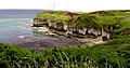
 Cliffs at Flamborough Head.jpg 2,288 × 1,712; 1.2 MB
-
 Cliffs near Holmpton.jpg 640 × 427; 268 KB
-
-
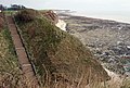
 Clifftop Path south of Withernsea - geograph.org.uk - 758547.jpg 640 × 348; 160 KB
-
 Clifftop Walk - geograph.org.uk - 1209140.jpg 640 × 480; 88 KB
-

-
 Coastal Defences on Easington Beach - geograph.org.uk - 951810.jpg 640 × 427; 244 KB
-
 Coastal Defences on Easington Beach 2 - geograph.org.uk - 951812.jpg 640 × 427; 248 KB
-
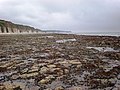
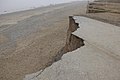
 Coastal erosion - geograph.org.uk - 666666.jpg 640 × 480; 93 KB
-
 Coastal Erosion - geograph.org.uk - 932261.jpg 640 × 480; 80 KB
-
 Coastal erosion near Easington - geograph.org.uk - 926057.jpg 640 × 391; 179 KB
-
 Coastal erosion south of Intack farm - geograph.org.uk - 1055483.jpg 640 × 427; 343 KB
-
 Coastal erosion south of Withernsea (geograph 6054927).jpg 1,600 × 1,200; 190 KB
-
 Coastal panorama - geograph.org.uk - 1358871.jpg 640 × 480; 82 KB
-

-
 Coastal scenery from High Holme - geograph.org.uk - 1419767.jpg 480 × 640; 83 KB
-
 Coastline and cliffs abeam Hollym aerial 2015 (geograph 4582501).jpg 640 × 427; 53 KB
-
 Cobles at north landing.JPG 585 × 534; 81 KB
-
 Collapsed Pillbox - geograph.org.uk - 551068.jpg 640 × 480; 81 KB
-
 Concrete blocks on Easington beach - geograph.org.uk - 926081.jpg 640 × 430; 150 KB
-
 Crumbling Cliffs - geograph.org.uk - 1221438.jpg 640 × 427; 48 KB
-
 Dad's Army (2015) filming on location in Yorkshire.JPG 2,304 × 3,072; 3.55 MB
-
 Dane's Dyke from the beach - geograph.org.uk - 506337.jpg 640 × 480; 107 KB
-
 Dane's Dyke, near Bridlington. By Thomas Tolkien (6385228707).jpg 5,000 × 3,156; 9.55 MB
-
 Danes' Dyke reaches the sea - geograph.org.uk - 606564.jpg 640 × 480; 68 KB
-
 Descent through the Chalk^ - geograph.org.uk - 1358622.jpg 480 × 640; 73 KB
-
 Dimlington Beach - geograph.org.uk - 304756.jpg 640 × 476; 48 KB
-
 Dykes End, Flamborough - geograph.org.uk - 538251.jpg 640 × 486; 116 KB
-
 Easington Beach - geograph.org.uk - 1247755.jpg 640 × 480; 134 KB
-
 Easington Beach - geograph.org.uk - 304787.jpg 640 × 472; 52 KB
-
 Easington Beach - geograph.org.uk - 304791.jpg 640 × 478; 49 KB
-
 Easington Beach - geograph.org.uk - 304802.jpg 640 × 480; 81 KB
-
 Easington beach - geograph.org.uk - 926097.jpg 640 × 335; 140 KB
-
 Easington Beach - geograph.org.uk - 926177.jpg 640 × 427; 150 KB
-
 Easington Cliffs - geograph.org.uk - 1263118.jpg 640 × 428; 93 KB
-
 Easington cliffs - geograph.org.uk - 269551.jpg 640 × 425; 81 KB
-
 Easington Gas Terminal - geograph.org.uk - 269549.jpg 640 × 425; 55 KB
-
 Easington Natural Gas Terminal - geograph.org.uk - 304760.jpg 480 × 640; 89 KB
-
 East Nook - geograph.org.uk - 173333.jpg 640 × 396; 153 KB
-
 East Nook and Great Scars from West Nook - geograph.org.uk - 1456159.jpg 640 × 408; 184 KB
-
 East of Hilston - geograph.org.uk - 300423.jpg 476 × 640; 77 KB
-
 End of the road, Easington Cliffs - geograph.org.uk - 1263090.jpg 640 × 428; 88 KB
-
 End of the road, Holmpton Cliffs - geograph.org.uk - 1260931.jpg 640 × 428; 67 KB
-
 End of the road, Holmpton Cliffs - geograph.org.uk - 1260951.jpg 640 × 428; 66 KB
-
 End of the road, Tunstall Cliffs - geograph.org.uk - 1257824.jpg 640 × 428; 87 KB
-
 End of the road^ - geograph.org.uk - 269559.jpg 640 × 402; 56 KB
-
 Evidence of landslip and erosion - geograph.org.uk - 1358694.jpg 640 × 480; 102 KB
-
 Fishing Boats at North Landing - geograph.org.uk - 1207018.jpg 640 × 481; 108 KB
-
 Fishing Cobble of North Landing - geograph.org.uk - 1210399.jpg 640 × 480; 91 KB
-
 Flamborough - panoramio (2).jpg 1,200 × 800; 419 KB
-
 Flamborough beach at the bottom of Danes' Dyke - panoramio.jpg 2,448 × 3,264; 1.71 MB
-
 Flamborough Cliffs - geograph.org.uk - 1227511.jpg 640 × 427; 136 KB
-
 Flamborough cliffs - geograph.org.uk - 1451767.jpg 640 × 480; 96 KB
-
 Flamborough Head - geograph.org.uk - 173318.jpg 640 × 335; 117 KB
-
 Flamborough Head - geograph.org.uk - 53865.jpg 640 × 480; 101 KB
-
 Flamborough head landing beach.jpg 4,000 × 2,651; 11.66 MB
-
 Flamborough Head Lighthouse - geograph.org.uk - 1192154.jpg 640 × 480; 64 KB
-
 Flamborough Head, North Landing - geograph.org.uk - 1860.jpg 640 × 455; 64 KB
-
 Flamborough Head, South Landing - geograph.org.uk - 1861.jpg 431 × 632; 46 KB
-
 Flamborough MB-4H (TW-18H).jpg 1,024 × 768; 164 KB
-
 Flamborough North Bay - geograph.org.uk - 480894.jpg 640 × 309; 46 KB
-
-
 Flamborough North Landing - geograph.org.uk - 278518.jpg 640 × 439; 87 KB
-
 Flamborough North Landing - geograph.org.uk - 278519.jpg 640 × 480; 133 KB
-
 Flamborough North Landing - geograph.org.uk - 834985.jpg 640 × 461; 99 KB
-
 Flamborough North Landing - geograph.org.uk - 834991.jpg 508 × 640; 125 KB
-
 Flamborough North Landing - geograph.org.uk - 835007.jpg 640 × 440; 91 KB
-
 Flamborough North Landing - geograph.org.uk - 835024.jpg 640 × 449; 109 KB
-
 Flamborough South Landing - geograph.org.uk - 392292.jpg 640 × 480; 104 KB
-
 Flamborough South Landing - geograph.org.uk - 392304.jpg 640 × 480; 110 KB
-
 Flamborough South Landing - geograph.org.uk - 424129.jpg 640 × 480; 85 KB
-
 Flamborough South Landing Beach - geograph.org.uk - 391699.jpg 640 × 480; 51 KB
-
 Flamborough South Landing in the Mist - geograph.org.uk - 688463.jpg 640 × 480; 60 KB
-
-
 Flamborough, North landing img 1949 - panoramio.jpg 1,300 × 866; 653 KB
-
 Flamborough, North Sea landing, Yorkshire, England-LCCN2002708306.jpg 3,675 × 2,759; 2.9 MB
-
 Flamborough, North Sea landing, Yorkshire, England-LCCN2002708306.tif 3,675 × 2,759; 29.01 MB
-
 FlamboroughHeadBeach1.JPG 3,872 × 2,592; 4.22 MB
-
 FlamboroughHeadBeach3.jpg 2,592 × 3,872; 4.3 MB
-
 FlamboroughHeadCliffs.JPG 3,872 × 2,592; 4.27 MB
-
 FlamboroughNorthLanding.JPG 3,872 × 2,592; 4.72 MB
-
 FlamboroughNorthLandingBoats.JPG 3,872 × 2,592; 4.84 MB
-
 FlamboroughNorthLandingSlip.JPG 2,592 × 3,872; 4.48 MB
-

-
 Great Thornwick Bay - geograph.org.uk - 1419682.jpg 640 × 480; 99 KB
-
 Green Stacks Pinnacle, Flamborough Head - geograph.org.uk - 766406.jpg 640 × 471; 207 KB
-
 Groyne - geograph.org.uk - 514955.jpg 640 × 427; 85 KB
-
 Heading North out of Withernsea (geograph 2096195).jpg 800 × 600; 219 KB
-
 Heading North towards Waxholme (geograph 2097674).jpg 800 × 600; 215 KB
-
 Here today, gone tomorrow - geograph.org.uk - 1055542.jpg 640 × 415; 332 KB
-
 Hogsea Lane, east of Hilston - geograph.org.uk - 300421.jpg 480 × 640; 94 KB
-
 Holmpton Cliffs - geograph.org.uk - 281716.jpg 640 × 477; 77 KB
-
 Holmpton Cliffs - geograph.org.uk - 293383.jpg 640 × 479; 80 KB
-
 Holmpton Cliffs - geograph.org.uk - 40987.jpg 640 × 480; 104 KB
-
 Holmpton Cliffs - geograph.org.uk - 595098.jpg 640 × 427; 56 KB
-

-
 I see no ships^ - geograph.org.uk - 1358639.jpg 640 × 480; 59 KB
-
 Intack Farm, Hollym - geograph.org.uk - 200435.jpg 640 × 493; 107 KB
-
 Intack, December 2006 - geograph.org.uk - 293374.jpg 640 × 474; 97 KB
-
 Landslide^ - geograph.org.uk - 424242.jpg 640 × 480; 116 KB
-
 Landslip at North Landing - geograph.org.uk - 676828.jpg 640 × 467; 122 KB
-
 Lark Hill Beach Cowden.jpg 640 × 471; 82 KB
-
 Lifeboat station, South Landing - geograph.org.uk - 412221.jpg 640 × 480; 135 KB
-
 Little Thornwick - geograph.org.uk - 834916.jpg 640 × 469; 102 KB
-
 Little Thornwick Bay - geograph.org.uk - 1419656.jpg 640 × 480; 96 KB
-
 Living on the edge - geograph.org.uk - 300417.jpg 640 × 480; 75 KB
-
 Looking north - geograph.org.uk - 505632.jpg 640 × 480; 85 KB
-
 Looking north from Dane's Dyke - geograph.org.uk - 1358823.jpg 640 × 480; 78 KB
-
 Looking northwards along coast - geograph.org.uk - 685447.jpg 640 × 480; 86 KB
-
 Looking south from Dane's Dyke - geograph.org.uk - 1358809.jpg 640 × 480; 46 KB
-
-

-
 Monkwith Beach, Tunstall - geograph.org.uk - 300419.jpg 476 × 640; 62 KB
-
 Monkwith cliffs - geograph.org.uk - 1507166.jpg 426 × 640; 221 KB
-
 Moor Hill Low Skirlington.jpg 640 × 480; 69 KB
-
 North Cliff, Flamborough - geograph.org.uk - 834880.jpg 453 × 640; 111 KB
-
 North Cliff, Flamborough - geograph.org.uk - 834894.jpg 640 × 488; 100 KB
-
 North Landing Beach (geograph 5483159).jpg 2,000 × 1,500; 494 KB
-
 Northeast of Hilston - geograph.org.uk - 300427.jpg 476 × 640; 88 KB
-

-
 Old Hive, Holmpton - geograph.org.uk - 200444.jpg 480 × 640; 115 KB
-
 Old iron chimney on Spurn beach.jpg 720 × 540; 48 KB
-
 Out to Sea - geograph.org.uk - 173304.jpg 640 × 480; 105 KB
-

-
 Pasture, and cliffs north of Holmpton - geograph.org.uk - 1048578.jpg 640 × 427; 365 KB
-
 Path Down The Cliff - geograph.org.uk - 1209161.jpg 480 × 640; 46 KB
-
 Paull River Defences - geograph.org.uk - 275129.jpg 640 × 480; 101 KB
-
 Paull River Front - geograph.org.uk - 302272.jpg 640 × 480; 112 KB
-
 Pebble Beach, Danes Dyke - geograph.org.uk - 1211607.jpg 640 × 480; 100 KB
-

-
 Pillbox on beach (geograph 6054919).jpg 1,600 × 1,260; 218 KB
-
 Pillbox on the beach (geograph 6054922).jpg 1,600 × 1,200; 206 KB
-
 Pillbox on the beach near Hollym (geograph 4586979).jpg 640 × 427; 54 KB
-
 Pond at Easington Beach - geograph.org.uk - 28465.jpg 640 × 480; 91 KB
-

-
 Restful holiday^ - geograph.org.uk - 269570.jpg 640 × 429; 51 KB
-
 River Defences at Paull - geograph.org.uk - 713946.jpg 480 × 640; 84 KB
-

-
 Sand bars - geograph.org.uk - 514954.jpg 640 × 427; 116 KB
-
 Sand le Mere - geograph.org.uk - 300409.jpg 476 × 640; 64 KB
-
 Sanwick Brig, Flamborough - geograph.org.uk - 834861.jpg 640 × 464; 121 KB
-
 Sanwick Brigg - geograph.org.uk - 1205498.jpg 640 × 427; 353 KB
-
 Sanwick Brigg - geograph.org.uk - 1226689.jpg 640 × 498; 124 KB
-
 Say Hello, Wave Goodbye - geograph.org.uk - 456340.jpg 640 × 443; 58 KB
-

-

-

-

-
 Selwick's Bay, Flamborough Head - geograph.org.uk - 248335.jpg 640 × 480; 113 KB
-
 Selwicks Bay - geograph.org.uk - 1204805.jpg 640 × 427; 86 KB
-
 Selwicks Bay - geograph.org.uk - 506714.jpg 640 × 480; 128 KB
-
 Selwicks Bay, Flamborough - geograph.org.uk - 835874.jpg 640 × 439; 102 KB
-
 Selwicks Bay, Flamborough Head - geograph.org.uk - 604950.jpg 640 × 480; 76 KB
-
 Selwicks Bay, Flamborough Head, Yorkshire - geograph.org.uk - 844171.jpg 640 × 414; 106 KB
-
 Sewerby Cliffs - geograph.org.uk - 1209168.jpg 640 × 480; 88 KB
-
 Sewerby Rocks - geograph.org.uk - 1227616.jpg 640 × 480; 75 KB
-
 Sewerby Rocks - geograph.org.uk - 496671.jpg 640 × 480; 110 KB
-
 Sewerby Rocks - geograph.org.uk - 538216.jpg 640 × 441; 121 KB
-
 Sewerby Rocks - geograph.org.uk - 538223.jpg 474 × 640; 108 KB
-
 Sewerby Rocks - geograph.org.uk - 538227.jpg 640 × 476; 99 KB
-
 Sewerby Rocks - geograph.org.uk - 779672.jpg 640 × 519; 121 KB
-
 Sewerby Rocks, East Yorks. - geograph.org.uk - 804870.jpg 640 × 359; 161 KB
-
 Sewerby Rocks, East Yorks. - geograph.org.uk - 804871.jpg 640 × 427; 178 KB
-
 Shoreline at Sewerby - geograph.org.uk - 883385.jpg 640 × 460; 273 KB
-
 Silex Bay Yorkshire England.jpg 1,059 × 827; 187 KB
-
 Silex Bay, Yorkshire, England-LCCN2002708329.jpg 3,634 × 2,706; 3.25 MB
-
 Silex Bay, Yorkshire, England-LCCN2002708329.tif 3,634 × 2,706; 28.14 MB
-
 Skirlington Cliff - geograph.org.uk - 1291468.jpg 640 × 480; 70 KB
-
 Skirlington Sands - geograph.org.uk - 1291454.jpg 640 × 480; 53 KB
-
 Skirlington Sands - geograph.org.uk - 1291463.jpg 640 × 480; 43 KB


.jpg)


.jpg)


.jpg)

_(34854492011).jpg)
_(34854491771).jpg)


.jpg)
.jpg)
.jpg)


.jpg)


.jpg)


.jpg)


_filming_on_location_in_Yorkshire.JPG)

.jpg)


.jpg)


.jpg)


.jpg)


.jpg)
.jpg)


.jpg)

.jpg)


_(34599126000).jpg)
.jpg)
.jpg)
.jpg)

_(34946697376).jpg)


_(34599128730).jpg)


_(34599127990).jpg)
_(34946692516).jpg)
_(34946692566).jpg)
_(34946692266).jpg)


