Category:Bays of Scotland
Jump to navigation
Jump to search
Council areas (municipalities) of Scotland: Aberdeen · Aberdeenshire · Angus · Argyll and Bute · Dumfries and Galloway · East Lothian · Falkirk · Fife · Highland · Inverclyde · Moray · North Ayrshire · Outer Hebrides · Orkney Islands · Perth and Kinross · Scottish Borders · Shetland Islands · South Ayrshire · Stirling ·

Wikimedia category | |||||
| Upload media | |||||
| Instance of | |||||
|---|---|---|---|---|---|
| Category combines topics | |||||
 | |||||
Subcategories
This category has the following 24 subcategories, out of 24 total.
Media in category "Bays of Scotland"
The following 200 files are in this category, out of 244 total.
(previous page) (next page)-
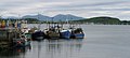
 Boats in Portree Bay - geograph.org.uk - 645203.jpg 640 × 480; 65 KB
-
 Catterline Bay Scotland.jpg 13,400 × 3,096; 14.81 MB
-
 Cowie and Stonehaven Bay. - geograph.org.uk - 110938.jpg 640 × 317; 116 KB
-

-
 Homeli Knoll.jpg 1,024 × 768; 370 KB
-
 Horse Isles and Horse Isles Bay - geograph.org.uk - 251258.jpg 640 × 480; 110 KB
-
 Iron Ring at Gibb's Hole - geograph.org.uk - 1300646.jpg 480 × 640; 96 KB
-
 Kilchoan01LB.jpg 3,264 × 2,448; 2.67 MB
-
 Kinghorn Bay viewing south over the Forth Estuary.jpg 3,088 × 2,056; 748 KB
-
 Landing on Lunga - geograph.org.uk - 13739.jpg 640 × 480; 112 KB
-
 Lon Mor, Gometra - geograph.org.uk - 204787.jpg 429 × 640; 382 KB
-
 Meikleross Bay - geograph.org.uk - 39216.jpg 640 × 480; 74 KB
-
 Moorings at Roghadal - geograph.org.uk - 36464.jpg 640 × 431; 48 KB
-
 North Haven - geograph.org.uk - 259403.jpg 640 × 480; 79 KB
-
 Oakbank Wood - geograph.org.uk - 1350974.jpg 640 × 480; 73 KB
-
 Old Hall Bay - geograph.org.uk - 107075.jpg 640 × 407; 143 KB
-
 Panorama south-west of White Hill - geograph.org.uk - 1716618.jpg 3,000 × 1,161; 1.01 MB
-
 Port a'Mhuilinn - geograph.org.uk - 36894.jpg 640 × 480; 69 KB
-
 Port an t-Sluic - geograph.org.uk - 452356.jpg 639 × 444; 55 KB
-
 Port Beul Mor - geograph.org.uk - 576320.jpg 640 × 480; 99 KB
-
 Quayside and bay - geograph.org.uk - 494843.jpg 640 × 286; 37 KB
-
 Rackwick on Hoy - geograph.org.uk - 214481.jpg 400 × 276; 44 KB
-
 Ramasaig Bay - geograph.org.uk - 166219.jpg 640 × 480; 81 KB
-
 Sailean Mor - geograph.org.uk - 245267.jpg 640 × 480; 97 KB
-
 Sandeels Bay - geograph.org.uk - 192157.jpg 640 × 480; 69 KB
-
-
 Seal colony - geograph.org.uk - 118921.jpg 640 × 480; 123 KB
-
 Seton sands west.jpg 800 × 318; 119 KB
-

-
 South Side of Currarie Bay - geograph.org.uk - 274331.jpg 640 × 426; 109 KB
-
 Southerness Point and the Solway Firth - geograph.org.uk - 1766132.jpg 3,872 × 2,592; 2.09 MB
-
 Sports Centre across Granton Bay - geograph.org.uk - 355049.jpg 640 × 480; 79 KB
-
 St Abbs pan.jpg 6,376 × 2,461; 9.38 MB
-
 St Margaret's Hope - geograph.org.uk - 54653.jpg 640 × 418; 72 KB
-
 Stac Cas a'Bhruic - geograph.org.uk - 102145.jpg 640 × 480; 312 KB
-
 Staffin Bay - geograph.org.uk - 222952.jpg 640 × 427; 93 KB
-
 Stake Nets at Balcary Fishery - geograph.org.uk - 1356142.jpg 640 × 480; 111 KB
-
 Steep climb... - geograph.org.uk - 1555511.jpg 480 × 640; 56 KB
-
 Stein Bay - geograph.org.uk - 222479.jpg 640 × 480; 115 KB
-
 Tanera Mòr - geograph.org.uk - 60631.jpg 640 × 426; 179 KB
-
 The Crow's Nest at Stairhaven - geograph.org.uk - 166986.jpg 640 × 480; 91 KB
-
 The edge of the wood - geograph.org.uk - 1402696.jpg 640 × 480; 141 KB
-

-
 The Mouth of the River Deveron - geograph.org.uk - 1762745.jpg 640 × 342; 176 KB
-
 The Muckle Lands - geograph.org.uk - 1305601.jpg 640 × 480; 294 KB
-
 Top of Screel Woods - geograph.org.uk - 1490867.jpg 640 × 480; 110 KB
-
 Towards Binsness - geograph.org.uk - 371345.jpg 640 × 480; 43 KB
-
 Traigh nan Siolag - geograph.org.uk - 570451.jpg 640 × 480; 91 KB
-

-
 Underneath the Arches - geograph.org.uk - 688619.jpg 637 × 457; 202 KB
-
 Upriver from above Gibbs Hole Wood - geograph.org.uk - 1280539.jpg 640 × 480; 91 KB
-

-
 View from Screel Hill - geograph.org.uk - 1220960.jpg 640 × 480; 38 KB
-
 View of Cowie - geograph.org.uk - 258131.jpg 640 × 436; 58 KB
-
 View of Torr Point - geograph.org.uk - 100794.jpg 640 × 429; 52 KB
-
 View to Dunnet Head - geograph.org.uk - 244034.jpg 640 × 480; 50 KB
-
 Wardie Bay and Granton Harbour - geograph.org.uk - 325639.jpg 640 × 480; 83 KB
-
 Wilkhaven - geograph.org.uk - 8543.jpg 640 × 332; 129 KB
-
 'Juniper Bay' on the Caledonian Canal - geograph.org.uk - 636752.jpg 640 × 480; 93 KB
-
 A stormy day on Clabhach Beach - geograph.org.uk - 1449426.jpg 640 × 480; 62 KB
-
 Across Scourie Bay - geograph.org.uk - 831757.jpg 640 × 432; 55 KB
-
 Across the bay. - geograph.org.uk - 1467210.jpg 640 × 480; 60 KB
-
 Ardghunel from Camuscross - geograph.org.uk - 584631.jpg 640 × 480; 105 KB
-
 Badcall Bay - geograph.org.uk - 472027.jpg 640 × 480; 72 KB
-
 Bagh Achadh da Mhaoilein - geograph.org.uk - 584901.jpg 640 × 480; 39 KB
-
 Bagh an Tailleir - geograph.org.uk - 340455.jpg 640 × 430; 97 KB
-
 Bagh Ban - geograph.org.uk - 165721.jpg 640 × 270; 137 KB
-
 Bagh Dail nan Ceann - geograph.org.uk - 165717.jpg 640 × 480; 200 KB
-
 Bagh Direcleit - geograph.org.uk - 1518108.jpg 640 × 426; 288 KB
-
 Bagh Fearnoch - geograph.org.uk - 765504.jpg 640 × 480; 54 KB
-
 Bagh Gleann a'Mhaoil bay - geograph.org.uk - 725187.jpg 640 × 355; 48 KB
-
 Bagh Gleann nam Muc - geograph.org.uk - 67644.jpg 640 × 440; 36 KB
-
 Bagh Gleann nan Muc - geograph.org.uk - 66959.jpg 640 × 465; 52 KB
-
 Bagh na Craobhag - geograph.org.uk - 843084.jpg 640 × 360; 46 KB
-
 Bagh na Doirelinne - geograph.org.uk - 718110.jpg 640 × 480; 73 KB
-
 Bagh nan Cleathan - geograph.org.uk - 773187.jpg 640 × 480; 104 KB
-
 Bagh Rubha Ruaidh - geograph.org.uk - 219379.jpg 640 × 480; 96 KB
-
 Balephetrish Bay - geograph.org.uk - 1460271.jpg 640 × 480; 107 KB
-

-
 Baravaig Bay - geograph.org.uk - 576720.jpg 640 × 480; 115 KB
-
 Barnbougle - geograph.org.uk - 308240.jpg 640 × 512; 154 KB
-
 Bay along the shores of Loch Ericht - geograph.org.uk - 801773.jpg 640 × 427; 34 KB
-
 Bay at Baugh - geograph.org.uk - 1460278.jpg 640 × 480; 108 KB
-
 Bay at Dalelia - geograph.org.uk - 413885.jpg 640 × 480; 89 KB
-
 Bay at Fearnbeg - geograph.org.uk - 602042.jpg 640 × 481; 89 KB
-
 Bay at Kenmore - geograph.org.uk - 578108.jpg 640 × 428; 97 KB
-
 Bay at Rudha Riabhach - geograph.org.uk - 351917.jpg 640 × 480; 197 KB
-
 Bay at Vaul - geograph.org.uk - 1460303.jpg 640 × 480; 79 KB
-
 Bay of Creekland - geograph.org.uk - 486137.jpg 640 × 480; 123 KB
-
 Bay of Keisgaig - geograph.org.uk - 815988.jpg 640 × 480; 163 KB
-
 Bay of Keisgaig - geograph.org.uk - 816155.jpg 640 × 480; 130 KB
-
 Bay of Skaill and Skara Brae - geograph.org.uk - 504506.jpg 640 × 480; 77 KB
-
 Bay of Skaill, Mainland Orkney - geograph.org.uk - 1457917.jpg 640 × 480; 48 KB
-
 Bay of Tuquoy, Westray - geograph.org.uk - 283985.jpg 640 × 480; 63 KB
-
 Bay on Cam Loch - geograph.org.uk - 826436.jpg 640 × 480; 66 KB
-
 Bay on Loch na Cairidh - geograph.org.uk - 1400065.jpg 640 × 480; 73 KB
-
 Bay on the Chraiginis peninsula - geograph.org.uk - 1440069.jpg 640 × 480; 101 KB
-
 Beach Crescent - geograph.org.uk - 535431.jpg 640 × 481; 166 KB
-
 Beasdaire Bay, Berneray - geograph.org.uk - 842233.jpg 640 × 360; 39 KB
-
 Bellochantuy Bay Before the Storm. - geograph.org.uk - 255834.jpg 640 × 480; 60 KB
-
 Bettyhill, Farr Bay - geograph.org.uk - 596771.jpg 640 × 480; 66 KB
-
 Bothy above Bagh Gleann a'Mhaoil - geograph.org.uk - 1519685.jpg 640 × 426; 247 KB
-
 Bothy near Logie Head - geograph.org.uk - 25137.jpg 640 × 480; 80 KB
-
 Brenfield Bay by Inverneill. - geograph.org.uk - 125416.jpg 640 × 480; 120 KB
-
 Bun Abhainn na Clolch - geograph.org.uk - 562757.jpg 640 × 427; 272 KB
-
 Bun an Loin - geograph.org.uk - 774516.jpg 640 × 480; 96 KB
-
 Bàgh Cnoc nan Gobhàr - geograph.org.uk - 1512084.jpg 640 × 480; 90 KB
-
 Bàgh Mòr, Grimsay - geograph.org.uk - 1435277.jpg 640 × 426; 115 KB
-
 Bàgh nan Gunnaichean - geograph.org.uk - 428152.jpg 640 × 425; 111 KB
-
 Bágh Shaltabhaigh - geograph.org.uk - 448841.jpg 640 × 480; 71 KB
-

-
 Camas Aird Nam Fiasgan - geograph.org.uk - 23876.jpg 640 × 448; 135 KB
-
 Camas Aird Nam Fiasgan - geograph.org.uk - 23878.jpg 640 × 456; 134 KB
-
 Camas an Tairidh - geograph.org.uk - 426236.jpg 640 × 480; 145 KB
-
 Camas Ban - geograph.org.uk - 132320.jpg 640 × 480; 89 KB
-
 Camas Beag - geograph.org.uk - 108695.jpg 640 × 480; 59 KB
-
 Camas Bostadh - geograph.org.uk - 546090.jpg 640 × 373; 209 KB
-
 Camas Chala Moil - geograph.org.uk - 1456550.jpg 640 × 480; 74 KB
-
 Camas Chonalain Beag - geograph.org.uk - 641708.jpg 800 × 600; 184 KB
-
 Camas Coille - geograph.org.uk - 1491492.jpg 640 × 480; 56 KB
-
 Camas Cuil an t-Siamh - geograph.org.uk - 570469.jpg 640 × 480; 165 KB
-
 Camas Driseach - geograph.org.uk - 23952.jpg 640 × 474; 125 KB
-
 Camas Eilan nam Ban - geograph.org.uk - 559617.jpg 640 × 480; 46 KB
-
 Camas Eilean Ghlais - geograph.org.uk - 1460736.jpg 640 × 480; 81 KB
-
 Camas Eilean Ghlais - geograph.org.uk - 1460777.jpg 640 × 480; 73 KB
-
 Camas Mol Linnis - geograph.org.uk - 575358.jpg 640 × 480; 84 KB
-
 Camas Mor - geograph.org.uk - 748114.jpg 640 × 480; 70 KB
-
 Camas na Cailinn - geograph.org.uk - 641720.jpg 800 × 600; 233 KB
-
 Camas na Gall - geograph.org.uk - 546002.jpg 640 × 480; 109 KB
-
 Camas nan Bairneach, Scarba - geograph.org.uk - 1519651.jpg 640 × 426; 290 KB
-
 Camas nan Gall - geograph.org.uk - 545913.jpg 640 × 480; 98 KB
-
 Camas nan Geall - geograph.org.uk - 448900.jpg 640 × 480; 135 KB
-
 Camas nan Geall - geograph.org.uk - 739253.jpg 640 × 360; 44 KB
-
 Camas Rubha na Liathaig - geograph.org.uk - 189566.jpg 640 × 426; 89 KB
-
 Camasnacroise - geograph.org.uk - 729161.jpg 640 × 480; 71 KB
-
 Camgaraidh Bay - geograph.org.uk - 765250.jpg 640 × 479; 95 KB
-
 Camp site to the South of South Lee - geograph.org.uk - 640172.jpg 640 × 480; 78 KB
-
 Camus an Lagain - geograph.org.uk - 448777.jpg 640 × 480; 122 KB
-
 Carleton Bay - geograph.org.uk - 1473604.jpg 640 × 457; 255 KB
-
 Carskiey Bay. - geograph.org.uk - 255721.jpg 640 × 474; 58 KB
-
 Cattlerline Bay - geograph.org.uk - 1412221.jpg 640 × 427; 47 KB
-
 Ceann a' Bhaigh - geograph.org.uk - 1437986.jpg 640 × 480; 143 KB
-
 Ceann a' Bháigh - geograph.org.uk - 443706.jpg 640 × 480; 83 KB
-
 Clasnessie Bay - geograph.org.uk - 242980.jpg 640 × 384; 61 KB
-
 Creagach Crosgach and Bagh Ban - geograph.org.uk - 165729.jpg 640 × 396; 177 KB
-
 Crovie, Gamrie Bay - geograph.org.uk - 251769.jpg 640 × 378; 136 KB
-
 Diabaig - geograph.org.uk - 7665.jpg 640 × 480; 80 KB
-
 Dores Bay - geograph.org.uk - 749529.jpg 640 × 480; 55 KB
-
 Dores beach from south of Dores - geograph.org.uk - 608083.jpg 640 × 480; 101 KB
-
 Eilean na Beitheiche - geograph.org.uk - 491027.jpg 640 × 432; 86 KB
-
 Feall Bay, from the west. - geograph.org.uk - 8310.jpg 640 × 480; 57 KB
-
 Fennachrochan and Port Ramsay Bay - geograph.org.uk - 137804.jpg 640 × 480; 70 KB
-
 Findhorn Bay from Binsness - geograph.org.uk - 579284.jpg 640 × 427; 215 KB
-

-
 Fiskavaig Bay - geograph.org.uk - 126897.jpg 640 × 480; 103 KB
-
 Flotsam and jetsam^ - geograph.org.uk - 127861.jpg 640 × 480; 133 KB
-
 Foyers Bay, Loch Ness - geograph.org.uk - 209418.jpg 640 × 427; 113 KB
-
 Gamrie Bay - geograph.org.uk - 434564.jpg 640 × 427; 242 KB
-
 Gamrie Bay - geograph.org.uk - 593974.jpg 640 × 305; 165 KB
-
 Ganavan Bay - geograph.org.uk - 92825.jpg 610 × 474; 321 KB
-
 Geodha na Ploytach Beag - geograph.org.uk - 304604.jpg 640 × 425; 174 KB
-
 Grob Bagh - geograph.org.uk - 395632.jpg 640 × 480; 114 KB
-
 Holm of Grimbister - geograph.org.uk - 509975.jpg 640 × 480; 43 KB
-

-
 Hushinish Bay - geograph.org.uk - 563049.jpg 640 × 480; 70 KB
-
 Inver Aulavaig - geograph.org.uk - 173053.jpg 640 × 480; 81 KB
-
 Inverie Bay, Knoydart - geograph.org.uk - 90053.jpg 640 × 480; 76 KB
-
 Inversanda Bay - geograph.org.uk - 410295.jpg 640 × 480; 91 KB
-
 Kayaks at Camascross - geograph.org.uk - 401204.jpg 640 × 480; 69 KB
-
 Kentallen - geograph.org.uk - 13792.jpg 640 × 381; 138 KB
-
 Kilchairan Bay - geograph.org.uk - 112447.jpg 640 × 480; 210 KB
-
 Kiloran Bay - geograph.org.uk - 25186.jpg 640 × 411; 74 KB
-
 Kiloran Bay and Carn nan Eoin - geograph.org.uk - 249710.jpg 640 × 480; 76 KB
-
 Laorin Bay and Pier - geograph.org.uk - 199902.jpg 640 × 480; 72 KB
-
 Laorin Bay from Dun Ara - geograph.org.uk - 45686.jpg 640 × 426; 82 KB
-
 Little Bay near Portnaluchaig - geograph.org.uk - 778261.jpg 640 × 480; 65 KB
-
 Loch Diubaig - geograph.org.uk - 172783.jpg 640 × 480; 173 KB
-

-
 Looking towards Fuam an Tolla - geograph.org.uk - 564549.jpg 640 × 480; 85 KB
-
 Lunan Bay by Moonlight - geograph.org.uk - 487428.jpg 427 × 640; 23 KB
-
 Macharioch Bay - geograph.org.uk - 484774.jpg 640 × 480; 78 KB
-
 Machrihanish Bay. - geograph.org.uk - 452582.jpg 640 × 426; 236 KB
-
 Meran Licks - geograph.org.uk - 434920.jpg 640 × 407; 240 KB
-
 Mol Foirs Geòdha - geograph.org.uk - 575349.jpg 640 × 480; 81 KB
-
 Mudslide at Crovie, Gamrie Bay - geograph.org.uk - 106558.jpg 640 × 432; 169 KB
-
 Newark Bay, Deerness - geograph.org.uk - 73123.jpg 640 × 480; 68 KB
-
 Nigg Bay and Cromarty Firth - geograph.org.uk - 8519.jpg 640 × 260; 82 KB
-
 North Bay - geograph.org.uk - 564977.jpg 640 × 480; 53 KB
-
 North Bay at Stonefield - geograph.org.uk - 564976.jpg 640 × 480; 48 KB
-
 North Bay, Shuna - geograph.org.uk - 211162.jpg 640 × 521; 50 KB
-
 North End of Currarie Port - geograph.org.uk - 274329.jpg 640 × 426; 136 KB
-
 Ob Gauscavaig - geograph.org.uk - 261214.jpg 640 × 480; 168 KB
-
 Ob Gauscavaig - geograph.org.uk - 261233.jpg 640 × 480; 76 KB
-
 Ob Liath - geograph.org.uk - 564951.jpg 640 × 480; 62 KB
-
 Ob Mheallaidh, near Shieldaig - geograph.org.uk - 274773.jpg 640 × 480; 84 KB
-
 Ob nam Portan - geograph.org.uk - 317249.jpg 640 × 425; 147 KB
-
 Ob nan Ròn - geograph.org.uk - 635787.jpg 640 × 480; 61 KB
-
 Old Store, Bay of Skaill - geograph.org.uk - 488932.jpg 640 × 473; 63 KB
-
 Papigoe, Broad Haven - geograph.org.uk - 596887.jpg 640 × 480; 76 KB
-
 Plocrapol Bay - geograph.org.uk - 564566.jpg 640 × 480; 67 KB


