Category:Baxterley
Jump to navigation
Jump to search
village in United Kingdom  | |||||
| Upload media | |||||
| Instance of | |||||
|---|---|---|---|---|---|
| Location | North Warwickshire, Warwickshire, West Midlands, England | ||||
| Population |
| ||||
| Area |
| ||||
| Said to be the same as | Baxterley (Wikimedia duplicated page, civil parish) | ||||
 | |||||
English: Baxterley is a village and civil parish in the North Warwickshire district of Warwickshire in England. According to the 2001 census, it had a population of 335. The village is about two miles west of Atherstone.
Media in category "Baxterley"
The following 50 files are in this category, out of 50 total.
-
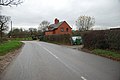 A House on Atherstone Lane - geograph.org.uk - 2729765.jpg 640 × 428; 57 KB
-
 Across the Green at Wigston Hill - geograph.org.uk - 2729755.jpg 640 × 428; 67 KB
-
 An old Barn near Baxterley - geograph.org.uk - 2730878.jpg 640 × 428; 59 KB
-
 Another view of Lloyd's Coppice - geograph.org.uk - 169300.jpg 426 × 640; 188 KB
-
 Approach to Baxterley parish church - geograph.org.uk - 2561316.jpg 640 × 480; 398 KB
-
 Atherstone Lane - geograph.org.uk - 5286234.jpg 1,600 × 901; 663 KB
-
 Atherstone Lane towards Wigston Hill - geograph.org.uk - 2729776.jpg 640 × 428; 71 KB
-
 Broken backed byre - geograph.org.uk - 111038.jpg 640 × 532; 117 KB
-
 Broomfield Farm, Bentley - geograph.org.uk - 103756.jpg 640 × 480; 113 KB
-
 Driveway to Kiddle's Farm, Baxterley - geograph.org.uk - 2730883.jpg 640 × 428; 52 KB
-
 Farmland and muddy footpath - geograph.org.uk - 5286241.jpg 1,600 × 901; 714 KB
-
 Farmland by Hipsley Lane - geograph.org.uk - 5975351.jpg 6,000 × 4,000; 7.52 MB
-
 Footpath to Hipsley Farm - geograph.org.uk - 5976008.jpg 6,000 × 4,000; 4.8 MB
-
 Green Farm - geograph.org.uk - 2561329.jpg 640 × 480; 353 KB
-
 Green Farm - geograph.org.uk - 5286245.jpg 1,600 × 901; 698 KB
-
 Green Farm - geograph.org.uk - 5976048.jpg 6,000 × 4,000; 4.7 MB
-
 House along Atherstone Lane - geograph.org.uk - 4843010.jpg 800 × 572; 125 KB
-

-

-
 North end of Hipsley Lane - geograph.org.uk - 2561321.jpg 640 × 480; 365 KB
-
 Preparing the ground near Green Farm - geograph.org.uk - 5976062.jpg 6,000 × 4,000; 7.43 MB
-
 Road junction - geograph.org.uk - 5577233.jpg 1,600 × 900; 361 KB
-

-
 Steam Mill Cottage near Baxterley - geograph.org.uk - 2730867.jpg 640 × 428; 67 KB
-
 The Orchard, Baxterley - geograph.org.uk - 5286238.jpg 1,600 × 901; 691 KB
-

-
 A stand of Lombardy Poplars - geograph.org.uk - 112145.jpg 480 × 640; 71 KB
-
 A stand of pines, Baxterley Common - geograph.org.uk - 111033.jpg 640 × 480; 94 KB
-
 Abandoned building, Crawshaws - geograph.org.uk - 111143.jpg 640 × 480; 133 KB
-
 Baxterley Village Pub - geograph.org.uk - 7830.jpg 640 × 480; 136 KB
-
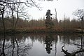 Bentley Park Wood Lake - geograph.org.uk - 103694.jpg 640 × 426; 126 KB
-
 Between charity and a lady. - geograph.org.uk - 103704.jpg 480 × 640; 155 KB
-
 Birchley Heath main-only street - geograph.org.uk - 103690.jpg 480 × 640; 129 KB
-
 Blocked doorway - geograph.org.uk - 111052.jpg 640 × 480; 125 KB
-
 Boultbee Farm - geograph.org.uk - 111047.jpg 640 × 480; 103 KB
-
 Cemetery, Bentley - geograph.org.uk - 111200.jpg 640 × 480; 116 KB
-
 Chapel Farm, Bentley - geograph.org.uk - 112143.jpg 640 × 430; 72 KB
-
 Hey hey hay^ - geograph.org.uk - 113112.jpg 518 × 388; 224 KB
-
 Lloyd's Coppice (looking South) - geograph.org.uk - 111144.jpg 640 × 480; 178 KB
-
 Lloyd's Coppice in the Spring - geograph.org.uk - 169297.jpg 640 × 426; 174 KB
-
 Old Farm Buildings, Waste Hill - geograph.org.uk - 111031.jpg 640 × 480; 155 KB
-
 Old wall near site of Baxterley Old Hall - geograph.org.uk - 111061.jpg 640 × 480; 104 KB
-
 Radio Masts at Ridge Lane - geograph.org.uk - 103689.jpg 426 × 640; 98 KB
-
 The Paddy Line, Waste Hill - geograph.org.uk - 110779.jpg 480 × 640; 197 KB
-
 The site of the old Baddesley colliery - geograph.org.uk - 8006.jpg 640 × 480; 76 KB
-
 Track to Baddesley Ensor from Waste Lane - geograph.org.uk - 112151.jpg 480 × 640; 169 KB
-
 Track to Baxterley Hall Farm - geograph.org.uk - 111039.jpg 480 × 640; 113 KB
-
 Track to cottage at Colliery Farm - geograph.org.uk - 111032.jpg 480 × 640; 148 KB
-
 Unusual stone house, Baxterley - geograph.org.uk - 111034.jpg 640 × 480; 95 KB
-


_-_geograph.org.uk_-_111144.jpg)


