Category:Baugh Fell
Jump to navigation
Jump to search
fell in Cumbria, England, UK  | |||||
| Upload media | |||||
| Instance of |
| ||||
|---|---|---|---|---|---|
| Located in protected area | |||||
| Location | Garsdale, Westmorland and Furness, Cumbria, North West England, England | ||||
| Mountain range | |||||
| Elevation above sea level |
| ||||
| Parent peak | |||||
 | |||||
Baugh Fell is a large, flat-topped hill in the northern Pennines of England. It lies in the north-western corner of the Yorkshire Dales National Park,
Media in category "Baugh Fell"
The following 13 files are in this category, out of 13 total.
-
 A row of cairns on Baugh Fell - geograph.org.uk - 254374.jpg 640 × 480; 72 KB
-
 Ascending Baugh Fell - geograph.org.uk - 744407.jpg 640 × 480; 47 KB
-
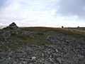
 Baugh Fell cairns - geograph.org.uk - 2053647.jpg 640 × 480; 91 KB
-
 Cairn, West Baugh Fell - geograph.org.uk - 2053619.jpg 640 × 480; 82 KB
-
 Descending Baugh Fell - geograph.org.uk - 744789.jpg 640 × 480; 90 KB
-
 Fence on West Baugh Fell - geograph.org.uk - 2383951.jpg 640 × 480; 85 KB
-
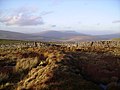 Looking towards Baugh fell - geograph.org.uk - 287612.jpg 640 × 480; 88 KB
-

-
 Ordnance Survey Sheet SD 79 Baugh Fell, Published 1958.jpg 5,522 × 5,640; 3.87 MB
-
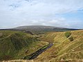 River valley with Baugh Fell beyond - geograph.org.uk - 4168505.jpg 1,500 × 1,125; 1.59 MB
-
 Rough ground on the slopes of Baugh Fell - geograph.org.uk - 2053687.jpg 640 × 480; 112 KB
-
 Wall, Baugh Fell - geograph.org.uk - 744779.jpg 640 × 480; 67 KB
-
 Wall, Baugh Fell - geograph.org.uk - 744794.jpg 640 × 480; 103 KB


