Category:Bauernhaus (Dorf 10, Deisswil bei Münchenbuchsee)
Jump to navigation
Jump to search
| Object location | | View all coordinates using: OpenStreetMap |
|---|
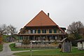
farmhouse in Deisswil bei Münchenbuchsee in the canton of Bern, Switzerland _019.JPG) | |||||
| Upload media | |||||
| Instance of | |||||
|---|---|---|---|---|---|
| Part of | |||||
| Location | Deisswil bei Münchenbuchsee, Bern-Mittelland administrative district, Bernese Mittelland administrative region, Bern, Switzerland | ||||
| Street address |
| ||||
| Heritage designation |
| ||||
| Inception |
| ||||
 | |||||
Media in category "Bauernhaus (Dorf 10, Deisswil bei Münchenbuchsee)"
The following 2 files are in this category, out of 2 total.
-
 2011-11-11-Mezlando (Foto Dietrich Michael Weidmann) 014.JPG 3,872 × 2,592; 3.43 MB
-
 2011-11-11-Mezlando (Foto Dietrich Michael Weidmann) 019.JPG 3,872 × 2,592; 3.7 MB
_014.JPG)