Category:Battlesden
Jump to navigation
Jump to search
village and civil parish in Bedfordshire, UK | |||||
| Upload media | |||||
| Instance of | |||||
|---|---|---|---|---|---|
| Location | Central Bedfordshire, Bedfordshire, East of England, England | ||||
| Population |
| ||||
 | |||||
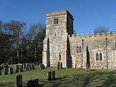
English: Battlesden is a hamlet and civil parish in the Central Bedfordshire district of Bedfordshire, England. It is just north of the A5, between Dunstable and Milton Keynes. According to the 2001 census, it had a population of 38. Because of its low electorate, it has a parish meeting rather than a parish council.
Subcategories
This category has only the following subcategory.
Media in category "Battlesden"
The following 73 files are in this category, out of 73 total.
-
Neale(1818) p1.048 - Battlesden Park, Bedfordshire.jpg 1,824 × 1,240; 790 KB
-
A5 heading towards Milton Keynes - geograph.org.uk - 5646760.jpg 640 × 428; 72 KB
-
Battlesden - Looking South - geograph.org.uk - 183147.jpg 640 × 553; 106 KB
-
Battlesden House.jpg 2,507 × 1,740; 678 KB
-
Battlesden Lake - geograph.org.uk - 1650853.jpg 640 × 427; 70 KB
-
Battlesden parish noticeboard - geograph.org.uk - 3182427.jpg 1,200 × 1,600; 484 KB
-
Battlesden village sign - geograph.org.uk - 3182428.jpg 1,200 × 1,600; 779 KB
-
Battlesden, St Peter ^ All Saints - geograph.org.uk - 5439389.jpg 4,608 × 3,456; 5.25 MB
-
Bridleway crosses Clipstone Brook - geograph.org.uk - 3290401.jpg 1,600 × 1,068; 723 KB
-
Bridleway onto the Hockliffe Road - geograph.org.uk - 3182412.jpg 1,200 × 1,600; 697 KB
-
Bridleway toward the Clipstone Brook - geograph.org.uk - 3182411.jpg 1,600 × 1,067; 649 KB
-
Cattle Grid - geograph.org.uk - 2631441.jpg 4,000 × 3,000; 4.84 MB
-
Central Bedfordshire , Battlesden Lodge - geograph.org.uk - 5733054.jpg 5,803 × 3,868; 6.39 MB
-
Centre Farm on the gated road - geograph.org.uk - 3182430.jpg 1,600 × 1,069; 555 KB
-
Centre Farm, Battlesden - geograph.org.uk - 183064.jpg 640 × 480; 86 KB
-
Electricity Pole by the bridleway - geograph.org.uk - 3182414.jpg 1,200 × 1,600; 562 KB
-
Farmland opposite Battlesden Church - geograph.org.uk - 2600632.jpg 640 × 480; 96 KB
-
Field by the Hockliffe Road - geograph.org.uk - 3182409.jpg 1,600 × 1,068; 787 KB
-
Gate on the path to Church End - geograph.org.uk - 3182417.jpg 1,600 × 1,067; 495 KB
-
Gated road out of Battlesden - geograph.org.uk - 1279282.jpg 480 × 640; 180 KB
-
Gateway on Battlesden Avenue - geograph.org.uk - 2776628.jpg 640 × 470; 102 KB
-
Grassy lane from Battlesden - geograph.org.uk - 1279304.jpg 640 × 480; 177 KB
-
Hockliffe Road - geograph.org.uk - 5579606.jpg 1,998 × 1,468; 520 KB
-
House and churchyard, Battlesden - geograph.org.uk - 183071.jpg 640 × 480; 132 KB
-
Lane from Battlesden to its Church - geograph.org.uk - 1279274.jpg 640 × 480; 181 KB
-
Lane to Hill Farm, Battlesden - geograph.org.uk - 173726.jpg 640 × 640; 103 KB
-
Mobile Phone Mast - geograph.org.uk - 2633293.jpg 3,000 × 4,000; 3.09 MB
-
Path to Tebworth - geograph.org.uk - 3182419.jpg 1,200 × 1,600; 804 KB
-
Pheasants, Battlesden - geograph.org.uk - 1279242.jpg 640 × 364; 196 KB
-
Pines, Battlesden - geograph.org.uk - 1279255.jpg 480 × 640; 189 KB
-
Stately trees, Battlesden - geograph.org.uk - 1279248.jpg 640 × 475; 177 KB
-
Steps and churchyard - geograph.org.uk - 183137.jpg 640 × 480; 150 KB
-
Sunset over Hockliffe Road - geograph.org.uk - 5570667.jpg 2,048 × 1,536; 1.08 MB
-
Sunset over Hockliffe Road - geograph.org.uk - 5570690.jpg 2,048 × 1,536; 846 KB
-
The A5 road from the air - geograph.org.uk - 3367511.jpg 555 × 640; 102 KB
-
Timber ^^^ - geograph.org.uk - 1279264.jpg 480 × 640; 194 KB
-
Transmitter Mast at Battlesden - geograph.org.uk - 1989829.jpg 640 × 480; 127 KB
-
Approaching Battlesden Church - geograph.org.uk - 183063.jpg 640 × 480; 86 KB
-
Battlesden - geograph.org.uk - 183065.jpg 640 × 485; 105 KB
-
Church Lane, Church End, Hockliffe - geograph.org.uk - 183135.jpg 640 × 480; 92 KB
-
Fields near Battlesden - geograph.org.uk - 183061.jpg 640 × 480; 124 KB
-
Gates to Hockliffe Rectory - geograph.org.uk - 182718.jpg 640 × 480; 142 KB
-
Ground Farm, Hockliffe - geograph.org.uk - 182722.jpg 640 × 480; 93 KB
-
Hockliffe Grange - geograph.org.uk - 182712.jpg 640 × 480; 107 KB
-
Hockliffe Grounds - geograph.org.uk - 183138.jpg 640 × 480; 98 KB
-
Track to Grange Farm, Hockliffe - geograph.org.uk - 183146.jpg 640 × 480; 119 KB


