Category:Bathymetric maps of volcanoes
Jump to navigation
Jump to search
Subcategories
This category has only the following subcategory.
Media in category "Bathymetric maps of volcanoes"
The following 56 files are in this category, out of 56 total.
-
 Ahyi 3d hires.jpg 2,724 × 2,029; 2.21 MB
-
 Arctic Ocean bathymetric features.png 803 × 664; 664 KB
-
 Atlantismeteorcomplex3d.png 1,020 × 609; 367 KB
-
 Axial bathymetry.jpg 432 × 153; 13 KB
-
 Azorestriple3d.png 1,020 × 609; 369 KB
-
 Bathymetry around Farallon de Pajaros.jpg 596 × 405; 113 KB
-
 Bathymetry image of the Hawaiian archipelago.png 3,681 × 2,844; 14.38 MB
-
 Bear Seamount.jpg 600 × 496; 100 KB
-
 Bouvettriplejunction3d.png 1,020 × 609; 470 KB
-
 Bouvettriplenarrow3d.svg 1,020 × 609; 505 KB
-
 Brothers Volcano - map00258.jpg 1,744 × 1,224; 239 KB
-
 Brothers Volcano - map00259.jpg 2,716 × 1,872; 766 KB
-
 Brothers Volcano - map00260.jpg 2,713 × 1,958; 582 KB
-
 Brothers Volcano - map00262.jpg 2,674 × 1,836; 310 KB
-
 Charles Darwin volcanic field.png 757 × 668; 1.17 MB
-
 Charliegibbstransform.png 1,020 × 609; 303 KB
-
 Charliegibbstransform.svg 1,020 × 609; 424 KB
-
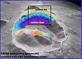
 Crater Lake bathymetry.jpg 600 × 345; 73 KB
-
 Daikoku 3d hires.jpg 2,724 × 2,029; 2.7 MB
-
 Denson Seamount.jpg 600 × 450; 33 KB
-
 East Scotia Ridge - Plos Biol 02.tif 2,894 × 3,439; 9.26 MB
-
 Esmeralda 3d hires.jpg 2,724 × 2,029; 2.07 MB
-
 Expl0049 - Flickr - NOAA Photo Library.jpg 3,240 × 2,283; 690 KB
-
 Galapagos-hotspot-large.png 10,380 × 8,611; 13.25 MB
-
 Geologists Seamounts.png 821 × 787; 1.01 MB
-
 Greatmeteorseamount3d.svg 1,020 × 609; 500 KB
-
 Hawaiian Islands landslides.jpg 2,208 × 1,705; 424 KB
-
 Hawaiian seamount chain.jpg 939 × 650; 164 KB
-
 Kasuga volcano.jpg 3,015 × 1,974; 2.45 MB
-
 Kasuga2 3d hires.jpg 3,042 × 2,092; 2.08 MB
-
 LoihiBathemetric.jpg 565 × 681; 230 KB
-
 Louisville seamount chain - bathymetry.jpg 738 × 521; 212 KB
-
 Magic Mountain map.jpg 525 × 776; 121 KB
-
 Map00177 (27670432084).jpg 600 × 239; 32 KB
-
 Map00323 - Flickr - NOAA Photo Library.jpg 1,284 × 1,278; 409 KB
-
 Maug 3d hires.jpg 3,044 × 2,293; 2.32 MB
-
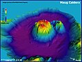
 Maug caldera bathymetry.jpg 3,693 × 2,250; 673 KB
-
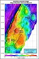
 Mazama bathymetry survey map.jpg 600 × 345; 61 KB
-
 MedicineLakeBathymetricMeters20080926.png 992 × 663; 123 KB
-
 Minami Kasuga.jpg 640 × 480; 46 KB
-
 Nikko 3d hires.jpg 2,724 × 2,029; 2.23 MB
-
 Nikko volcano.jpg 3,015 × 1,974; 2.38 MB
-
 NPS crater-lake-depth-map.gif 606 × 544; 189 KB
-
 Nweifuku 3d hires.jpg 3,047 × 2,294; 1.87 MB
-
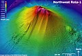 Nwrota1 3d hires.jpg 2,803 × 1,927; 3.13 MB
-
 Ruby 3d hires.jpg 2,724 × 2,029; 2 MB
-
 Ruby bathymetry map 600.jpg 600 × 639; 89 KB
-
 SeamontDavidson expedition bathymetric-2002.jpg 600 × 478; 59 KB
-
 Seamountx 3d hires.jpg 2,724 × 2,029; 1.81 MB
-
 Seewarte3d.svg 1,020 × 609; 513 KB
-
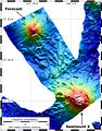 Smnx frcast map hires.jpg 2,160 × 2,757; 2.4 MB
-
 Sodade Seamount.png 758 × 716; 1.54 MB
-
 Tafu-Maka.jpg 430 × 480; 89 KB
-
 Vematransform.png 1,020 × 609; 282 KB
-
 Wrota 3d hires.jpg 2,724 × 1,998; 2.55 MB
-
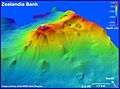 Zealandia 3d hires.jpg 2,721 × 2,029; 1.99 MB


.jpg)