Category:Bathymetric maps of the Southern Ocean
Jump to navigation
Jump to search
Media in category "Bathymetric maps of the Southern Ocean"
The following 10 files are in this category, out of 10 total.
-
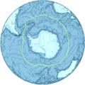
Antarctica-Location.jpg 872 × 872; 389 KB
-
Antarctica-Region.png 874 × 874; 550 KB
-
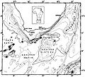
Bransfield Basin Bathymetry.png 946 × 554; 697 KB
-
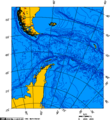
Drake Passage - Lambert Azimuthal projection 0.png 517 × 562; 26 KB
-
Polar sea depth.jpg 12,851 × 12,830; 54.64 MB
-
Seir.png 3,509 × 2,480; 5.67 MB
-
South africa sea.jpg 927 × 843; 455 KB
-
South American-Antarctic Ridge NOAA.jpg 1,758 × 816; 172 KB


