Category:Bathpool, Somerset
Jump to navigation
Jump to search
English: Bathpool is a settlement in the civil parish of West Monkton, in the Somerset West and Taunton district, in the county of Somerset, England.
settlement in Somerset, England | |||||
| Upload media | |||||
| Instance of | |||||
|---|---|---|---|---|---|
| Location | Somerset, South West England, England | ||||
| |||||
Subcategories
This category has only the following subcategory.
T
- Transport in Bathpool, Somerset (154 F)
Media in category "Bathpool, Somerset"
The following 69 files are in this category, out of 69 total.
-

-
 Autumn on the canal at Bathpool.JPG 1,366 × 910; 683 KB
-
 Bathpool - Canal and Neptune.jpg 1,024 × 768; 347 KB
-
 Bathpool - Jean Pierre.JPG 1,366 × 910; 449 KB
-
 Bathpool - River Usk passing beneath the M5.JPG 1,366 × 910; 627 KB
-
 Bathpool Bus Gate.JPG 1,366 × 1,024; 362 KB
-
 Bathpool Canal Bridge (2021).JPG 1,366 × 910; 486 KB
-
 Bathpool canal swing bridge.JPG 1,366 × 910; 574 KB
-
 Bathpool Chapel (2021).JPG 1,366 × 1,024; 536 KB
-
 Bathpool Forge bus stop.jpg 1,366 × 1,024; 636 KB
-
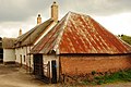
 Bird's Farm, Bathpool (2021) rear gate.JPG 1,024 × 1,366; 414 KB
-
 Bird's Farm, Bathpool (2021).JPG 1,366 × 1,024; 490 KB
-
 Bridge 29 on the Bridgwater ^ Taunton canal at Bathpool - geograph.org.uk - 2541525.jpg 1,600 × 1,200; 727 KB
-
 Bridge over the canal at Bathpool - geograph.org.uk - 1871028.jpg 640 × 480; 174 KB
-
 Bridgwater and Taunton Canal - geograph.org.uk - 3105567.jpg 1,600 × 1,200; 517 KB
-
 Bridgwater and Taunton Canal - geograph.org.uk - 600019.jpg 600 × 450; 62 KB
-
 Canal at Bathpool - geograph.org.uk - 1871026.jpg 640 × 480; 133 KB
-
 Canal at Bathpool, heading east - geograph.org.uk - 1871029.jpg 640 × 480; 171 KB
-
 Canal bridge, Bathpool - geograph.org.uk - 2008461.jpg 640 × 470; 110 KB
-
 Canal bridge, Bathpool - geograph.org.uk - 2008499.jpg 640 × 480; 91 KB
-
 Canal swing bridge, Bathpool - geograph.org.uk - 2349894.jpg 1,024 × 768; 232 KB
-

-
 Canal View, Bathpool (2021).JPG 1,366 × 1,024; 400 KB
-
 Clearing the reeds on the canal at Bathpool.JPG 1,366 × 910; 792 KB
-
 Cottages, Bathpool - geograph.org.uk - 2349928.jpg 1,024 × 768; 296 KB
-
 Creech Castle (2021).JPG 1,366 × 1,024; 692 KB
-
 Dredged mud unloading at Bathpool.JPG 1,366 × 910; 711 KB
-
 Dredging the canal at Bathpool.JPG 1,366 × 910; 639 KB
-
 Dredging tug and barge at Bathpool.JPG 1,366 × 910; 859 KB
-
 Dredging tug and barge at Hankridge.JPG 1,366 × 910; 609 KB
-
 Hankridge Lake, Taunton - geograph.org.uk - 1413784.jpg 640 × 480; 128 KB
-
 Hankridge memorial (2021).JPG 1,366 × 910; 752 KB
-
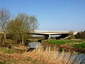
 Hankridge Viaduct (2021).JPG 1,366 × 910; 667 KB
-
 Hyde Cottages, Bathpool (2021).JPG 1,366 × 910; 394 KB
-
 Hyde Farm, Bathpool (2021).jpg 1,366 × 1,024; 428 KB
-
 Hyde Lane Bridge (2021).JPG 1,366 × 910; 609 KB
-
 Marina, Bathpool - geograph.org.uk - 2958613.jpg 2,592 × 1,944; 1.14 MB
-
 Marina, Taunton and Bridgwater Canal - geograph.org.uk - 2349871.jpg 1,024 × 768; 209 KB
-
 New Mill Inn, Bathpool (2021).JPG 1,366 × 910; 380 KB
-
 Noisy neighbours - geograph.org.uk - 196608.jpg 640 × 480; 102 KB
-

-

-
 River Tone - geograph.org.uk - 1026792.jpg 640 × 480; 111 KB
-

-
 River Tone M5 bridge at Hankridge.jpg 1,824 × 1,368; 1.04 MB
-
 River Tone near Ruishton - geograph.org.uk - 1458913.jpg 640 × 480; 91 KB
-
 Roadworks on the A38 at Bathpool.JPG 1,366 × 910; 749 KB
-
 Slip road Junction 25 M5 Eastbound - geograph.org.uk - 1874848.jpg 640 × 489; 89 KB
-
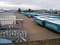 Somerfield Distribution Depot - geograph.org.uk - 512867.jpg 640 × 480; 60 KB
-
 Swing bridge, Bathpool - geograph.org.uk - 2008620.jpg 480 × 640; 106 KB
-
 Swingbridge, Bathpool (2021).JPG 1,366 × 910; 505 KB
-

-
 Tanpits Cider Farm Caravan and Camping Park - geograph.org.uk - 2542651.jpg 1,600 × 1,200; 485 KB
-

-
 Taunton , Creech Castle Hotel - geograph.org.uk - 1216931.jpg 640 × 480; 61 KB
-
 Taunton , Hyde Park - Taunton RFC - geograph.org.uk - 1346725.jpg 640 × 472; 53 KB
-
 Taunton , Hyde Park - Taunton RFC - geograph.org.uk - 1346732.jpg 640 × 479; 53 KB
-
 Taunton , Junction 25 at Taunton - geograph.org.uk - 1139728.jpg 640 × 427; 38 KB
-
 Taunton , Junction 25 Slip Road - geograph.org.uk - 1263481.jpg 640 × 466; 72 KB
-
 Taunton , Toneway Roadside - geograph.org.uk - 1216930.jpg 640 × 480; 87 KB
-
 The Bathpool Inn - geograph.org.uk - 2684762.jpg 800 × 600; 288 KB
-
 The Bathpool Inn Pub, Bathpool - geograph.org.uk - 1816993.jpg 2,048 × 1,536; 627 KB
-

-
 The Hankridge Arms (2021).JPG 1,366 × 1,024; 254 KB
-
 The Odeon Cinema, Taunton - geograph.org.uk - 1413779.jpg 640 × 480; 88 KB
-
 The Poplars, Bathpool (2021).JPG 1,366 × 1,024; 305 KB
-
 The River Tone at Hankridge - geograph.org.uk - 1413786.jpg 640 × 480; 139 KB
-

-
 Mistletoe (Viscum Album) - geograph.org.uk - 196611.jpg 480 × 640; 156 KB


.JPG)

.JPG)

_rear_gate.JPG)
.JPG)


.JPG)

.JPG)


.JPG)
.JPG)
.JPG)
.jpg)
.JPG)


.JPG)


.JPG)


.JPG)

.JPG)


_-_geograph.org.uk_-_196611.jpg)