Category:Baryatino (Tarusa district)
Jump to navigation
Jump to search
| Object location | | View all coordinates using: OpenStreetMap |
|---|
This is a category about a cultural heritage object in Russia, number: 4000000764
| |
| This template and pages using it are maintained by the Russian WLM team. Please read the guidelines before making any changes that can affect the monuments database! |
human settlement in Tarussky District, Kaluga Oblast, Russia _house_02_by_shakko.jpg) | |||||
| Upload media | |||||
| Instance of | |||||
|---|---|---|---|---|---|
| Location |
| ||||
| Population |
| ||||
 | |||||
Media in category "Baryatino (Tarusa district)"
The following 54 files are in this category, out of 54 total.
-
 Orlov P N Portret M A Bek.jpg 945 × 1,134; 227 KB
-
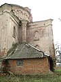
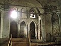
 Assumption Day's Church in Baryatino 01.JPG 4,320 × 3,240; 4.01 MB
-
 Assumption Day's Church in Baryatino 02.JPG 4,320 × 3,240; 5.27 MB
-
 Baryatino (Tarusa district) 01 church by shakko.jpg 3,072 × 2,304; 2.92 MB
-
 Baryatino (Tarusa district) 02 church by shakko.jpg 2,341 × 2,304; 2.27 MB
-
 Baryatino (Tarusa district) 03 church by shakko.jpg 3,072 × 2,304; 2.93 MB
-
 Baryatino (Tarusa district) 04 church by shakko.jpg 3,072 × 2,304; 2.88 MB
-
 Baryatino (Tarusa district) 05 church by shakko.jpg 2,304 × 3,072; 3.35 MB
-
 Baryatino (Tarusa district) 07 church by shakko.jpg 2,304 × 3,072; 3.2 MB
-
 Baryatino (Tarusa district) 08 church by shakko.jpg 2,304 × 3,072; 3.83 MB
-
 Baryatino (Tarusa district) 09 church by shakko.jpg 2,304 × 3,072; 3.71 MB
-
 Baryatino (Tarusa district) 10 church by shakko.jpg 2,304 × 3,072; 3.25 MB
-
 Baryatino (Tarusa district) 11 church by shakko.jpg 2,304 × 3,072; 4.1 MB
-
 Baryatino (Tarusa district) 12 church by shakko.jpg 3,072 × 2,304; 3.41 MB
-
 Baryatino (Tarusa district) 13 church by shakko.jpg 2,304 × 3,072; 3.03 MB
-
 Baryatino (Tarusa district) house 01 by shakko.jpg 3,072 × 2,029; 4.06 MB
-
 Baryatino (Tarusa district) house 02 by shakko.jpg 2,657 × 1,603; 3.53 MB
-
 Baryatino (Tarusa district) house 03 by shakko.jpg 3,072 × 1,728; 2.17 MB
-
 Baryatino (Tarusa district) house 04 by shakko.jpg 3,072 × 1,728; 1.98 MB
-
 Baryatino (Tarusa district) manager's house 01 by shakko.jpg 3,072 × 1,728; 2.09 MB
-
 Baryatino house (1870-1880s).jpg 400 × 278; 11 KB
-
 Baryatino house (1870s).jpeg 632 × 480; 58 KB
-
 Giovanni Antonio Guardi - Alexander of Macedonia.jpg 1,200 × 890; 310 KB
-
 Karl Brullov 36.jpg 817 × 1,000; 302 KB
-
 Manager's House in Baryatino.JPG 4,076 × 2,527; 2.07 MB
-
 Manor in Baryatino 01.JPG 4,320 × 3,240; 5.02 MB
-
 Manor in Baryatino 02.JPG 4,320 × 3,240; 3.12 MB
-
 S.D. Gorchakov's exlibris.jpeg 300 × 373; 52 KB
-
 Seal of the Gorchakov collection.jpg 156 × 163; 10 KB
-
 Sergey Dm. Gorchakov.jpeg 479 × 877; 202 KB
-
 Tarussky District, Kaluga Oblast, Russia - panoramio (1).jpg 4,352 × 2,904; 2.09 MB
-
 Tarussky District, Kaluga Oblast, Russia - panoramio.jpg 3,264 × 2,176; 2.89 MB
-
 Барятино. Амбар. Боковой вход.jpg 2,600 × 4,624; 3.08 MB
-
 Барятино. Амбар. Вид сбоку.jpg 3,472 × 4,640; 1.01 MB
-
 Барятино. Амбар. Винный подвал.jpg 2,600 × 4,624; 1.52 MB
-
 Барятино. Амбар. Детали входа.jpg 3,472 × 4,640; 2.3 MB
-
 Барятино. Амбар. Детали двери.jpg 2,600 × 4,624; 3.13 MB
-
 Барятино. Амбар. Кованые детали.jpg 2,600 × 4,624; 2.99 MB
-
 Барятино. Амбар. Общий вид.jpg 4,624 × 2,600; 2.05 MB
-
 Барятино. Амбар. Подвал.jpg 4,624 × 2,600; 1.67 MB
-
 Барятино. Амбар.jpg 1,942 × 1,152; 204 KB
-
 Барятино. Вид из парка на главный дом.jpg 3,000 × 4,000; 5.6 MB
-
 Барятино. Главный дом. Парк.jpg 3,000 × 4,000; 4.62 MB
-
 Барятино. Дом управляющего. Вид в сторону церкви.jpg 3,000 × 4,000; 4.21 MB
-
 Барятино. Дом управляющего.jpg 3,000 × 4,000; 4.24 MB
-
 Барятино. Успенская церковь.jpg 3,000 × 4,000; 5.23 MB
-
 Барятино. Церковь успения Пресвятой Богородицы.jpg 3,000 × 4,000; 5.53 MB
-
 Дом управляющего. Вид в сторону амбара.jpg 4,000 × 3,000; 4.67 MB
-
 Дом управляющего. Метлахская плитка.jpg 3,000 × 4,000; 4.14 MB
-
 Парк усадьбы Барятино.jpg 3,000 × 4,000; 5.85 MB
-
 Церковь Успения Божией Матери. Вид со стороны въезда.jpg 4,624 × 2,600; 753 KB
-
 Церковь Успения Божией Матери. Купол.jpg 2,597 × 2,597; 345 KB
-
 Церковь Успения Божией Матери. На закате.jpg 3,173 × 3,173; 1.25 MB
-
 Церковь Успения Божией Матери. Общий вид.jpg 3,630 × 3,092; 629 KB


_01_church_by_shakko.jpg)
_02_church_by_shakko.jpg)
_03_church_by_shakko.jpg)
_04_church_by_shakko.jpg)
_05_church_by_shakko.jpg)
_07_church_by_shakko.jpg)
_08_church_by_shakko.jpg)
_09_church_by_shakko.jpg)
_10_church_by_shakko.jpg)
_11_church_by_shakko.jpg)
_12_church_by_shakko.jpg)
_13_church_by_shakko.jpg)
_house_01_by_shakko.jpg)
_house_03_by_shakko.jpg)
_house_04_by_shakko.jpg)
_manager%27s_house_01_by_shakko.jpg)
.jpg)
.jpeg)


.jpg)


