Category:Barton-upon-Humber photographs taken on 2008-12-31
Jump to navigation
Jump to search
Media in category "Barton-upon-Humber photographs taken on 2008-12-31"
The following 17 files are in this category, out of 17 total.
-
 A15 - Entry Slip Road from the A1077 - geograph.org.uk - 1099784.jpg 640 × 480; 71 KB
-
 A15 Northbound - geograph.org.uk - 1099766.jpg 640 × 514; 52 KB
-

-

-
 Grey New Year's Eve on the Humber - geograph.org.uk - 1101088.jpg 640 × 480; 36 KB
-
 Light at the end of the Tunnel - geograph.org.uk - 1099975.jpg 591 × 535; 336 KB
-
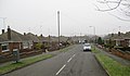
 New Housing off Westfield Road - geograph.org.uk - 1101055.jpg 640 × 499; 87 KB
-
 Old Coach Houses on Castledyke West - geograph.org.uk - 1101076.jpg 640 × 462; 83 KB
-
 Western Drive, Barton Upon Humber - geograph.org.uk - 1101004.jpg 640 × 376; 51 KB
-
 Westfield Road - geograph.org.uk - 1099855.jpg 589 × 640; 128 KB
-
 Westfield Road Public Footpath - geograph.org.uk - 1099799.jpg 640 × 480; 125 KB
-
 Westfield Road Subway - geograph.org.uk - 1099812.jpg 640 × 510; 141 KB
-
 Westfield Road Subway - geograph.org.uk - 1099960.jpg 640 × 480; 159 KB
-
 Westfield Road Subway - geograph.org.uk - 1099968.jpg 640 × 480; 103 KB
-
 Westfield Road Subway - geograph.org.uk - 1099984.jpg 640 × 533; 104 KB
-
 Westfield Road, Barton Upon Humber - geograph.org.uk - 1101029.jpg 640 × 439; 71 KB
-
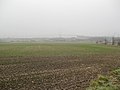 Winter Wheat - geograph.org.uk - 1099838.jpg 640 × 480; 75 KB


