Category:Barton, Preston
Jump to navigation
Jump to search
English: Barton is a linear village and civil parish in the Preston district of Lancashire, England. The parish had a population of 1,096 according to the 2001 census. The village is about six miles north of Preston. The parish is bound by the A6 road to the west. The M6 motorway also passes through the parish, splitting the village, west of the motorway, from the rest of the parish.
village and civil parish in the City of Preston, Lancashire, England  | |||||
| Upload media | |||||
| Instance of | |||||
|---|---|---|---|---|---|
| Location | Preston, Lancashire, North West England, England | ||||
| Population |
| ||||
 | |||||
Subcategories
This category has the following 6 subcategories, out of 6 total.
B
- Boars Head, Barton (5 F)
C
- Barton Cross, Lancashire (6 F)
L
- St Lawrence's Church, Barton (3 F)
W
- Westfield Bridge, Lancashire (2 F)
Media in category "Barton, Preston"
The following 126 files are in this category, out of 126 total.
-

-
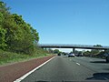
 A footbridge over the M6 taken from Barton Lane bridge - geograph.org.uk - 4148972.jpg 4,491 × 2,988; 6.99 MB
-
 A6 Garstang Road at Newsham - geograph.org.uk - 6089107.jpg 1,024 × 770; 135 KB
-
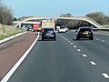
 Barton , M6 Motorway - geograph.org.uk - 6300440.jpg 6,000 × 4,000; 5.18 MB
-
 Barton , M6 Motorway - geograph.org.uk - 6300441.jpg 6,000 × 4,000; 5.34 MB
-
 Barton , M6 Motorway - geograph.org.uk - 6300443.jpg 6,000 × 4,000; 4.85 MB
-
 Barton , M6 Motorway - geograph.org.uk - 6300445.jpg 6,000 × 4,000; 5 MB
-
 Barton , M6 Motorway - geograph.org.uk - 6359867.jpg 6,000 × 4,000; 4.61 MB
-
 Barton , M6 Motorway - geograph.org.uk - 6359870.jpg 6,000 × 4,000; 4.58 MB
-
 Barton , M6 Motorway - geograph.org.uk - 6359871.jpg 6,000 × 4,000; 4.97 MB
-
 Barton , M6 Motorway - geograph.org.uk - 6359873.jpg 6,000 × 4,000; 5.22 MB
-
 Barton Brook - geograph.org.uk - 1557780.jpg 480 × 640; 88 KB
-
 Barton Brook - geograph.org.uk - 3357981.jpg 2,560 × 1,920; 2.9 MB
-
 Barton Brook Aqueduct - geograph.org.uk - 1557786.jpg 640 × 480; 121 KB
-
 Barton Brook Aqueduct - geograph.org.uk - 1557789.jpg 640 × 480; 94 KB
-
 Barton Lane Bridge from the M6 - geograph.org.uk - 3121070.jpg 4,601 × 2,631; 2 MB
-
 Barton Lane bridge over the M6 - geograph.org.uk - 4149881.jpg 2,990 × 2,990; 4.69 MB
-
 Barton Lane Bridge, M6 - geograph.org.uk - 4510802.jpg 640 × 357; 18 KB
-
 Barton Lane crosses the M6 - geograph.org.uk - 2377080.jpg 1,600 × 1,019; 372 KB
-
 Barton Village Hall - geograph.org.uk - 209798.jpg 640 × 480; 221 KB
-
 Barton, welcome sign - geograph.org.uk - 2956244.jpg 1,024 × 768; 226 KB
-

-
 Brickwork pattern - geograph.org.uk - 637358.jpg 640 × 480; 103 KB
-
 Bridge 42 Lancaster Canal - geograph.org.uk - 1557765.jpg 640 × 480; 74 KB
-
 Bridge No 39 on Lancaster Canal - geograph.org.uk - 1245750.jpg 640 × 427; 104 KB
-

-

-

-
 Bridleway Towards Barton House - geograph.org.uk - 3418332.jpg 2,560 × 1,920; 4.18 MB
-
 Cardwell Bridge - geograph.org.uk - 3881889.jpg 2,560 × 1,920; 2.79 MB
-
 Carron Lane heading to Bilsborrow - geograph.org.uk - 5077456.jpg 1,500 × 999; 158 KB
-
 Causeway road to Green Kettle Farm - geograph.org.uk - 1498081.jpg 640 × 398; 67 KB
-
 Christina and the swans - geograph.org.uk - 3636296.jpg 1,024 × 768; 577 KB
-

-
 Dog Stinkhorn @ Barton Hall - geograph.org.uk - 3256242.jpg 1,365 × 973; 1.09 MB
-
 Entrance To Blake Hall - geograph.org.uk - 3905269.jpg 2,560 × 1,920; 3.24 MB
-
 Entrance To Jack Nook Farm - geograph.org.uk - 3922574.jpg 2,560 × 1,920; 3.18 MB
-
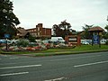
 Entrance to the Barton Grange hotel - geograph.org.uk - 2480569.jpg 640 × 480; 62 KB
-
 Farm Track crosses the M6 - geograph.org.uk - 3121067.jpg 4,486 × 2,648; 2.01 MB
-
 Farm track overbridge on M6 near Bilsbarrow - geograph.org.uk - 2377329.jpg 1,600 × 1,198; 418 KB
-
 Footbridge Over Barton Brook - geograph.org.uk - 3264007.jpg 2,560 × 1,920; 2.69 MB
-
 Footbridge over Barton Brook - geograph.org.uk - 4143383.jpg 4,023 × 2,678; 7.72 MB
-
 Footbridge over the M6 - geograph.org.uk - 1383836.jpg 640 × 480; 91 KB
-
 Footbridge over the M6 - geograph.org.uk - 3121072.jpg 4,283 × 2,752; 2.12 MB
-
 Footbridge over the M6 - geograph.org.uk - 4510798.jpg 640 × 367; 22 KB
-
 Footbridge over the M6 - SD5236 234.jpg 2,048 × 1,536; 708 KB
-
 Footbridge over the M6 at Jack Nook Farm - geograph.org.uk - 3121068.jpg 4,295 × 2,527; 1.9 MB
-

-
 Footpath to Hoole Fold - geograph.org.uk - 4143414.jpg 4,077 × 2,525; 5.87 MB
-
 Footpath to Park Head - geograph.org.uk - 4154521.jpg 4,592 × 3,056; 6.43 MB
-
 Garstang Road crosses Cardwell Bridge - geograph.org.uk - 5592837.jpg 2,700 × 2,025; 519 KB
-
 Garstang Road crosses the West Coast Main Line - geograph.org.uk - 4327093.jpg 1,500 × 999; 168 KB
-
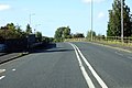
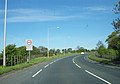
 Garstang Road entering Barton - geograph.org.uk - 4327079.jpg 1,500 × 999; 211 KB
-
 Garstang Road looking south - geograph.org.uk - 3293581.jpg 640 × 480; 59 KB
-
 Garstang Road through Barton - geograph.org.uk - 4327083.jpg 1,500 × 974; 240 KB
-
 Garstang Road through Barton - geograph.org.uk - 4327090.jpg 1,500 × 999; 204 KB
-
 Garstang Road, Barton - geograph.org.uk - 3636308.jpg 1,024 × 719; 383 KB
-
 Garstang Road, Barton Bangla Brasserie - geograph.org.uk - 6152505.jpg 800 × 533; 573 KB
-
 Gettern Mere Farm entrance - geograph.org.uk - 1498104.jpg 640 × 426; 94 KB
-
 Heather Farm on Carr Moss Lane - geograph.org.uk - 1498137.jpg 640 × 426; 101 KB
-

-

-
 Lancaster Canal - geograph.org.uk - 1557777.jpg 640 × 480; 92 KB
-
 Langley Lane - geograph.org.uk - 2848834.jpg 640 × 481; 69 KB
-
 Large lorry on a narrow lane - geograph.org.uk - 5024338.jpg 1,280 × 960; 1.25 MB
-
 Lodge, Newsham - geograph.org.uk - 5141224.jpg 640 × 480; 224 KB
-
 M6 - geograph.org.uk - 2075653.jpg 640 × 480; 104 KB
-
 M6 Jack Nook - geograph.org.uk - 2475491.jpg 640 × 480; 56 KB
-
 M6 motorway northbound between Junction 32 & 33 (geograph 6774477).jpg 1,799 × 1,199; 158 KB
-
 M6 Motorway, Barton - geograph.org.uk - 88903.jpg 640 × 480; 68 KB
-

-
 M6 northbound - geograph.org.uk - 4257545.jpg 640 × 453; 28 KB
-
 M6 northbound - geograph.org.uk - 4257548.jpg 640 × 480; 35 KB
-
 M6 northbound - geograph.org.uk - 4257552.jpg 640 × 480; 34 KB
-
 M6 northbound - geograph.org.uk - 4257556.jpg 640 × 465; 33 KB
-
 M6 northbound - geograph.org.uk - 4257558.jpg 640 × 480; 37 KB
-
 M6, northbound - geograph.org.uk - 4510830.jpg 640 × 364; 24 KB
-
 M6, northbound - geograph.org.uk - 4510836.jpg 640 × 379; 25 KB
-
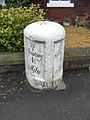 Milestone 2, Barton.jpg 480 × 640; 137 KB
-
 Milestone near Barton - geograph.org.uk - 1792082.jpg 640 × 480; 148 KB
-
 Milestone, Barton.jpg 480 × 640; 165 KB
-
 Mossland des. res. - geograph.org.uk - 741509.jpg 640 × 480; 76 KB
-
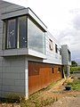 New house on Station Road - geograph.org.uk - 1394305.jpg 480 × 640; 66 KB
-
 New house on Station Road - geograph.org.uk - 1394306.jpg 640 × 480; 61 KB
-
-

-
 Playground at King George V Playing Field - geograph.org.uk - 3636306.jpg 1,024 × 740; 460 KB
-
 Plex Moss - geograph.org.uk - 741534.jpg 640 × 480; 73 KB
-
 Plex Moss Lane - geograph.org.uk - 828820.jpg 640 × 480; 41 KB
-
 Recently harvested Silage Field - geograph.org.uk - 4093196.jpg 2,560 × 1,920; 3.07 MB
-
 Roebuck Bowling Club - geograph.org.uk - 3811153.jpg 640 × 480; 83 KB
-
 Sandhams' Lancashire Cheese Factory - geograph.org.uk - 61222.jpg 640 × 480; 80 KB
-
 Seat next to the A6 at Barton - geograph.org.uk - 6152508.jpg 800 × 600; 938 KB
-
 Some kind sink hole or pit, left for the wild life - geograph.org.uk - 4154880.jpg 4,414 × 2,436; 7.95 MB
-
 Southbound M6, Barton Lane Bridge - geograph.org.uk - 4032996.jpg 640 × 480; 255 KB
-
 St Lawrence's Church, Barton - geograph.org.uk - 6152523.jpg 600 × 800; 749 KB
-
 Station Lane at Hepgreave Bridge - geograph.org.uk - 3636302.jpg 1,024 × 768; 528 KB
-
-

-

-
 The A6 enters Barton village at Cardwell Bridge - geograph.org.uk - 2376552.jpg 1,600 × 1,125; 278 KB
-
 The A6 heading north through Barton - geograph.org.uk - 2480570.jpg 640 × 480; 53 KB
-
 The A6 heading south from Barton - geograph.org.uk - 2480572.jpg 640 × 480; 47 KB
-
 The Boar's Head Public House, Barton - geograph.org.uk - 6152526.jpg 800 × 533; 598 KB
-
 The end of Short Lane - geograph.org.uk - 4144043.jpg 4,100 × 2,325; 6.3 MB
-
 The icecream parlour - geograph.org.uk - 6284173.jpg 2,000 × 1,330; 1.96 MB
-
 The M6 from Jepps Lane - geograph.org.uk - 4144150.jpg 4,592 × 3,056; 7.63 MB
-
 The Parish Church of St Lawrence, Barton - geograph.org.uk - 6152515.jpg 600 × 800; 665 KB
-
 The Roebuck Bowling Club - geograph.org.uk - 3126096.jpg 1,500 × 974; 1.21 MB
-
 The track to Blake Hall - geograph.org.uk - 4144113.jpg 4,592 × 2,562; 7.78 MB
-
 Under The Canal - geograph.org.uk - 1557784.jpg 640 × 480; 58 KB
-
 Under the Lancaster Canal - Barton Brook - geograph.org.uk - 2575220.jpg 640 × 428; 117 KB
-

-
 White Horse Lane joins the Garstang Road at Barton - geograph.org.uk - 2376599.jpg 1,600 × 1,193; 349 KB
-
 Across the moss. - geograph.org.uk - 741556.jpg 640 × 480; 71 KB
-
 Barton Grange Garden Centre and Hotel - geograph.org.uk - 61235.jpg 640 × 480; 98 KB
-
 Bridge over culvert at Barton - geograph.org.uk - 778156.jpg 640 × 480; 42 KB
-
 Calm spring morning - geograph.org.uk - 637320.jpg 640 × 480; 87 KB
-
 Concrete structure in field - geograph.org.uk - 637363.jpg 640 × 480; 63 KB
-
 Footpath across the moss - geograph.org.uk - 637319.jpg 640 × 480; 64 KB
-
 Harvesting, Downholland Moss - geograph.org.uk - 1411666.jpg 640 × 426; 97 KB
-

-
 M6 - geograph.org.uk - 485317.jpg 640 × 480; 165 KB
-
 Neat rows of young crops - geograph.org.uk - 637321.jpg 640 × 480; 107 KB
-
 Past their best - geograph.org.uk - 81419.jpg 640 × 426; 108 KB
-
 Road to Cross House Farm - geograph.org.uk - 485328.jpg 640 × 480; 237 KB


,_Downholland_Moss_-_geograph.org.uk_-_691322.jpg)


.jpg)


.jpg)
.jpg)
.jpg)


