Category:Barton, Cumbria
Jump to navigation
Jump to search
English: Barton is a village in the civil parish of Barton and Pooley Bridge, in the Eden district of Cumbria, England.
village in Barton and Pooley Bridge, Eden, Cumbria, England  | |||||
| Upload media | |||||
| Instance of | |||||
|---|---|---|---|---|---|
| Location | Barton and Pooley Bridge, Eden, Cumbria, North West England, England | ||||
 | |||||
Subcategories
This category has the following 3 subcategories, out of 3 total.
G
- Glebe Farm, Barton (3 F)
M
Media in category "Barton, Cumbria"
The following 27 files are in this category, out of 27 total.
-
 Access Track from Seat Farm - geograph.org.uk - 1914145.jpg 640 × 426; 125 KB
-
 Access Track outside Sharrow Cottages - geograph.org.uk - 1915851.jpg 2,032 × 1,354; 865 KB
-
 Barn at Kirkbarrow - geograph.org.uk - 1718675.jpg 640 × 427; 258 KB
-
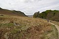 Between White Knott and Barton Park - geograph.org.uk - 1885748.jpg 1,600 × 1,068; 371 KB
-
 Bridleway above Barton Park - geograph.org.uk - 1919978.jpg 2,032 × 1,354; 863 KB
-
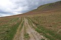 Bridleway below White Knott - geograph.org.uk - 1919965.jpg 2,032 × 1,354; 801 KB
-
 Cairn on Bridleway near Aik Beck - geograph.org.uk - 1919987.jpg 2,032 × 1,354; 747 KB
-
 Distressed Trees on Ullswater - geograph.org.uk - 1914131.jpg 2,032 × 1,354; 923 KB
-
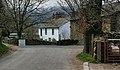
 Entering Pooley Bridge - geograph.org.uk - 1920030.jpg 2,032 × 1,354; 967 KB
-
 Eusemere - geograph.org.uk - 1822171.jpg 3,456 × 2,232; 1.5 MB
-
 Faint Track on the Flanks of Heughscar Hill - geograph.org.uk - 1920016.jpg 2,032 × 1,354; 925 KB
-
 Fields by Seat Farm - geograph.org.uk - 1915812.jpg 2,032 × 1,354; 827 KB
-
 High Street near The Cockpit - geograph.org.uk - 1920010.jpg 2,032 × 1,354; 859 KB
-
 High Street Roman Road - geograph.org.uk - 1835813.jpg 2,048 × 1,536; 1.31 MB
-
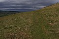
 Looking north from Loadpot Hill - geograph.org.uk - 1834816.jpg 2,048 × 1,536; 1,012 KB
-
 Outside Thwaitehill - geograph.org.uk - 1915839.jpg 2,032 × 1,354; 1.16 MB
-
 Path to Howtown - geograph.org.uk - 1885770.jpg 1,600 × 1,068; 353 KB
-
 Pooley Bridge - geograph.org.uk - 2309588.jpg 4,000 × 3,000; 3.32 MB
-
 Portion of the Cockpit - geograph.org.uk - 1920004.jpg 2,032 × 1,354; 803 KB
-
 Ravencragg - geograph.org.uk - 1824815.jpg 3,304 × 2,084; 1.4 MB
-
 River Eamont - geograph.org.uk - 1951120.jpg 640 × 480; 65 KB
-
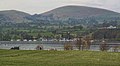
 Sharrow Bay - geograph.org.uk - 1822519.jpg 3,443 × 1,951; 1.06 MB
-
 Suspension Footbridge - geograph.org.uk - 1951113.jpg 480 × 640; 122 KB
-
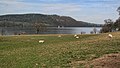
 Ullswater - geograph.org.uk - 2232750.jpg 3,443 × 1,891; 1.04 MB
-
 Ullswater - geograph.org.uk - 2232752.jpg 3,230 × 1,819; 1.16 MB
-
 Waterside House - geograph.org.uk - 1824806.jpg 3,291 × 1,930; 1.48 MB
-
 Wether Hill - geograph.org.uk - 1834858.jpg 2,048 × 1,536; 1.26 MB


