Category:Barrow Gurney
Jump to navigation
Jump to search
village and civil parish in Somerset, England  | |||||
| Upload media | |||||
| Instance of | |||||
|---|---|---|---|---|---|
| Location | North Somerset, Somerset, South West England, England | ||||
| Population |
| ||||
 | |||||
Subcategories
This category has the following 4 subcategories, out of 4 total.
Media in category "Barrow Gurney"
The following 200 files are in this category, out of 208 total.
(previous page) (next page)-
 'Insect apartments' - geograph.org.uk - 6775646.jpg 4,896 × 3,264; 3.83 MB
-
 'Pro Patria' - geograph.org.uk - 2703885.jpg 1,704 × 2,304; 1.72 MB
-
 'Staff Cottages' - geograph.org.uk - 6774816.jpg 4,896 × 3,264; 4.39 MB
-
 @ The Fox ^ Goose, near Bristol Airport - panoramio.jpg 2,000 × 1,217; 736 KB
-
 A field of sorrow - geograph.org.uk - 3925704.jpg 2,304 × 1,704; 1.06 MB
-
 A flowery warning - geograph.org.uk - 5501729.jpg 2,304 × 1,704; 1.6 MB
-
 A former name - geograph.org.uk - 5501763.jpg 1,704 × 2,304; 1.29 MB
-
 A gift from the Gibbs family - geograph.org.uk - 5502698.jpg 1,704 × 2,304; 1.86 MB
-
 A green space - geograph.org.uk - 5502490.jpg 2,304 × 1,704; 1.6 MB
-
 A heavy fall - geograph.org.uk - 3925720.jpg 2,304 × 1,704; 1.46 MB
-
 A leafy path to St Mary and St Edward - geograph.org.uk - 5613607.jpg 1,704 × 2,304; 1.99 MB
-
 A little shelter - geograph.org.uk - 5502531.jpg 1,704 × 2,304; 1.87 MB
-
 A lone figure by the reservoir - geograph.org.uk - 6686213.jpg 3,296 × 2,472; 1.91 MB
-
 A lonely furrow - geograph.org.uk - 5613609.jpg 2,304 × 1,704; 1.57 MB
-
 A spring in the green - geograph.org.uk - 5502497.jpg 2,304 × 1,704; 1.59 MB
-

-
 A38 above Dial Cottage - geograph.org.uk - 4506562.jpg 1,920 × 1,161; 355 KB
-
 A38 at Barrow Fountain - car stuck in snow - geograph.org.uk - 6773608.jpg 1,800 × 1,200; 298 KB
-
 A38 at Barrow Fountain - geograph.org.uk - 6773603.jpg 1,800 × 1,200; 236 KB
-
 A38 road widening at the Fox ^ Goose PH, Barrow Gurney - geograph.org.uk - 6776015.jpg 1,800 × 1,200; 371 KB
-
 A38 road widening at the Fox ^ Goose PH, Barrow Gurney - geograph.org.uk - 6776016.jpg 1,800 × 1,200; 250 KB
-
 A38 road widening at the Fox ^ Goose PH, Barrow Gurney - geograph.org.uk - 6776019.jpg 1,800 × 1,200; 282 KB
-
 A38 to Bristol - geograph.org.uk - 1275538.jpg 640 × 480; 66 KB
-
 A38 towards Bristol - geograph.org.uk - 4251846.jpg 640 × 480; 82 KB
-
 A38 towards Bristol - geograph.org.uk - 4251852.jpg 640 × 480; 73 KB
-
 Across Barrow Hill - geograph.org.uk - 5614085.jpg 2,304 × 1,704; 1.76 MB
-
 Agricultural merchants at Barrow Mill - geograph.org.uk - 5364026.jpg 1,024 × 788; 190 KB
-
 Airy barn - geograph.org.uk - 5614089.jpg 2,304 × 1,704; 2.37 MB
-
 At the heart of any village - geograph.org.uk - 5502713.jpg 2,304 × 1,704; 1.42 MB
-
 B3130 near Barrow Gurney - geograph.org.uk - 1886918.jpg 640 × 451; 99 KB
-
 Barrow Big Wood - geograph.org.uk - 2459880.jpg 1,024 × 768; 166 KB
-
 Barrow Court Lane - geograph.org.uk - 3924232.jpg 1,704 × 2,304; 2.11 MB
-
 Barrow Court Lane walling - geograph.org.uk - 3924217.jpg 2,304 × 1,704; 1.81 MB
-
 Barrow Court Lodge - geograph.org.uk - 5613603.jpg 2,304 × 1,704; 1.69 MB
-
 Barrow Court ^ Church, Barrow Gurney - geograph.org.uk - 6400144.jpg 1,800 × 1,200; 337 KB
-
 Barrow Court ^ Church, Barrow Gurney - geograph.org.uk - 6400146.jpg 1,191 × 1,197; 319 KB
-
 Barrow Court ^ Church, Barrow Gurney - geograph.org.uk - 6400150.jpg 1,797 × 1,198; 421 KB
-
 Barrow Gurney - geograph.org.uk - 4142978.jpg 4,000 × 2,664; 4.31 MB
-

-
 Barrow Gurney - Reservoir Farm - geograph.org.uk - 6776011.jpg 1,800 × 1,200; 455 KB
-
 Barrow Gurney - The Prince's Motto PH - geograph.org.uk - 6776012.jpg 1,799 × 1,199; 273 KB
-
 Barrow Gurney - Upper Barrow Mill - geograph.org.uk - 291298.jpg 640 × 427; 170 KB
-
 Barrow Gurney Post Office - geograph.org.uk - 6773597.jpg 1,500 × 999; 153 KB
-
 Barrow Gurney Village Green - geograph.org.uk - 5502513.jpg 2,304 × 1,704; 1.65 MB
-
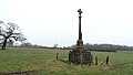
 Barrow Gurney war memorial - geograph.org.uk - 5501688.jpg 1,704 × 2,304; 2.02 MB
-
 Barrow Gurney Water Filtration Works - geograph.org.uk - 6774401.jpg 1,800 × 1,200; 261 KB
-

-

-

-
 Barrow Gurney, - Steps Farm and Reservoir Farm - geograph.org.uk - 6774417.jpg 1,800 × 1,200; 315 KB
-
 Barrow Hill farm tracks - geograph.org.uk - 3923199.jpg 2,304 × 1,704; 1.74 MB
-
 Barrow Hill Field - geograph.org.uk - 128026.jpg 640 × 426; 111 KB
-
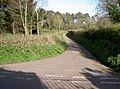
 Barrow Hill path - geograph.org.uk - 889937.jpg 640 × 480; 83 KB
-
 Barrow Lane, near Winford - geograph.org.uk - 2737603.jpg 4,000 × 3,000; 1.45 MB
-
 Barrow Lodge - geograph.org.uk - 128021.jpg 640 × 426; 119 KB
-
 Barrow play area - geograph.org.uk - 5502519.jpg 2,304 × 1,704; 1.73 MB
-
 Barrow Reservoirs from Rocks Lane, Winford - geograph.org.uk - 6424955.jpg 1,799 × 1,199; 334 KB
-
 Barrow Tanks - geograph.org.uk - 2570502.jpg 3,648 × 2,736; 2.63 MB
-
 Barrow Tanks - geograph.org.uk - 4937774.jpg 2,304 × 1,704; 1.18 MB
-
 Barrow Tanks from the air - geograph.org.uk - 2612901.jpg 640 × 480; 113 KB
-
 Barrow Tanks from the air - geograph.org.uk - 2612924.jpg 640 × 480; 149 KB
-
 Barrow Tanks, from Barrow Lane - geograph.org.uk - 2737607.jpg 4,000 × 3,000; 1.41 MB
-
 Barrow Tanks, from Barrow Lane - geograph.org.uk - 2737610.jpg 4,000 × 3,000; 1.82 MB
-
 Barrow's biggest - geograph.org.uk - 4937777.jpg 2,304 × 1,704; 1.39 MB
-
 Benchmark on Reservoir Farm barn - geograph.org.uk - 5501697.jpg 1,704 × 2,304; 2.1 MB
-
 Bridgwater Road (A38) - geograph.org.uk - 4251867.jpg 640 × 480; 67 KB
-
 Bridleway near Batches Wood - geograph.org.uk - 4500598.jpg 1,920 × 1,440; 880 KB
-
 Bridleway near Batches Wood - geograph.org.uk - 4506487.jpg 1,920 × 1,534; 855 KB
-
 Bridleway past Batches Wood - geograph.org.uk - 4506494.jpg 1,920 × 1,350; 644 KB
-
 Bridleway past Batches Wood - geograph.org.uk - 4506506.jpg 1,920 × 1,440; 911 KB
-
 Bridleway to Slade Lane - geograph.org.uk - 4506479.jpg 1,920 × 2,900; 1.88 MB
-
 Bus stop and War Memorial - geograph.org.uk - 4648049.jpg 800 × 488; 96 KB
-
 Clearing snow on B3130 Winford Lane, Barrow Gurney - geograph.org.uk - 6403702.jpg 1,797 × 1,198; 452 KB
-
 Close to the Elwell Brook - geograph.org.uk - 6685440.jpg 3,296 × 2,472; 3.04 MB
-
 Compton Mead - geograph.org.uk - 5502704.jpg 2,304 × 1,704; 1.58 MB
-
 Corner benchmark - geograph.org.uk - 3924249.jpg 1,704 × 2,304; 1.85 MB
-
 Covering the jubilees - geograph.org.uk - 3925713.jpg 1,704 × 2,304; 1.72 MB
-
 Crossroads on Bridgwater Road - geograph.org.uk - 5363568.jpg 1,024 × 794; 171 KB
-
 Cut benchmark on the Fox and Goose - geograph.org.uk - 2528257.jpg 1,704 × 2,304; 1.95 MB
-
 Deep winter at Barrow Gurney Water Filtration Works - geograph.org.uk - 6774405.jpg 1,800 × 1,200; 300 KB
-
 Demolition rubble - geograph.org.uk - 6775942.jpg 4,188 × 3,050; 4.77 MB
-
 Detached house at Oatley Park - geograph.org.uk - 6774601.jpg 4,755 × 3,136; 2.98 MB
-
 Development Map - geograph.org.uk - 6775624.jpg 4,501 × 3,184; 2.96 MB
-

-
 Dogs are not restricted but begrudged - geograph.org.uk - 3924293.jpg 1,704 × 2,304; 2.29 MB
-
 Dragging up the stones - geograph.org.uk - 3924269.jpg 1,704 × 2,304; 1.99 MB
-
 Entering Oatley Park - geograph.org.uk - 6774808.jpg 4,676 × 3,116; 3.68 MB
-
 Entrance at Dial Farm - geograph.org.uk - 4647591.jpg 800 × 425; 58 KB
-
 Entrance to Freemans Quarry - geograph.org.uk - 1275540.jpg 640 × 391; 48 KB
-
 Entrance to Freemans Quarry - geograph.org.uk - 1275554.jpg 640 × 396; 43 KB
-
 Entrance to Lakeside Spas - geograph.org.uk - 4648046.jpg 800 × 456; 72 KB
-
 Entrance, Bristol Water depot - geograph.org.uk - 5363577.jpg 1,024 × 768; 253 KB
-
 Farmland north of Hartcliff Rocks, Barrow Gurney - geograph.org.uk - 6774420.jpg 1,800 × 1,200; 329 KB
-
 Farmland off Bridgwater Road - geograph.org.uk - 3456723.jpg 640 × 480; 69 KB
-
 Farmland off the A38 - geograph.org.uk - 3456709.jpg 640 × 480; 99 KB
-
 Field boundary by Batches Wood - geograph.org.uk - 4740642.jpg 2,816 × 2,112; 1.18 MB
-
 Field by Batches Wood - geograph.org.uk - 4740615.jpg 1,920 × 1,440; 527 KB
-
 Field near Potters Hill - geograph.org.uk - 1275547.jpg 640 × 480; 57 KB
-
 Field near Potters Hill - geograph.org.uk - 1275551.jpg 640 × 480; 69 KB
-
 Field near Potters Hill - geograph.org.uk - 1275553.jpg 640 × 480; 56 KB
-
 Field off Currells Lane - geograph.org.uk - 1548559.jpg 640 × 480; 51 KB
-
 Flush Bracket OSBM G3696, Lake House - geograph.org.uk - 5572897.jpg 960 × 1,280; 396 KB
-
 Footpath off the A38 - geograph.org.uk - 3456713.jpg 640 × 480; 70 KB
-
 Footpath through grassland on the summit of Barrow Hill - geograph.org.uk - 5146183.jpg 3,648 × 2,048; 2.29 MB
-
 Footpath to Barrow Court - geograph.org.uk - 889913.jpg 640 × 480; 68 KB
-
 Former primary school at Barrow Gurney - geograph.org.uk - 5607162.jpg 5,184 × 2,920; 6.27 MB
-
 Freeman's Quarry Potters Hill - geograph.org.uk - 6524206.jpg 1,600 × 986; 795 KB
-
 Getting the green light - geograph.org.uk - 4142990.jpg 4,000 × 2,664; 5.54 MB
-
 Give it time to grow - geograph.org.uk - 5614104.jpg 2,304 × 1,704; 1.8 MB
-
 God took back to himself - geograph.org.uk - 3925731.jpg 1,704 × 2,304; 1.44 MB
-
 Golden trees on the lower slopes around Dundry - geograph.org.uk - 6686234.jpg 3,296 × 2,472; 1.89 MB
-
 Grassy summit of Barrow Hill with footpath - geograph.org.uk - 5146149.jpg 3,648 × 2,048; 1.74 MB
-
 Harvested field - geograph.org.uk - 1548607.jpg 640 × 480; 62 KB
-
 Having a party^ - geograph.org.uk - 5502487.jpg 2,304 × 1,704; 1.31 MB
-
 Hern Lane, Barrow Gurney under deep snow - geograph.org.uk - 6774416.jpg 1,799 × 1,199; 269 KB
-
 Hobbs Lane, Barrow Gurney - geograph.org.uk - 6773617.jpg 1,799 × 1,199; 199 KB
-
 Holly Hedge animal sanctuary - geograph.org.uk - 5032231.jpg 3,648 × 2,048; 2.49 MB
-
 House and Upholstery Business - geograph.org.uk - 4422007.jpg 4,147 × 2,734; 4.96 MB
-
 House at The Fillies - geograph.org.uk - 6774604.jpg 4,612 × 3,120; 3.96 MB
-
 Housing development - geograph.org.uk - 6774596.jpg 4,863 × 3,242; 4.18 MB
-
 How now, my flower^ - geograph.org.uk - 5501743.jpg 2,304 × 1,704; 1.54 MB
-
 I will lift up mine eyes - geograph.org.uk - 3925741.jpg 2,304 × 1,704; 1.62 MB
-
 Junction of Barrow Lane and Elwell Lane, near Winford - geograph.org.uk - 2737601.jpg 4,000 × 3,000; 1.41 MB
-
 Just by the pub - geograph.org.uk - 5502494.jpg 2,304 × 1,704; 1.44 MB
-
 Leaves inside and out - geograph.org.uk - 5614100.jpg 1,704 × 2,304; 2.16 MB
-
 Lower Mill Farm - geograph.org.uk - 5501736.jpg 2,304 × 1,704; 1.81 MB
-
 Mark along the lane - geograph.org.uk - 3924206.jpg 1,704 × 2,304; 1.98 MB
-
 Memorial to Roland Vicary Gibbs, Barrow Gurney - geograph.org.uk - 5607159.jpg 5,184 × 2,920; 3.58 MB
-
 Mill house at Barrow Gurney - geograph.org.uk - 5364021.jpg 1,024 × 768; 194 KB
-
 Mill stream at Upper Barrow Mill - geograph.org.uk - 3496760.jpg 3,648 × 2,736; 3.69 MB
-
 Mortuary chapel - geograph.org.uk - 4118155.jpg 640 × 402; 41 KB
-
 Naish Lane - geograph.org.uk - 4251862.jpg 640 × 480; 68 KB
-
 Near Batches Wood - geograph.org.uk - 4506521.jpg 1,920 × 1,442; 744 KB
-
 Newditch Lane - geograph.org.uk - 1548617.jpg 480 × 640; 85 KB
-
 Newditch Lane - geograph.org.uk - 1548619.jpg 480 × 640; 88 KB
-
 Next in line for a trim - geograph.org.uk - 5614102.jpg 2,304 × 1,704; 1.81 MB
-
 North gates to Barrow Court - geograph.org.uk - 5613627.jpg 1,704 × 2,304; 1.36 MB
-
 North Somerset , Aerial Scenery - geograph.org.uk - 5844516.jpg 6,000 × 4,000; 6.76 MB
-
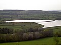
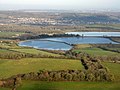
 North Somerset , Barrow Gurney Reservoir - geograph.org.uk - 4155532.jpg 4,288 × 2,848; 7.16 MB
-
 North Somerset , Barrow Gurney Reservoir - geograph.org.uk - 5844518.jpg 6,000 × 4,000; 7.56 MB
-
 Number 3 Reservoir, Barrow Gurney - geograph.org.uk - 6774403.jpg 1,800 × 1,200; 351 KB
-
 Odd iron on the post - geograph.org.uk - 5614097.jpg 1,704 × 2,304; 1.74 MB
-
 Odd niche - geograph.org.uk - 3924257.jpg 1,704 × 2,304; 1.96 MB
-

-

-
 Old Post Office sign - geograph.org.uk - 5501709.jpg 2,304 × 1,704; 1.52 MB
-
 Ordnance Survey Cut Mark - geograph.org.uk - 6415924.jpg 1,024 × 683; 191 KB
-
 Ordnance Survey Rivet - geograph.org.uk - 6415923.jpg 710 × 1,024; 301 KB
-
 Path to Bridgwater Road - geograph.org.uk - 5363547.jpg 1,024 × 788; 180 KB
-
 Play area - geograph.org.uk - 6774599.jpg 4,653 × 3,111; 5.11 MB
-
 Porchway or film set^ - geograph.org.uk - 6774602.jpg 4,266 × 2,884; 2.48 MB
-
 Prince of elves^ - geograph.org.uk - 5501770.jpg 2,304 × 1,704; 1.16 MB
-
 Ran out of fuel - geograph.org.uk - 2703902.jpg 2,304 × 1,704; 1.63 MB
-
 Reading the lichens - geograph.org.uk - 3925736.jpg 2,304 × 1,704; 1.74 MB
-
 Rear of Barrow Gurney Primary School - geograph.org.uk - 6773586.jpg 1,500 × 1,000; 249 KB
-
 Recently harvested arable crop on the summit of Barrow Hill - geograph.org.uk - 5146157.jpg 3,648 × 2,048; 2.05 MB
-
 Redirected right-of-way by Freeman's Quarry - geograph.org.uk - 6524785.jpg 1,600 × 1,200; 1.15 MB
-
 Remains of a mill stream - geograph.org.uk - 5502507.jpg 1,704 × 2,304; 2.05 MB
-
 Reservoir Farm - geograph.org.uk - 5501696.jpg 2,304 × 1,704; 1.48 MB
-
 Reservoir Farm - geograph.org.uk - 5501706.jpg 2,304 × 1,704; 1.68 MB
-
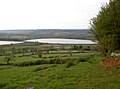
 Reservoirs near Barrow Gurney - geograph.org.uk - 4295751.jpg 3,264 × 2,448; 2.81 MB
-
 Ridings Wood - geograph.org.uk - 6775632.jpg 4,896 × 3,264; 7.14 MB
-
 Room for more celebrations - geograph.org.uk - 3925711.jpg 1,704 × 2,304; 2.23 MB
-
 Route 334 on Hobbs Lane - geograph.org.uk - 5501664.jpg 2,304 × 1,704; 1.8 MB
-
 Ruptured signs - geograph.org.uk - 3924274.jpg 1,704 × 2,304; 1.56 MB
-
 Rusting away - geograph.org.uk - 2703899.jpg 1,704 × 2,304; 1.64 MB
-
 School Farm - geograph.org.uk - 5363788.jpg 1,024 × 805; 247 KB
-
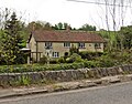
 Semi-detached houses, Barrow Gurney - geograph.org.uk - 5363782.jpg 1,024 × 772; 140 KB
-

-
 Slade Lane - geograph.org.uk - 3924239.jpg 2,304 × 1,704; 1.79 MB
-
 Snow cutting Hobbs Lane, Barrow Gurney - geograph.org.uk - 6773620.jpg 1,199 × 1,799; 245 KB
-
 Snow drifts in Hobbs Lane, Barrow Gurney - geograph.org.uk - 6403707.jpg 1,800 × 1,200; 432 KB
-
 Snow drifts in Hobbs Lane, Barrow Gurney - geograph.org.uk - 6403709.jpg 1,797 × 1,198; 402 KB
-
 Snow in B3130 Winford Lane, Barrow Gurney - geograph.org.uk - 6403704.jpg 1,799 × 1,199; 414 KB
-
 Snow scene - Barrow Gurney Church - geograph.org.uk - 6433267.jpg 1,199 × 1,799; 343 KB
-
 Snowy day at the Fox ^ Goose PH, Barrow Gurney - geograph.org.uk - 6403699.jpg 1,801 × 1,201; 415 KB
-

-
 Steps Farm, Barrow Gurney - geograph.org.uk - 5363754.jpg 1,024 × 768; 232 KB
-
 Stonework detail - geograph.org.uk - 2703889.jpg 1,704 × 2,304; 2.34 MB
-
 Take either way - geograph.org.uk - 3923189.jpg 2,304 × 1,704; 1.71 MB
-

-

-
 The Elwell Brook reaches the reservoir - geograph.org.uk - 6685443.jpg 3,296 × 2,472; 1.9 MB
-
 The Elwell landscape - geograph.org.uk - 6685451.jpg 3,296 × 2,472; 1.83 MB
-
 The end of the road^ - geograph.org.uk - 3924282.jpg 2,304 × 1,704; 1.65 MB
-
 The Fox and Goose, Bridgwater Road - geograph.org.uk - 2528259.jpg 2,304 × 1,704; 1.7 MB
-
 The Fox ^ Goose pub - geograph.org.uk - 3456720.jpg 640 × 480; 66 KB
-
 The Monarch's Way - geograph.org.uk - 6775640.jpg 3,264 × 4,896; 5.65 MB
-
 The old compensator - geograph.org.uk - 5501676.jpg 2,304 × 1,704; 1.74 MB
-
 The old Post Office - geograph.org.uk - 5502691.jpg 1,704 × 2,304; 1.52 MB
-
 The Princes Motto, Barrow Gurney - geograph.org.uk - 5363772.jpg 1,024 × 755; 160 KB
-
 Think Bike - geograph.org.uk - 1275555.jpg 640 × 480; 82 KB
-
 Three wheels on my wagon - geograph.org.uk - 3924286.jpg 2,304 × 1,704; 1.75 MB
-
 Tiles, trusses, battens, woodworm and fresh air - geograph.org.uk - 5614098.jpg 2,304 × 1,704; 1.73 MB
-
 Timber clearance - geograph.org.uk - 6774806.jpg 4,502 × 3,004; 5.14 MB
-
 Trimmed for winter - geograph.org.uk - 5613620.jpg 1,704 × 2,304; 2.09 MB
-
 Two tanks of water - geograph.org.uk - 6686271.jpg 3,296 × 2,472; 1.82 MB
-
 Upper Barrow Mill - geograph.org.uk - 3496764.jpg 3,648 × 2,736; 3.51 MB
-
 Village Hall, Barrow Gurney - geograph.org.uk - 5363761.jpg 1,024 × 798; 201 KB
-


_-_geograph.org.uk_-_4251867.jpg)


