Category:Barrhill, South Ayrshire
Jump to navigation
Jump to search
English: Category:Villages in South Ayrshire
village in South Ayrshire, Scotland, UK | |||||
| Upload media | |||||
| Instance of | |||||
|---|---|---|---|---|---|
| Location |
| ||||
 | |||||
Subcategories
This category has the following 2 subcategories, out of 2 total.
B
- Barrhill railway station (18 F)
K
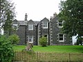
- Kildonan House (5 F)
Media in category "Barrhill, South Ayrshire"
The following 91 files are in this category, out of 91 total.
-
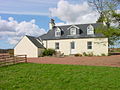 Arnsheen Farmhouse - geograph.org.uk - 385872.jpg 640 × 480; 94 KB
-
 Chirmorie Cairn - geograph.org.uk - 597234.jpg 640 × 480; 80 KB
-
 Chirmorie farm - geograph.org.uk - 597289.jpg 640 × 480; 81 KB
-
 Country Road - geograph.org.uk - 476138.jpg 640 × 480; 108 KB
-
 Daljarrock Hotel - geograph.org.uk - 333365.jpg 640 × 480; 54 KB
-
 Duisk River - geograph.org.uk - 89044.jpg 640 × 427; 122 KB
-
 Loch Nahinie - geograph.org.uk - 476093.jpg 640 × 480; 116 KB
-
 Looking towards Corwar Mains - geograph.org.uk - 89042.jpg 640 × 427; 88 KB
-
 Open Area - geograph.org.uk - 476096.jpg 450 × 600; 66 KB
-
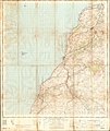 Ordnance Survey One-Inch Sheet 72 Girvan, Published 1955.jpg 8,360 × 9,944; 7.81 MB
-
 Ordnance Survey One-Inch Sheet 72 Girvan, Published 1965.jpg 8,617 × 10,682; 8.3 MB
-
 Ordnance Survey One-Inch Sheet 82 Ailsa Craig & Girvan, Published 1925.jpg 8,691 × 12,855; 8.44 MB
-
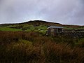
 Sheepfold north of Standard Knowe - geograph.org.uk - 892109.jpg 640 × 428; 45 KB
-
 Sheepfold on Shiel Hill - geograph.org.uk - 891131.jpg 640 × 428; 101 KB
-
 Trout Inn. Main Street, Barrhill. - geograph.org.uk - 554239.jpg 640 × 480; 154 KB
-
 Abandoned cattle market - geograph.org.uk - 464162.jpg 640 × 480; 134 KB
-
 Across The Burn - geograph.org.uk - 476167.jpg 450 × 600; 78 KB
-
 After the clearfell - geograph.org.uk - 464158.jpg 640 × 480; 84 KB
-
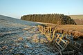 Along The Fence - geograph.org.uk - 1100977.jpg 640 × 426; 120 KB
-
 Altercannoch Farm - geograph.org.uk - 464468.jpg 640 × 480; 73 KB
-
 Approaching The Gate - geograph.org.uk - 1101010.jpg 640 × 445; 130 KB
-
 Area of clearfell - geograph.org.uk - 771712.jpg 640 × 480; 72 KB
-
 Arecleoch Forest - geograph.org.uk - 598041.jpg 640 × 480; 87 KB
-
 Ballochmorrie Farm - geograph.org.uk - 217863.jpg 640 × 480; 185 KB
-
 Beech Hedge and conifers - geograph.org.uk - 464340.jpg 640 × 480; 123 KB
-
 Below Craig Airie Fell - geograph.org.uk - 633262.jpg 640 × 431; 51 KB
-
 Blair Farm - geograph.org.uk - 464286.jpg 640 × 480; 127 KB
-
 Boreland - geograph.org.uk - 464350.jpg 640 × 480; 120 KB
-
 Bowling green, Barrhill - geograph.org.uk - 554233.jpg 640 × 480; 51 KB
-
 Cairnlea Cottage. - geograph.org.uk - 554252.jpg 640 × 480; 158 KB
-
 Cairnlea farm - geograph.org.uk - 554253.jpg 640 × 480; 164 KB
-
 Cairnlea pond - geograph.org.uk - 544450.jpg 600 × 450; 31 KB
-

-
 Church in Barrhill - geograph.org.uk - 217875.jpg 480 × 640; 181 KB
-
 Cowar Mains Hill trig - geograph.org.uk - 89041.jpg 640 × 427; 109 KB
-
 Cross Water - geograph.org.uk - 464167.jpg 480 × 640; 149 KB
-
 Darnaconnar - geograph.org.uk - 464328.jpg 640 × 480; 116 KB
-
 Drive into Darnaconnar - geograph.org.uk - 464324.jpg 640 × 480; 129 KB
-
 Duisk Bridge, Barrhill - geograph.org.uk - 217881.jpg 480 × 640; 206 KB
-
 Eldrick Farm - geograph.org.uk - 464356.jpg 640 × 480; 87 KB
-
 Enclosure, Artfield Fell - geograph.org.uk - 650850.jpg 640 × 480; 198 KB
-
 Feoch Bank wood - geograph.org.uk - 464299.jpg 640 × 480; 107 KB
-
 Field Beside Ballochmorrie Farm - geograph.org.uk - 217866.jpg 640 × 480; 154 KB
-
 Fire break - geograph.org.uk - 464425.jpg 640 × 480; 88 KB
-
 Forest Break on Darnarroch Fell - geograph.org.uk - 561335.jpg 640 × 480; 169 KB
-
 Forest Road at Airyewn - geograph.org.uk - 561336.jpg 640 × 480; 145 KB
-
 Forestry track fork - geograph.org.uk - 464435.jpg 640 × 480; 88 KB
-
 General store, Main Street Barrhill - geograph.org.uk - 544293.jpg 640 × 480; 53 KB
-
 Golden Field to Northwest of Barrhill - geograph.org.uk - 217872.jpg 640 × 480; 188 KB
-
 Gowlands farm. - geograph.org.uk - 554245.jpg 640 × 480; 156 KB
-
 Gowlands terrace. - geograph.org.uk - 554246.jpg 640 × 480; 150 KB
-
 In Arecleoch Forest - geograph.org.uk - 598028.jpg 640 × 480; 95 KB
-
 In Arecleoch Forest - geograph.org.uk - 598035.jpg 640 × 480; 95 KB
-
 Killantringan Farm - geograph.org.uk - 464335.jpg 640 × 480; 79 KB
-
 Knockycoid Cottage - geograph.org.uk - 476144.jpg 640 × 480; 86 KB
-
 Knockycoid Farm - geograph.org.uk - 476148.jpg 640 × 461; 87 KB
-
 Knowe Road. - geograph.org.uk - 554238.jpg 640 × 480; 152 KB
-
 Laggan - geograph.org.uk - 464294.jpg 640 × 480; 107 KB
-
 Large Tree in Roadside Field - geograph.org.uk - 217870.jpg 640 × 480; 163 KB
-
 Leaving Arecleoch Forest - geograph.org.uk - 598058.jpg 640 × 480; 70 KB
-
 Loads Of Logs - geograph.org.uk - 476142.jpg 640 × 464; 101 KB
-
 Lochton Mill - geograph.org.uk - 476159.jpg 640 × 469; 72 KB
-

-
 Main Street, Barrhill. - geograph.org.uk - 554243.jpg 640 × 480; 155 KB
-
 Martyrs' Tomb - geograph.org.uk - 464280.jpg 640 × 480; 181 KB
-
 Memorial Hall, Barrhill. - geograph.org.uk - 554241.jpg 640 × 480; 150 KB
-
 Millstones and mixer - geograph.org.uk - 464476.jpg 640 × 480; 67 KB
-
 Near Knockcroon - geograph.org.uk - 464346.jpg 640 × 480; 120 KB
-
 Near the fork - geograph.org.uk - 464362.jpg 640 × 480; 97 KB
-
 New cemetery, Barrhill. - geograph.org.uk - 554248.jpg 640 × 480; 150 KB
-
 New Luce Road, Barrhill - geograph.org.uk - 313503.jpg 640 × 480; 72 KB
-
 Nice pond, no ducks - geograph.org.uk - 464334.jpg 640 × 480; 117 KB
-

-
 On The Way In - geograph.org.uk - 476170.jpg 640 × 480; 102 KB
-
 Once a wood - geograph.org.uk - 464313.jpg 640 × 480; 130 KB
-
 Pollgowan Burn - geograph.org.uk - 476157.jpg 450 × 600; 53 KB
-
 Pool On The Lavery Burn - geograph.org.uk - 476165.jpg 450 × 600; 65 KB
-
 Primary school, Barrhill. - geograph.org.uk - 554242.jpg 640 × 480; 153 KB
-
 Replanting - geograph.org.uk - 464154.jpg 640 × 480; 99 KB
-
 River Cree at Wheeb Bridge - geograph.org.uk - 217887.jpg 640 × 480; 144 KB
-
 Rolling moorland - geograph.org.uk - 464359.jpg 640 × 480; 70 KB
-
 Sheep Country - geograph.org.uk - 561493.jpg 640 × 480; 116 KB
-
 Sheepfold, Cairnlea farm. - geograph.org.uk - 554255.jpg 640 × 480; 154 KB
-
 Sheepfold, Cairnlea farm. - geograph.org.uk - 554256.jpg 640 × 480; 161 KB
-
 Still a forest - geograph.org.uk - 464321.jpg 640 × 480; 77 KB
-

-
 The road through Arecleoch Forest - geograph.org.uk - 597568.jpg 640 × 480; 114 KB
-
 The road to Dochroyle - geograph.org.uk - 598047.jpg 640 × 480; 79 KB
-
 Towards Black Clauchrie - geograph.org.uk - 477142.jpg 640 × 405; 92 KB
-
 Towards Darnaconnar - geograph.org.uk - 477145.jpg 640 × 413; 78 KB
-
 View from Arnsheen - geograph.org.uk - 385857.jpg 640 × 480; 61 KB


