Category:Barratitoppy townland, County Monaghan
Jump to navigation
Jump to search
Media in category "Barratitoppy townland, County Monaghan"
The following 13 files are in this category, out of 13 total.
-
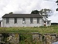 Barratitoppy National School - geograph.org.uk - 537361.jpg 640 × 480; 99 KB
-
 Barratitoppy Townland - geograph.org.uk - 782189.jpg 640 × 479; 73 KB
-
 Barratitoppy Townland - geograph.org.uk - 782230.jpg 640 × 479; 93 KB
-
 Barratitoppy Townland - geograph.org.uk - 782234.jpg 640 × 479; 60 KB
-
 Barratitoppy Townland - geograph.org.uk - 782236.jpg 640 × 479; 73 KB
-
 Barratitoppy Townland - geograph.org.uk - 782245.jpg 640 × 479; 80 KB
-
 Barratitoppy Townland - geograph.org.uk - 782275.jpg 640 × 479; 61 KB
-
 Barratitoppy Townland - geograph.org.uk - 782326.jpg 640 × 479; 83 KB
-
 Barratitoppy Townland - geograph.org.uk - 782333.jpg 640 × 479; 75 KB
-
 Road at Barratitoppy - geograph.org.uk - 782225.jpg 640 × 479; 50 KB
-
 Road at Barratitoppy - geograph.org.uk - 782241.jpg 640 × 479; 64 KB
-
 Road at Barratitoppy - geograph.org.uk - 782300.jpg 640 × 479; 60 KB
-
 Road at Tonystackan - geograph.org.uk - 782168.jpg 640 × 479; 70 KB


