Category:Barnt Green
Jump to navigation
Jump to search
village in Worcestershire  | |||||
| Upload media | |||||
| Instance of | |||||
|---|---|---|---|---|---|
| Location | Bromsgrove, Worcestershire, West Midlands, England | ||||
| Said to be the same as | Barnt Green (Wikimedia duplicated page, civil parish) | ||||
 | |||||
Subcategories
This category has the following 5 subcategories, out of 5 total.
A
B
- Barnt Green railway station (19 F)
I
- The Barnt Green Inn (3 F)
L
- Lower Bittell Reservoir (2 F)
V
- The Victoria, Barnt Green (3 F)
Media in category "Barnt Green"
The following 115 files are in this category, out of 115 total.
-
 4 Minutes to Junction 3 - geograph.org.uk - 5890641.jpg 800 × 600; 653 KB
-
 A bend on the Worcester and Birmingham Canal - geograph.org.uk - 3174636.jpg 1,024 × 768; 174 KB
-
 Aqueduct Lane - geograph.org.uk - 3917281.jpg 640 × 480; 100 KB
-
 Autumn Colours, Pool Cofton Hackett - geograph.org.uk - 2953744.jpg 444 × 640; 126 KB
-

-
 Barnt Green Bridge - geograph.org.uk - 2533673.jpg 800 × 600; 130 KB
-
 Barnt Green Guides - geograph.org.uk - 2533657.jpg 800 × 600; 118 KB
-
 Barnt Green Surgery, 82 Hewell Road, Barnt Green - geograph.org.uk - 2796887.jpg 1,024 × 666; 194 KB
-

-
 Barnt Green, Bittell Farm Road - geograph.org.uk - 2759588.jpg 640 × 480; 83 KB
-

-

-
 Bgthevic.jpg 640 × 480; 34 KB
-
 Bittell Farm Road - geograph.org.uk - 2710240.jpg 640 × 480; 62 KB
-

-
 Bittell Lane Barnt Green - geograph.org.uk - 3735588.jpg 1,024 × 638; 128 KB
-
 Bittell Road bridge over Birmingham Canal - geograph.org.uk - 3735590.jpg 1,024 × 688; 192 KB
-
 Bittell Road, Barnt Green - geograph.org.uk - 2710231.jpg 640 × 480; 80 KB
-
 Bittell Road, Barnt Green - geograph.org.uk - 3735589.jpg 1,024 × 651; 170 KB
-
 Bridge 65, Worcester and Birmingham Canal - geograph.org.uk - 3428108.jpg 1,024 × 680; 243 KB
-
 Bridge No 65 south-west of Hopwood - geograph.org.uk - 2278993.jpg 800 × 600; 341 KB
-
-
-
 Bromsgrove , The M42 Motorway - geograph.org.uk - 2795199.jpg 4,288 × 2,848; 4.48 MB
-
 Bromsgrove , The M42 Motorway - geograph.org.uk - 2795221.jpg 4,288 × 2,848; 4.55 MB
-
 Bromsgrove , The M42 Motorway - geograph.org.uk - 2795222.jpg 4,288 × 2,848; 4.28 MB
-
 Bromsgrove , The M42 Motorway - geograph.org.uk - 2795223.jpg 4,166 × 2,652; 3.37 MB
-
 Bromsgrove , The M42 Motorway - geograph.org.uk - 2795383.jpg 4,218 × 2,740; 3.49 MB
-
 Bromsgrove District , M42 Motorway - geograph.org.uk - 5951503.jpg 6,000 × 4,000; 6.95 MB
-
 Bromsgrove District , M42 Motorway - geograph.org.uk - 5951504.jpg 6,000 × 4,000; 6.89 MB
-
 Bromsgrove District , M42 Motorway - geograph.org.uk - 5951505.jpg 6,000 × 4,000; 7.48 MB
-

-

-
 Canal cottage at Lower Bittel - geograph.org.uk - 2115262.jpg 640 × 480; 95 KB
-
 Canal Cottage, Lower Bittell - geograph.org.uk - 3426384.jpg 1,024 × 680; 160 KB
-
 Canal Cottage, near Lower Bittell Reservoir - geograph.org.uk - 3426052.jpg 680 × 1,024; 148 KB
-
 Canal diversion under the M42 - geograph.org.uk - 154584.jpg 640 × 480; 329 KB
-

-
 Canalside house at Lower Bittell reservoir - geograph.org.uk - 5814464.jpg 1,024 × 768; 165 KB
-
 Class 31 Near Barnt Green, 1975 - geograph.org.uk - 2754232.jpg 640 × 480; 102 KB
-
 Class 323s Near Barnt Green - geograph.org.uk - 2827246.jpg 640 × 397; 92 KB
-
 Cross Country Train at Barnt Green - geograph.org.uk - 2347656.jpg 640 × 488; 59 KB
-
 Engine house by Upper Bittell Reservoir - geograph.org.uk - 3916939.jpg 640 × 480; 113 KB
-
 Farmland off Bittell Road - geograph.org.uk - 4370034.jpg 640 × 432; 66 KB
-
 Fields turn into houses - geograph.org.uk - 5145733.jpg 640 × 426; 69 KB
-

-
 Fiery Hill Road meets the B4120 - geograph.org.uk - 2710219.jpg 640 × 480; 80 KB
-
 Footpath from Cherry Hill Road to Barnt Green Station (geograph 302725, high-res).jpg 1,064 × 1,600; 847 KB
-
 Grazing near Barnt Green - geograph.org.uk - 6191894.jpg 800 × 520; 69 KB
-
 Guide Hut now a new private house - geograph.org.uk - 5145728.jpg 800 × 533; 429 KB
-
 Hewell Lane Bridge - geograph.org.uk - 2533683.jpg 800 × 600; 171 KB
-

-
 Hewell Road from the Redditch train - geograph.org.uk - 1373796.jpg 640 × 425; 94 KB
-

-
 High Speed Train at Barnt Green - geograph.org.uk - 2556361.jpg 640 × 426; 89 KB
-

-

-

-
 Kendal End Road (B4120), Barnt Green - geograph.org.uk - 2792438.jpg 1,024 × 652; 183 KB
-
 Lickey Hills Country Park - geograph.org.uk - 5661862.jpg 1,280 × 851; 557 KB
-
 Lickey Hills Country Park - geograph.org.uk - 5662216.jpg 851 × 1,280; 761 KB
-
 Lickey Hills Country Park - geograph.org.uk - 5662843.jpg 1,280 × 851; 634 KB
-
 Long straight on Fiery Hill Road - geograph.org.uk - 2710206.jpg 640 × 480; 95 KB
-
 Longmead Barnt Green.JPG 3,264 × 2,448; 2.81 MB
-
 M42 approaching Hopwood Park Services - geograph.org.uk - 5890630.jpg 800 × 533; 576 KB
-
 M42 eastbound near Barnt Green - geograph.org.uk - 4849904.jpg 640 × 480; 43 KB
-
 M42 Footbridge near Barnt Green - geograph.org.uk - 5890627.jpg 800 × 534; 551 KB
-
 M42 south east of Barnt Green - geograph.org.uk - 3102622.jpg 640 × 480; 59 KB
-
 M42, Sandhills Green Bridge - geograph.org.uk - 5890625.jpg 800 × 533; 518 KB
-
 Moorings at Bittell Arm and Lower Bittell Reservoir - geograph.org.uk - 3378714.jpg 3,872 × 2,592; 3.84 MB
-
 Oak tree at road junction, Barnt Green - geograph.org.uk - 127292.jpg 640 × 480; 161 KB
-
 Railway bridge Sandhills Green - geograph.org.uk - 3735586.jpg 1,024 × 680; 222 KB
-
 Railway Junction at Barnt Green - geograph.org.uk - 2311617.jpg 4,000 × 3,000; 3.51 MB
-
 Road - panoramio (117).jpg 1,936 × 1,936; 1.27 MB
-
 Road junction near Barnt Green - geograph.org.uk - 127654.jpg 640 × 480; 191 KB
-
 Sandhills Lane, Barnt Green - geograph.org.uk - 2796922.jpg 1,024 × 673; 185 KB
-
 Services Ahead, M42 Motorway - geograph.org.uk - 5890619.jpg 800 × 534; 550 KB
-
 Shepley Road crossroads - geograph.org.uk - 2710202.jpg 640 × 480; 98 KB
-

-
 The aqueduct on Aqueduct Lane - geograph.org.uk - 3735585.jpg 1,024 × 768; 258 KB
-
 The Grey House, Barnt Green (2).jpg 1,520 × 2,162; 1,010 KB
-
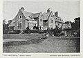 The Grey House, Barnt Green.jpg 2,096 × 1,472; 797 KB
-

-

-
 Twatling Road, Barnt Green - geograph.org.uk - 5661872.jpg 1,280 × 851; 384 KB
-

-
 View from the Train - Golden Fields, Barnt Green.jpg 3,095 × 1,731; 4.32 MB
-

-

-

-

-

-

-

-

-

-

-

-

-
 Worcester ^ Birmingham Canal, near Bittell Farm - geograph.org.uk - 4724435.jpg 1,280 × 851; 289 KB
-

-
 Cattespool - geograph.org.uk - 172503.jpg 640 × 480; 132 KB
-
 Cobley Hill - geograph.org.uk - 112011.jpg 480 × 640; 91 KB
-
 Field. With cows and things. - geograph.org.uk - 172507.jpg 640 × 480; 123 KB
-

-

-
-
 Foxhill Lane - north end - geograph.org.uk - 172511.jpg 640 × 480; 129 KB
-
 Kittenspool - geograph.org.uk - 172504.jpg 640 × 480; 145 KB
-

-
 Scarfield Hill - geograph.org.uk - 172506.jpg 640 × 480; 143 KB
-
 Shortwood Tunnel - geograph.org.uk - 173407.jpg 640 × 480; 298 KB
-
 Towards Withybed Green - geograph.org.uk - 172515.jpg 640 × 480; 123 KB
-
 View from Wheeley Farm - geograph.org.uk - 173418.jpg 639 × 481; 185 KB
-


.jpg)


_looking_towards_the_railway_bridge,_Barnt_Green_-_geograph.org.uk_-_2792417.jpg)
,_Barnt_Green_-_geograph.org.uk_-_2792438.jpg)


.jpg)


.jpg)


,_Worcester_and_Birmingham_Canal_nr_Alvechurch_-_geograph.org.uk_-_267057.jpg)


