Category:Barnstone
Jump to navigation
Jump to search
village in Nottinghamshire, UK | |||||
| Upload media | |||||
| Instance of | |||||
|---|---|---|---|---|---|
| Location | Langar cum Barnstone, Rushcliffe, Nottinghamshire, East Midlands, England | ||||
 | |||||
Subcategories
This category has the following 2 subcategories, out of 2 total.
B
- Barnstone railway station (2 F)
M
- St Mary's Church, Barnstone (4 F)
Media in category "Barnstone"
The following 47 files are in this category, out of 47 total.
-
 Barnstone Cement Works - geograph.org.uk - 2255608.jpg 1,280 × 854; 296 KB
-
 Barnstone Cement Works - geograph.org.uk - 324002.jpg 640 × 418; 75 KB
-
 Barnstone Methodist Chapel - geograph.org.uk - 3177449.jpg 640 × 427; 84 KB
-
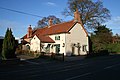 Barnstone Old House - geograph.org.uk - 611704.jpg 640 × 427; 91 KB
-

-
 Entrance to Barnstone - geograph.org.uk - 2255602.jpg 1,280 × 854; 206 KB
-
 Field barn near Barnstone - geograph.org.uk - 2255606.jpg 1,280 × 854; 679 KB
-
 Former Methodist chapel, Barnstone - geograph.org.uk - 2255607.jpg 1,280 × 841; 299 KB
-
 Main Road, Barnstone - geograph.org.uk - 611707.jpg 640 × 427; 90 KB
-
 Main Road, Barnstone - geograph.org.uk - 611842.jpg 640 × 480; 117 KB
-
-
 Public footpath by The Brambles - geograph.org.uk - 611821.jpg 640 × 427; 93 KB
-
 Public footpath near Barnstone (1) - geograph.org.uk - 611196.jpg 640 × 427; 81 KB
-
 Public footpath near Barnstone (2) - geograph.org.uk - 611197.jpg 640 × 427; 155 KB
-
 Public footpath near Barnstone (3) - geograph.org.uk - 611467.jpg 640 × 427; 105 KB
-
 Public footpath near Barnstone (4) - geograph.org.uk - 611468.jpg 640 × 427; 131 KB
-
 Public footpath near Barnstone (5) - geograph.org.uk - 611469.jpg 640 × 427; 64 KB
-
 Public Footpath near Barnstone (6) - geograph.org.uk - 611476.jpg 640 × 427; 99 KB
-
 River Whipling - geograph.org.uk - 611180.jpg 640 × 427; 99 KB
-
 Sheep pasture at Barnstone - geograph.org.uk - 611634.jpg 640 × 427; 77 KB
-
 Station Farm, Barnstone - geograph.org.uk - 611486.jpg 640 × 427; 76 KB
-
 The Brambles, Barnstone.jpg 1,280 × 960; 468 KB
-

-
 Barnstone, Nottinghamshire - geograph.org.uk - 65395.jpg 640 × 480; 87 KB
-
-
 Cement works at the end of Works Lane - geograph.org.uk - 611654.jpg 640 × 427; 97 KB
-
 End of the track. - geograph.org.uk - 292550.jpg 640 × 480; 115 KB
-
 Farmland off Works Lane - geograph.org.uk - 611648.jpg 640 × 427; 113 KB
-
 Farmland on the edge of Langar airfield - geograph.org.uk - 164273.jpg 640 × 427; 130 KB
-
 Four way fingerpost. - geograph.org.uk - 293891.jpg 640 × 480; 117 KB
-
 Industrial yard at Barnstone - geograph.org.uk - 611643.jpg 640 × 427; 71 KB
-
 Landfill site, Coach Gap Lane, Langar - geograph.org.uk - 164283.jpg 640 × 349; 93 KB
-
 Langar Airfield - geograph.org.uk - 164278.jpg 640 × 427; 94 KB
-
 Langar Airfield - geograph.org.uk - 164937.jpg 640 × 427; 88 KB
-
 Muddy Track Home. - geograph.org.uk - 293924.jpg 640 × 480; 115 KB
-
 North-south runway, Langar Airfield - geograph.org.uk - 164938.jpg 640 × 427; 86 KB
-
 Northfield Farm. - geograph.org.uk - 293892.jpg 640 × 480; 118 KB
-

-
 Private road - geograph.org.uk - 611645.jpg 640 × 427; 93 KB
-
 Railway cutting and overbridge - geograph.org.uk - 324015.jpg 640 × 427; 71 KB
-
 Ridge and Furrow at Roadside Farm - geograph.org.uk - 611624.jpg 640 × 427; 83 KB
-
 Sheep pasture near Barnstone - geograph.org.uk - 611186.jpg 640 × 480; 98 KB
-
 The Melton to Bottesford line (1) - geograph.org.uk - 611470.jpg 640 × 427; 87 KB
-
 The Melton to Bottesford line (2) - geograph.org.uk - 611589.jpg 640 × 427; 130 KB
-
 The Old Post Office - geograph.org.uk - 611676.jpg 640 × 427; 93 KB
-
 The River Whipling - geograph.org.uk - 611181.jpg 640 × 427; 84 KB
-
 This must be the footpath^ - geograph.org.uk - 611614.jpg 640 × 427; 101 KB


_-_geograph.org.uk_-_611196.jpg)
_-_geograph.org.uk_-_611197.jpg)
_-_geograph.org.uk_-_611467.jpg)
_-_geograph.org.uk_-_611468.jpg)
_-_geograph.org.uk_-_611469.jpg)
_-_geograph.org.uk_-_611476.jpg)


_-_geograph.org.uk_-_611470.jpg)
_-_geograph.org.uk_-_611589.jpg)


