Category:Barns in the Metropolitan Borough of Kirklees
Jump to navigation
Jump to search
Media in category "Barns in the Metropolitan Borough of Kirklees"
The following 22 files are in this category, out of 22 total.
-
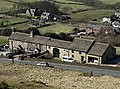 Ashes Lane, Almondbury.jpg 5,051 × 3,738; 5.22 MB
-
 Barn and White Cross Farm - geograph.org.uk - 109169.jpg 640 × 480; 107 KB
-
-

-
 Barn attached to Nathan's Cottages - geograph.org.uk - 3602264.jpg 2,000 × 1,485; 1.44 MB
-
 Barn by Booth's Bridge - geograph.org.uk - 5540032.jpg 4,032 × 3,024; 3.33 MB
-
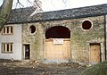
 Barn conversion at Mount Pleasant - geograph.org.uk - 3355731.jpg 2,000 × 1,500; 972 KB
-
 Barn near Hardenby Farm - geograph.org.uk - 5966093.jpg 640 × 487; 77 KB
-
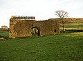
 Barn O'Cot - geograph.org.uk - 5965646.jpg 640 × 426; 80 KB
-
 Barn On Worts Hill Lane - geograph.org.uk - 5056543.jpg 1,200 × 799; 414 KB
-
-
 Barn, Upper Cote, Fixby - geograph.org.uk - 225367.jpg 640 × 475; 97 KB
-
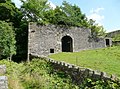
 Bradley Hall railway crossing - geograph.org.uk - 2488056.jpg 2,848 × 2,136; 1.5 MB
-
-
 Disused Barn on the Kirklees Way - geograph.org.uk - 960976.jpg 600 × 400; 71 KB
-
 Eroded barn wall - geograph.org.uk - 980255.jpg 480 × 640; 136 KB
-
 Field Barn, Holme - geograph.org.uk - 1412949.jpg 640 × 476; 152 KB
-
 Former barn, Gawthorpe Green Lane, Lepton - geograph.org.uk - 558882.jpg 640 × 476; 152 KB
-
 Grazing, Holt Head - geograph.org.uk - 5978812.jpg 640 × 480; 81 KB
-
 Nether Hall Barn.jpg 1,024 × 768; 223 KB
-
 Small barn, Almondbury - geograph.org.uk - 564859.jpg 640 × 480; 73 KB
-
 Springfield Barn, Scholes, Cleckheaton - geograph.org.uk - 217697.jpg 640 × 477; 149 KB


