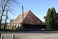
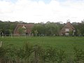
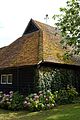
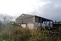
Category:Barns in Kent
Jump to navigation
Jump to search
Ceremonial counties of England: Bedfordshire · Berkshire · Buckinghamshire · Cambridgeshire · Cheshire · Cornwall · Cumbria · Derbyshire · Devon · Dorset · Durham · East Riding of Yorkshire · East Sussex · Essex · Gloucestershire · Greater London · Greater Manchester · Hampshire · Herefordshire · Hertfordshire · Kent · Lancashire · Leicestershire · Lincolnshire · Merseyside · Norfolk · North Yorkshire · Northamptonshire · Northumberland · Nottinghamshire · Oxfordshire · Rutland · Shropshire · Somerset · South Yorkshire · Staffordshire · Suffolk · Surrey · Warwickshire · West Midlands · West Sussex · West Yorkshire · Wiltshire · Worcestershire
City-counties:
Former historic counties: Westmorland ·
Other former counties:
City-counties:
Former historic counties: Westmorland ·
Other former counties:
Subcategories
This category has the following 12 subcategories, out of 12 total.
B
- Barn at Littlebourne Court (6 F)
- Boxley Abbey Barn (4 F)
- Brook Rural Museum (5 F)
E
- Barns in Edenbridge, Kent (15 F)
G
- Barns in Goudhurst (4 F)
Media in category "Barns in Kent"
The following 200 files are in this category, out of 300 total.
(previous page) (next page)-
 Quex Barn café roof at Quex Park, Birchington, Kent, England.jpg 3,000 × 2,249; 3.73 MB
-
 A new barn, Whitehall Farm - geograph.org.uk - 1746005.jpg 640 × 430; 118 KB
-
 Ancient barns at Abbey Farm - geograph.org.uk - 1147418.jpg 640 × 480; 77 KB
-
 Artichoke Barn - geograph.org.uk - 1292873.jpg 640 × 480; 76 KB
-
 August barn fire at Monkton Kent England 2.jpg 3,000 × 2,000; 5.07 MB
-
 August barn fire at Monkton Kent England 3.jpg 3,000 × 2,000; 3.64 MB
-
 August barn fire at Monkton Kent England.jpg 3,000 × 2,000; 5.08 MB
-
-

-
 Barn and Oast house, Skinner's Farm - geograph.org.uk - 1714020.jpg 640 × 427; 61 KB
-
 Barn and out building, Smockham Farm - geograph.org.uk - 1516282.jpg 640 × 430; 155 KB
-
 Barn at Barden Furnace Farm - geograph.org.uk - 1240657.jpg 640 × 427; 85 KB
-
 Barn at Barden Furnace Farm - geograph.org.uk - 1545418.jpg 640 × 430; 154 KB
-
 Barn at Boughton Monchelsea Place - geograph.org.uk - 1585614.jpg 640 × 384; 74 KB
-
 Barn at Charing Heath - geograph.org.uk - 1141712.jpg 640 × 480; 143 KB
-
 Barn at Court Farm on Church Lane - geograph.org.uk - 1345613.jpg 640 × 480; 150 KB
-
 Barn at Crowhurst Farm - geograph.org.uk - 2874608.jpg 640 × 480; 87 KB
-

-
 Barn at Green Hill, Otham - geograph.org.uk - 1418562.jpg 640 × 427; 99 KB
-
 Barn at Homestall Farm - geograph.org.uk - 170541.jpg 480 × 640; 121 KB
-
 Barn at Kempe's Corner (geograph 6475028).jpg 1,024 × 685; 165 KB
-

-
 Barn at Kent House Farm - geograph.org.uk - 2521406.jpg 640 × 480; 159 KB
-
 Barn at Lambsland Farm - geograph.org.uk - 85435.jpg 640 × 480; 151 KB
-

-
 Barn at Monkery Farm - geograph.org.uk - 245473.jpg 640 × 480; 95 KB
-
 Barn at Old Swaylands - geograph.org.uk - 1816886.jpg 1,024 × 768; 212 KB
-
 Barn at Paddlesworth Farm - geograph.org.uk - 2520244.jpg 640 × 480; 100 KB
-

-
 Barn at Preston Court Farm - geograph.org.uk - 1374401.jpg 640 × 427; 81 KB
-
 Barn at Rhode Court - geograph.org.uk - 4422285.jpg 2,000 × 1,500; 1.07 MB
-

-

-
 Barn at Tanyard Farm, Hawkhurst, Kent - geograph.org.uk - 1196132.jpg 640 × 480; 100 KB
-
 Barn at the rear of The Woolpack, Iwade - geograph.org.uk - 669572.jpg 640 × 480; 114 KB
-
 Barn at Yorkshill Farm - geograph.org.uk - 1803366.jpg 1,024 × 683; 190 KB
-
 Barn by Tea Garden Lane - geograph.org.uk - 5567281.jpg 640 × 426; 91 KB
-
 Barn by the Flying Horse - geograph.org.uk - 2436692.jpg 640 × 480; 130 KB
-
 Barn conversion at Yockletts Farm - geograph.org.uk - 1194745.jpg 640 × 480; 137 KB
-
 Barn conversion rooflights.jpg 4,000 × 2,250; 3.81 MB
-
 Barn conversion, Broad Street Farm - geograph.org.uk - 149080.jpg 640 × 480; 124 KB
-
 Barn conversion, Silver Street - geograph.org.uk - 326379.jpg 640 × 484; 86 KB
-
 Barn conversions at Scott's Farm - geograph.org.uk - 251804.jpg 640 × 480; 103 KB
-

-
 Barn entrance gate at Easole Street, Nonington, Kent, England.jpg 2,000 × 3,000; 6.25 MB
-
 Barn entrance Goodnestone Park Dover Kent England.jpg 5,204 × 3,380; 16.35 MB
-
 Barn for sale - geograph.org.uk - 6490968.jpg 1,024 × 684; 338 KB
-
 Barn full of straw, Knowlton. - geograph.org.uk - 304161.jpg 640 × 480; 161 KB
-
 Barn in an orchard - geograph.org.uk - 1142472.jpg 640 × 430; 63 KB
-
 Barn in Barnden Farm - geograph.org.uk - 1421889.jpg 640 × 480; 80 KB
-
 Barn in Bean Farm - geograph.org.uk - 1245814.jpg 640 × 480; 60 KB
-
 Barn in Bromhey Farm - geograph.org.uk - 1363524.jpg 640 × 480; 72 KB
-
 Barn in Manor Farm - geograph.org.uk - 1200478.jpg 640 × 481; 82 KB
-
 Barn in Pett Street Farm - geograph.org.uk - 1765748.jpg 3,072 × 2,304; 2.02 MB
-
 Barn in Pippins Farm - geograph.org.uk - 1409091.jpg 640 × 480; 71 KB
-
 Barn in RSPB Bromhey Farm - geograph.org.uk - 1160416.jpg 481 × 640; 72 KB
-
 Barn in Sextries Farm - geograph.org.uk - 1780513.jpg 3,072 × 2,304; 1.7 MB
-
 Barn in the woods, Hubbard's Hill - geograph.org.uk - 1381324.jpg 640 × 430; 179 KB
-
 Barn just off Barden Rd - geograph.org.uk - 1554049.jpg 640 × 356; 79 KB
-
 Barn near Ashurst Manor - geograph.org.uk - 1735334.jpg 3,072 × 2,304; 2.72 MB
-
 Barn near Court Lodge - geograph.org.uk - 1802999.jpg 3,072 × 2,304; 1.63 MB
-
 Barn near Dockenden Cottage - geograph.org.uk - 1620369.jpg 640 × 427; 83 KB
-
 Barn near Fawke Farm House - geograph.org.uk - 1533079.jpg 640 × 427; 74 KB
-

-
 Barn of Budd's Green Farm - geograph.org.uk - 1399592.jpg 640 × 480; 84 KB
-
 Barn of Grange Oast - geograph.org.uk - 1292979.jpg 640 × 480; 117 KB
-
 Barn off Stan Lane - geograph.org.uk - 1569712.jpg 640 × 430; 166 KB
-

-
 Barn on Canterbury Road, Challock - geograph.org.uk - 1393877.jpg 640 × 427; 70 KB
-

-

-
 Barn on Coopers Lane - geograph.org.uk - 1242443.jpg 640 × 480; 101 KB
-
 Barn on farmland near Etchinghill - geograph.org.uk - 966066.jpg 640 × 480; 156 KB
-
 Barn on Grain Marsh - geograph.org.uk - 1026027.jpg 576 × 432; 93 KB
-
 Barn on Hunton Road, Marden, Kent - geograph.org.uk - 629213.jpg 640 × 436; 54 KB
-
 Barn on Ridge Farm - geograph.org.uk - 853711.jpg 640 × 480; 173 KB
-
 Barn on Ridge Farm - geograph.org.uk - 860271.jpg 640 × 480; 199 KB
-
 Barn on Ryestreet Common - geograph.org.uk - 360375.jpg 640 × 427; 76 KB
-
 Barn on Snargate Lane - geograph.org.uk - 1528814.jpg 640 × 427; 77 KB
-
 Barn on Wrotham Road - geograph.org.uk - 327735.jpg 640 × 428; 107 KB
-
 Barn Plumpton Lane Geograph-1849984-by-David-Anstiss.jpg 3,072 × 2,304; 1.44 MB
-
 Barn renovation at Etchinghill Farm - geograph.org.uk - 293821.jpg 640 × 427; 87 KB
-
 Barn still in use - geograph.org.uk - 1376844.jpg 640 × 480; 75 KB
-
 Barn with hydrangea and ivy at Monkton Kent England.jpg 3,000 × 2,000; 5.58 MB
-
 Barn with hydrangea and ivy in Monkton Kent England.jpg 2,000 × 3,000; 5.29 MB
-
 Barn, Barden Furnace Farm - geograph.org.uk - 1545401.jpg 640 × 388; 90 KB
-
 Barn, Beckett's Farm - geograph.org.uk - 1262746.jpg 640 × 430; 56 KB
-
 Barn, Beech Farm, Stan Lane - geograph.org.uk - 1569739.jpg 640 × 430; 121 KB
-
 Barn, Beechenwood Farm - geograph.org.uk - 1708919.jpg 640 × 427; 55 KB
-
 Barn, Bells Farm - geograph.org.uk - 2346070.jpg 640 × 430; 70 KB
-
 Barn, Bore Place - geograph.org.uk - 1256700.jpg 640 × 430; 63 KB
-
 Barn, Brook Farm - geograph.org.uk - 2339935.jpg 640 × 430; 45 KB
-
 Barn, Broomhill Farm - geograph.org.uk - 1670623.jpg 640 × 430; 106 KB
-
 Barn, Chafford Park - geograph.org.uk - 1550285.jpg 640 × 430; 145 KB
-
 Barn, Chicks Farm, Chicks Lane - geograph.org.uk - 1765220.jpg 640 × 370; 97 KB
-
 Barn, Cockham Farm - geograph.org.uk - 1605939.jpg 640 × 430; 110 KB
-
 Barn, Colehurst Farm - geograph.org.uk - 1381347.jpg 640 × 430; 132 KB
-
 Barn, Court Lodge Farm, West Peskham - geograph.org.uk - 1360372.jpg 640 × 462; 99 KB
-
 Barn, Crowhurst Farm - geograph.org.uk - 2344818.jpg 640 × 390; 55 KB
-
 Barn, Dundale Farm, Dundale Rd - geograph.org.uk - 1564542.jpg 640 × 430; 64 KB
-
 Barn, Eyhorne Farm - geograph.org.uk - 1612040.jpg 640 × 430; 134 KB
-
 Barn, Fairlawne Home Farm, Plaxtol - geograph.org.uk - 1363994.jpg 640 × 430; 136 KB
-
 Barn, Faulkner Hill Farm - geograph.org.uk - 1256574.jpg 640 × 430; 69 KB
-
 Barn, Gravelpits - geograph.org.uk - 1258980.jpg 640 × 430; 72 KB
-
 Barn, Great Hollanden Farm - geograph.org.uk - 1372987.jpg 640 × 401; 63 KB
-
 Barn, Great Weddington Farm - geograph.org.uk - 3462377.jpg 640 × 430; 40 KB
-
 Barn, Hale Farm, Tudeley Hale - geograph.org.uk - 1355661.jpg 640 × 406; 84 KB
-
 Barn, Hall's Green Farm, Hale Oak Rd - geograph.org.uk - 1379098.jpg 640 × 430; 148 KB
-
 Barn, High Rocks Lane - geograph.org.uk - 6681269.jpg 1,024 × 684; 226 KB
-
 Barn, Home Farm, Nizels Lane - geograph.org.uk - 1535921.jpg 640 × 290; 61 KB
-
 Barn, Kettleshill Farm - geograph.org.uk - 1372262.jpg 640 × 430; 123 KB
-
 Barn, Landway Farm - geograph.org.uk - 1572022.jpg 640 × 430; 145 KB
-
 Barn, Little Bayhall Farm - geograph.org.uk - 4190771.jpg 640 × 430; 76 KB
-
 Barn, Little Bayhall Farm - geograph.org.uk - 4190773.jpg 640 × 430; 60 KB
-
 Barn, Little Hall Farm - geograph.org.uk - 1142329.jpg 640 × 430; 56 KB
-
 Barn, Little Hickmans, Cooper's Lane - geograph.org.uk - 1549204.jpg 640 × 430; 161 KB
-

-
 Barn, Mouseden - geograph.org.uk - 6490702.jpg 1,024 × 684; 107 KB
-
 Barn, Mouseden - geograph.org.uk - 6490704.jpg 1,024 × 685; 115 KB
-
 Barn, Owl House Fruit Farm - geograph.org.uk - 1760670.jpg 640 × 430; 66 KB
-
 Barn, Paddlesworth Farm - geograph.org.uk - 3140397.jpg 640 × 430; 63 KB
-
 Barn, Paddlesworth Farm - geograph.org.uk - 3140398.jpg 640 × 430; 92 KB
-
 Barn, Paddlesworth Farm - geograph.org.uk - 3140409.jpg 640 × 430; 77 KB
-
 Barn, Palmer's Farm - geograph.org.uk - 1549260.jpg 640 × 430; 136 KB
-
 Barn, Panthurst Farm (2) - geograph.org.uk - 1382269.jpg 640 × 430; 131 KB
-
 Barn, Panthurst Farm - geograph.org.uk - 1382262.jpg 640 × 430; 134 KB
-
 Barn, Poldhurst Farm - geograph.org.uk - 1133100.jpg 640 × 430; 62 KB
-
 Barn, Pond Farm - geograph.org.uk - 2345003.jpg 640 × 430; 72 KB
-
 Barn, Pond Farm - geograph.org.uk - 2345006.jpg 640 × 430; 63 KB
-
 Barn, Sandfield Farm - geograph.org.uk - 1376768.jpg 640 × 430; 132 KB
-
 Barn, Skinner's Farm - geograph.org.uk - 1714074.jpg 640 × 427; 54 KB
-
 Barn, Smockham Farm - geograph.org.uk - 1670340.jpg 640 × 430; 62 KB
-
 Barn, Snargate Lane - geograph.org.uk - 394301.jpg 640 × 479; 118 KB
-
 Barn, Strettit Farm - geograph.org.uk - 2370924.jpg 640 × 430; 41 KB
-
 Barn, The Dowels - geograph.org.uk - 393737.jpg 640 × 479; 153 KB
-
 Barn, Wat Stock - geograph.org.uk - 1680126.jpg 640 × 430; 126 KB
-
 Barn, Whitehall Farm - geograph.org.uk - 1745998.jpg 640 × 430; 125 KB
-
 Barn, Winfield Lane - geograph.org.uk - 1572041.jpg 640 × 430; 129 KB
-
 Barn. Fitchett Farm - geograph.org.uk - 1550529.jpg 640 × 430; 124 KB
-
 Barns and outbuildings at Heronden - geograph.org.uk - 2303243.jpg 640 × 480; 116 KB
-
 Barns at Green Farm, Stalisfield - geograph.org.uk - 214125.jpg 640 × 480; 93 KB
-
 Barns at Lower Halstow - geograph.org.uk - 668926.jpg 640 × 480; 168 KB
-
 Barns at South Green Farm - geograph.org.uk - 2523093.jpg 640 × 480; 76 KB
-
 Barns near Delmonden House - geograph.org.uk - 392004.jpg 640 × 428; 146 KB
-
 Barns of Court Lodge Farm - geograph.org.uk - 1720695.jpg 3,072 × 2,304; 1.54 MB
-
 Barns, Green Farm, Nettlestead Green - geograph.org.uk - 1506645.jpg 640 × 430; 56 KB
-
 Barns, Little Bayhall Farm - geograph.org.uk - 6490742.jpg 1,024 × 684; 141 KB
-
 Barns, Sevton Farm, Powder Mills - geograph.org.uk - 1391816.jpg 640 × 430; 141 KB
-
 Beston Barn - geograph.org.uk - 1618932.jpg 640 × 427; 77 KB
-
 Bexon Manor Barn, Bredgar - geograph.org.uk - 3573536.jpg 640 × 505; 97 KB
-
 Billy Banks Barn - geograph.org.uk - 1344928.jpg 640 × 480; 58 KB
-
 Bluebell Barn - geograph.org.uk - 1201932.jpg 640 × 481; 97 KB
-
 Boughton Aluph Farm barn - geograph.org.uk - 1456300.jpg 640 × 480; 62 KB
-
 Chapel at Newlands Farm Geograph-2259115-by-Oast-House-Archive.jpg 640 × 480; 144 KB
-
 Chegworth Barn - geograph.org.uk - 1189363.jpg 640 × 481; 67 KB
-
 Chestfield Barn.JPG 2,560 × 1,920; 520 KB
-
 Church Barn - geograph.org.uk - 1231471.jpg 640 × 480; 99 KB
-
 Church House Barn, Tudeley - geograph.org.uk - 1355534.jpg 640 × 430; 132 KB
-
 Cobtree barn.JPG 2,304 × 1,728; 809 KB
-
 Cobtree museum.jpg 640 × 427; 138 KB
-
 Colkins Barn - geograph.org.uk - 350553.jpg 640 × 483; 108 KB
-
 Converted Barn - geograph.org.uk - 1242579.jpg 640 × 480; 113 KB
-
 Converted barn on Marley Lane - geograph.org.uk - 680217.jpg 640 × 480; 259 KB
-
 Converted barn, Church St - geograph.org.uk - 1540944.jpg 640 × 430; 118 KB
-
 Converted Barn, Cryals Farm - geograph.org.uk - 1755683.jpg 640 × 393; 73 KB
-
 Court Lodge Barn Mersham Geograph-1889972-by-David-Anstiss.jpg 3,072 × 2,304; 1.75 MB
-
 Court Lodge Farm, West Peckham - geograph.org.uk - 1360349.jpg 640 × 430; 132 KB
-
 Cronks Farm Barn - geograph.org.uk - 1212145.jpg 640 × 480; 108 KB
-
 Crowhurst Hop Farm - geograph.org.uk - 2343494.jpg 640 × 367; 43 KB
-
 Crowhurst Hop Farm, Bullen Lane, East Peckham - geograph.org.uk - 4374435.jpg 1,024 × 768; 230 KB
-
 Dilapidated barn near Cliffe - geograph.org.uk - 215317.jpg 640 × 480; 61 KB
-
 Downingbury Farm barn, Pembury - geograph.org.uk - 1409062.jpg 640 × 480; 88 KB
-
 Ebony barn - geograph.org.uk - 1421912.jpg 640 × 480; 97 KB
-
 Evergreen Barn - geograph.org.uk - 1186245.jpg 640 × 481; 62 KB
-
 Fairbourne Mill Barn - geograph.org.uk - 1189225.jpg 640 × 481; 90 KB
-
 Farm Buildings at Little Fish Hall - geograph.org.uk - 1533810.jpg 640 × 427; 87 KB
-

-
 Fishpond Farm - geograph.org.uk - 849498.jpg 640 × 430; 97 KB
-

-
 Flint Barn at Seed - geograph.org.uk - 183734.jpg 640 × 480; 103 KB
-
 Flint building at Cotman's Ash - geograph.org.uk - 940836.jpg 640 × 430; 93 KB
-
 Flint Building on Cotman's Ash Lane - geograph.org.uk - 1267404.jpg 640 × 480; 78 KB
-
 Foley Farm Barn - geograph.org.uk - 1180955.jpg 640 × 481; 93 KB
-
 Four Wents Barn - geograph.org.uk - 1593545.jpg 640 × 427; 61 KB
-
 Haffenden Barn, Pook Lane - geograph.org.uk - 1524262.jpg 640 × 427; 62 KB
-
 Harty, a barn in semi-silhouette - geograph.org.uk - 1333334.jpg 640 × 480; 68 KB
-
 Hodge Barn, Maltman's Hill - geograph.org.uk - 1428019.jpg 640 × 480; 87 KB
-
 Homestall Farm - geograph.org.uk - 169393.jpg 640 × 480; 119 KB
-
 Ickham, Kent. - geograph.org.uk - 467792.jpg 640 × 480; 65 KB
-
 Iddenden Barn - geograph.org.uk - 1720557.jpg 3,072 × 2,304; 1.84 MB
-
 Ivy clad barn at Rowling - geograph.org.uk - 695603.jpg 640 × 480; 199 KB
-

-
 Large Barn, Whitehall Farm - geograph.org.uk - 1745984.jpg 640 × 353; 65 KB
-
 Little Brook Barn - geograph.org.uk - 1231517.jpg 640 × 480; 57 KB
-
 Mascalli's Court Barn - geograph.org.uk - 1660395.jpg 640 × 480; 84 KB
-
 Moat Farm Barn, Collier Street - geograph.org.uk - 3164843.jpg 4,288 × 3,216; 3.71 MB
-
 Modern barn, Paddlesworth Farm - geograph.org.uk - 3140419.jpg 640 × 430; 59 KB
-
 Modern barn, Paddlesworth Farm - geograph.org.uk - 3140429.jpg 640 × 430; 50 KB
-
 Morry Barn - geograph.org.uk - 1196023.jpg 640 × 481; 80 KB
-
 Mossy barn roof, Heronden Farm - geograph.org.uk - 4770344.jpg 2,448 × 3,264; 3.12 MB


.jpg)


_-_geograph.org.uk_-_1382269.jpg)


,_Rectory_Lane,_Sutton_Valence,_Kent_-_geograph.org.uk_-_1207633.jpg)


