Category:Barningham, Suffolk
Jump to navigation
Jump to search
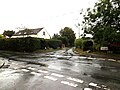
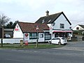
English: Barningham is a village and civil parish in the St Edmundsbury district of Suffolk, England, about twelve miles north-east of Bury St Edmunds itself. According to Eilert Ekwall the meaning of the village name is the homestead of Beorn's people. The Domesday Book records the population of Barningham in 1086 to be 36. It has a primary school opposite a local pub called the Royal George, there's a shop with a post office, further down the road is St Andrews church.
village and civil parish in Suffolk, UK  Eglwys Sant Andreas, Barningham | |||||
| Upload media | |||||
| Instance of | |||||
|---|---|---|---|---|---|
| Location | West Suffolk, Suffolk, East of England, England | ||||
| Population |
| ||||
| Said to be the same as | Barningham (Wikimedia duplicated page, civil parish) | ||||
 | |||||
Subcategories
This category has the following 5 subcategories, out of 5 total.
Media in category "Barningham, Suffolk"
The following 84 files are in this category, out of 84 total.
-
 B1111 Bury Road, Market Weston - geograph.org.uk - 5042132.jpg 3,072 × 2,304; 1.78 MB
-
 B1111 Hopton Road, Barningham - geograph.org.uk - 5007697.jpg 3,072 × 2,304; 2.36 MB
-
 B1111 Stanton Road, Barningham - geograph.org.uk - 5007669.jpg 3,072 × 2,304; 2.01 MB
-
 B1111 Stanton Road, Barningham - geograph.org.uk - 5007674.jpg 2,970 × 2,225; 2.7 MB
-
 Bardwell Road sign - geograph.org.uk - 5121013.jpg 3,072 × 2,304; 2.02 MB
-
 Bardwell Road, Barningham - geograph.org.uk - 4466539.jpg 640 × 480; 97 KB
-
 Bardwell Road, Barningham - geograph.org.uk - 5120990.jpg 3,072 × 2,304; 3.89 MB
-
 Bardwell Road, Barningham - geograph.org.uk - 5121009.jpg 3,072 × 2,304; 3.8 MB
-
 Bardwell Road, Barningham - geograph.org.uk - 5121027.jpg 3,072 × 2,304; 3.89 MB
-
 Barningham Post Office, Barningham - geograph.org.uk - 5007250.jpg 3,072 × 2,307; 4.13 MB
-
 Barningham Primary School - geograph.org.uk - 2305892.jpg 1,600 × 1,200; 592 KB
-

-
 Buildings at Home Farm - geograph.org.uk - 3971107.jpg 4,320 × 3,240; 6.83 MB
-
 Byway Sign - geograph.org.uk - 2306365.jpg 1,200 × 1,600; 667 KB
-
 C641 Hollow Lane, Market Weston - geograph.org.uk - 5042087.jpg 3,072 × 2,304; 1.89 MB
-
 Church Road sign - geograph.org.uk - 5007713.jpg 3,072 × 2,304; 1.88 MB
-
 Church Road, Barningham - geograph.org.uk - 4563985.jpg 640 × 480; 368 KB
-
 Church Road, Barningham - geograph.org.uk - 5007663.jpg 3,072 × 2,304; 4.31 MB
-
 Concrete Hardstanding off Barningham Road - geograph.org.uk - 5087237.jpg 3,072 × 2,304; 1.83 MB
-
 Cottages - geograph.org.uk - 2306383.jpg 1,600 × 1,200; 569 KB
-
 Crop fields beside Hollow Lane - geograph.org.uk - 4563919.jpg 640 × 480; 342 KB
-
 Cross Roads and Post Office in Barningham - geograph.org.uk - 4254665.jpg 4,000 × 3,000; 2.57 MB
-
 Dead tree beside farm track - geograph.org.uk - 4563940.jpg 640 × 480; 303 KB
-
 Direction Sign - geograph.org.uk - 2305897.jpg 1,200 × 1,600; 472 KB
-
 Distant Deer - geograph.org.uk - 2306379.jpg 1,600 × 1,200; 430 KB
-
 Drout's Lane sign - geograph.org.uk - 5121004.jpg 2,991 × 2,243; 5.03 MB
-
 Drout's Lane, Barningham - geograph.org.uk - 5120996.jpg 3,051 × 2,288; 3.48 MB
-
 Farm track through crop fields - geograph.org.uk - 4563938.jpg 640 × 480; 332 KB
-
 Field and footpath gate - geograph.org.uk - 4563927.jpg 640 × 480; 518 KB
-
 Footpath gate into a pasture - geograph.org.uk - 4563929.jpg 640 × 573; 568 KB
-
 Footpath Signs - geograph.org.uk - 2306381.jpg 1,200 × 1,600; 465 KB
-
 Hall Cottage (name sign) - geograph.org.uk - 4563990.jpg 640 × 480; 474 KB
-
 Hardstanding beside Day's Lane - geograph.org.uk - 4563989.jpg 640 × 480; 366 KB
-

-
 Hepworth Road sign - geograph.org.uk - 5087259.jpg 3,031 × 2,273; 5 MB
-
 Hepworth Road, Barningham - geograph.org.uk - 5087245.jpg 3,072 × 2,304; 1.76 MB
-
 Hepworth Road, Barningham - geograph.org.uk - 5087256.jpg 3,072 × 2,304; 1.74 MB
-
 Hepworth Road, Barningham - geograph.org.uk - 5087261.jpg 3,072 × 2,215; 2.3 MB
-
 Hepworth Road, Barningham - geograph.org.uk - 5087597.jpg 3,072 × 2,273; 2.55 MB
-
 Hopton Road sign - geograph.org.uk - 5007707.jpg 3,072 × 2,304; 1.83 MB
-
 House building in Barningham - geograph.org.uk - 3971132.jpg 4,320 × 3,240; 4.51 MB
-

-
 Looking across a field to Barningham - geograph.org.uk - 3014856.jpg 3,648 × 2,736; 2.12 MB
-
 Market Weston, Harvested field - geograph.org.uk - 6592452.jpg 7,761 × 5,174; 7.08 MB
-
 Market Weston, Harvested field - geograph.org.uk - 6592457.jpg 7,620 × 5,080; 6.01 MB
-
 Mill Road, Barningham - geograph.org.uk - 2282243.jpg 640 × 480; 62 KB
-
 Mill Road, Barningham - geograph.org.uk - 5121023.jpg 3,072 × 2,304; 3.9 MB
-
 More Oilseed rape at Barningham - geograph.org.uk - 4466589.jpg 640 × 480; 62 KB
-
-

-
 Notice on footpath gate - geograph.org.uk - 4563931.jpg 520 × 640; 447 KB
-
 Ordnance Survey Flush Bracket S8202 - geograph.org.uk - 4293082.jpg 4,000 × 3,000; 3.25 MB
-
 Pasture in Coney Weston - geograph.org.uk - 4563932.jpg 640 × 480; 415 KB
-
 Post Office Postbox - geograph.org.uk - 5007252.jpg 2,304 × 3,072; 2.45 MB
-
 Post Office Postbox - geograph.org.uk - 5007469.jpg 2,304 × 3,072; 2.22 MB
-
 Post Office Postbox - geograph.org.uk - 5007472.jpg 2,291 × 3,046; 2.83 MB
-
 Public Footpath - geograph.org.uk - 2358675.jpg 1,200 × 1,600; 587 KB
-
 Ripening wheat by Coney Weston - geograph.org.uk - 4563981.jpg 640 × 480; 369 KB
-

-
 Roadsign on the B1111 Hopton Road - geograph.org.uk - 5042100.jpg 2,215 × 2,936; 2.81 MB
-
 Roadsign on the B1111 Stanton Road - geograph.org.uk - 5007487.jpg 3,072 × 2,304; 1.88 MB
-
 Sandy Lane Barningham - geograph.org.uk - 5006967.jpg 3,072 × 2,304; 1.79 MB
-
 Spar Shop - geograph.org.uk - 2305894.jpg 1,600 × 1,200; 396 KB
-
 Stack of baled straw - geograph.org.uk - 4563983.jpg 640 × 480; 397 KB
-
 The Mill Inn at Market Weston - geograph.org.uk - 4466591.jpg 640 × 480; 88 KB
-
 The Mill Inn Public House, Market Weston - geograph.org.uk - 5042121.jpg 3,051 × 2,288; 5.28 MB
-
 The Royal George Public House, Barningham - geograph.org.uk - 5007754.jpg 3,072 × 2,222; 3.14 MB
-
 This pony bites - geograph.org.uk - 4563933.jpg 640 × 480; 515 KB
-
 View along Coney Weston Road - geograph.org.uk - 4563986.jpg 640 × 480; 329 KB
-
 View along Day's Lane, Barningham - geograph.org.uk - 4563988.jpg 640 × 480; 330 KB
-

-
 Weston Bury Lane - geograph.org.uk - 212255.jpg 640 × 427; 63 KB
-
 Weston Bury Lane - geograph.org.uk - 2305916.jpg 1,600 × 1,200; 402 KB
-

-
 Weston Bury Lane Byway to North Common - geograph.org.uk - 5087242.jpg 3,072 × 2,304; 2.02 MB
-
 Wheat crop field - geograph.org.uk - 4563936.jpg 640 × 480; 376 KB
-
 Woodland corner near Coney Weston - geograph.org.uk - 800380.jpg 640 × 480; 98 KB
-
 Bridleway to Bardwell Road - geograph.org.uk - 212242.jpg 640 × 427; 70 KB
-
 Bridleway to Hepworth - geograph.org.uk - 216239.jpg 640 × 427; 94 KB
-
 Byway to Hepworth - geograph.org.uk - 212250.jpg 640 × 427; 88 KB
-
 Conservation walk alongside the B1111 - geograph.org.uk - 212254.jpg 640 × 427; 87 KB
-
 No entry^ - geograph.org.uk - 212235.jpg 640 × 427; 92 KB
-
 North Common - geograph.org.uk - 212258.jpg 640 × 427; 83 KB
-
 Rest area, Stanton - geograph.org.uk - 212378.jpg 640 × 427; 121 KB


_-_geograph.org.uk_-_4563990.jpg)


