Category:Barnby in the Willows
Jump to navigation
Jump to search
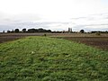
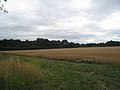
English: Barnby in the Willows is a village and civil parish in the Newark and Sherwood district of Nottinghamshire, England, just east of Newark-on-Trent. According to the 2001 census it had a population of 244. Just to the south of the village is the River Witham, which also forms the border with Lincolnshire here.
village in United Kingdom | |||||
| Upload media | |||||
| Instance of | |||||
|---|---|---|---|---|---|
| Location | Newark and Sherwood, Nottinghamshire, East Midlands, England | ||||
| Population |
| ||||
 | |||||
Subcategories
This category has only the following subcategory.
Media in category "Barnby in the Willows"
The following 200 files are in this category, out of 281 total.
(previous page) (next page)-
 A17 Sleaford Road near Flawford Farm - geograph.org.uk - 5672326.jpg 640 × 480; 66 KB
-
 A17, Sleaford Road - geograph.org.uk - 4933550.jpg 640 × 427; 393 KB
-
 Accident at Barnby in the Willows - geograph.org.uk - 3633916.jpg 1,024 × 768; 356 KB
-
 Afternoon nap - geograph.org.uk - 6488405.jpg 1,024 × 768; 318 KB
-
 Ah ^ Where's the path ^ - geograph.org.uk - 2442738.jpg 1,024 × 768; 244 KB
-
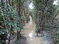
 All Saints' church above a flooded River Witham - geograph.org.uk - 6741833.jpg 1,024 × 768; 119 KB
-

-
 All Saints' church tower, Barnby in the Willows - geograph.org.uk - 6351237.jpg 768 × 1,024; 294 KB
-
 All Saints' church, Barnby in the Willows - geograph.org.uk - 6666055.jpg 1,024 × 768; 111 KB
-
 All Saints' church, Barnby in the Willows - geograph.org.uk - 6666058.jpg 1,024 × 768; 118 KB
-
 All Saints' church, Barnby in the Willows - geograph.org.uk - 6666060.jpg 768 × 1,024; 126 KB
-
 All Saints' church, Barnby in the Willows - geograph.org.uk - 6666062.jpg 768 × 1,024; 101 KB
-
 All Saints' church, Barnby in the Willows - geograph.org.uk - 6666064.jpg 768 × 1,024; 85 KB
-
 All Saints' church, Barnby in the Willows - geograph.org.uk - 6666069.jpg 768 × 1,024; 119 KB
-
 Alongside Long Lane - geograph.org.uk - 4883029.jpg 1,024 × 768; 242 KB
-
 Another new gate on the footpath to Balderton - geograph.org.uk - 3084072.jpg 1,024 × 768; 261 KB
-
 Approaching Barnby from Coddington - geograph.org.uk - 6323764.jpg 1,024 × 768; 233 KB
-
 Approaching the A17 - geograph.org.uk - 6681384.jpg 1,024 × 768; 318 KB
-
 Approaching the Church Bridge - geograph.org.uk - 4752472.jpg 1,024 × 768; 282 KB
-
-
 Autumn in Barnby - geograph.org.uk - 6323535.jpg 1,024 × 768; 301 KB
-
 Autumn sown crop - geograph.org.uk - 6698048.jpg 1,024 × 768; 190 KB
-
 Autumn sown crop - geograph.org.uk - 6698053.jpg 1,024 × 768; 143 KB
-
 Autumn sown crop - geograph.org.uk - 6712879.jpg 1,024 × 768; 143 KB
-
 Autumn sown crop and Coddington Plantation - geograph.org.uk - 6732651.jpg 1,024 × 768; 214 KB
-
 Autumn sown crop in a waterlogged field - geograph.org.uk - 6712865.jpg 1,024 × 768; 189 KB
-
 Autumn sown crop near Beckingham - geograph.org.uk - 6709323.jpg 1,024 × 768; 241 KB
-
 Barn at the Gables - geograph.org.uk - 2442708.jpg 1,024 × 768; 163 KB
-
 Barnby Dovecote - geograph.org.uk - 2442690.jpg 1,024 × 768; 233 KB
-
 Barnby Grange - geograph.org.uk - 1999377.jpg 1,024 × 768; 181 KB
-
 Barnby Hall - geograph.org.uk - 5246875.jpg 1,024 × 768; 165 KB
-
 Barnby Hall - geograph.org.uk - 6321267.jpg 1,024 × 768; 201 KB
-
 Barnby Hall seen across the River Witham - geograph.org.uk - 6033779.jpg 1,024 × 768; 226 KB
-
 Barnby House - geograph.org.uk - 2442702.jpg 1,024 × 768; 143 KB
-
 Barnby in the Willows at sunset - geograph.org.uk - 6222235.jpg 1,024 × 768; 90 KB
-

-
 Barnby in the Willows seen from Long Lane - geograph.org.uk - 6468155.jpg 1,024 × 768; 272 KB
-

-

-
 Barnby Sewage Works - geograph.org.uk - 6299436.jpg 1,024 × 768; 227 KB
-
 Barnby sewage works - geograph.org.uk - 6479085.jpg 1,024 × 768; 191 KB
-
 Barnby Village Hall - geograph.org.uk - 1999405.jpg 1,024 × 768; 137 KB
-
 Bend in Long Lane - geograph.org.uk - 3295861.jpg 2,256 × 1,504; 1.34 MB
-
 Bleak House Farm from Newark Road, Barnby - geograph.org.uk - 2009934.jpg 1,024 × 768; 111 KB
-
 Bridge over Shire Dyke - geograph.org.uk - 3084100.jpg 1,024 × 768; 192 KB
-
 Bridge over Shire Dyke - geograph.org.uk - 6434157.jpg 1,024 × 768; 173 KB
-
 Bridge over the River Witham - geograph.org.uk - 3084087.jpg 1,024 × 768; 211 KB
-
 Bridge over the River Witham - geograph.org.uk - 6321275.jpg 1,024 × 768; 274 KB
-

-
 Bridge over the Witham by the Skerries - geograph.org.uk - 6701164.jpg 1,024 × 768; 293 KB
-
 Broadsyke Lane - geograph.org.uk - 6299385.jpg 1,024 × 768; 193 KB
-
 By the A17 - geograph.org.uk - 4883009.jpg 1,024 × 768; 227 KB
-
 Bypassed stile - geograph.org.uk - 6429474.jpg 1,024 × 768; 275 KB
-
 Changed signage, no less danger - geograph.org.uk - 6681376.jpg 1,024 × 768; 359 KB
-
 Clear felled area, Stapleford Wood - geograph.org.uk - 6530730.jpg 1,024 × 768; 157 KB
-
 Corner of a wheat field near Grove Farm - geograph.org.uk - 6457187.jpg 1,024 × 768; 212 KB
-
 Corporation Plantation - geograph.org.uk - 2443967.jpg 1,024 × 768; 203 KB
-
 Cottages on Back Street, Barnby - geograph.org.uk - 1999412.jpg 1,024 × 768; 166 KB
-
 Cutting the corner - geograph.org.uk - 6457190.jpg 1,024 × 768; 221 KB
-
 Damaged ash - geograph.org.uk - 4883017.jpg 1,024 × 768; 192 KB
-
 Dovecote Farm - geograph.org.uk - 2446011.jpg 1,024 × 768; 175 KB
-
 Dovecote, Barnby in the Willows - geograph.org.uk - 2910086.jpg 640 × 500; 106 KB
-
 Eastbound A17 near to Beckingham - geograph.org.uk - 4934496.jpg 640 × 427; 354 KB
-
 Entering Barnby in the Willows - geograph.org.uk - 2910071.jpg 640 × 480; 83 KB
-
 Entering Barnby in the Willows - geograph.org.uk - 3293117.jpg 2,256 × 1,504; 892 KB
-
 Entering Nottinghamshire on the A17 - geograph.org.uk - 2910050.jpg 640 × 480; 91 KB
-
 Entrance to Barnby in the Willows - geograph.org.uk - 4081817.jpg 3,776 × 2,520; 4.06 MB
-
 Entrance to Fen Farm - geograph.org.uk - 389664.jpg 640 × 427; 91 KB
-
 Fancy a swim to Balderton^ - geograph.org.uk - 6321265.jpg 1,024 × 768; 308 KB
-

-
 Farm buildings, Barnby Hall - geograph.org.uk - 1910677.jpg 1,600 × 1,200; 562 KB
-
 Farm road on Claypole Fen - geograph.org.uk - 389648.jpg 640 × 427; 79 KB
-
 Farmland and pylons, Bleak House Farm - geograph.org.uk - 2910098.jpg 2,686 × 2,048; 841 KB
-
 Farmland at the end of Broad Fen Lane - geograph.org.uk - 389497.jpg 640 × 427; 97 KB
-
 Farmland near Manor Farm - geograph.org.uk - 2910060.jpg 640 × 480; 40 KB
-
 Farmland off Long Lane - geograph.org.uk - 2910062.jpg 640 × 480; 82 KB
-
 Farmland, Barnby in the Willows - geograph.org.uk - 2910079.jpg 640 × 480; 37 KB
-
 Fen Farm - geograph.org.uk - 2009959.jpg 1,024 × 768; 155 KB
-
 Fen Lane - geograph.org.uk - 3671933.jpg 1,024 × 768; 167 KB
-
 Fen Lane - geograph.org.uk - 6669813.jpg 1,024 × 768; 143 KB
-
 Fen Lane and pylon - geograph.org.uk - 6712844.jpg 1,024 × 768; 235 KB
-
 Field alongside the A17 - geograph.org.uk - 1978392.jpg 1,024 × 768; 178 KB
-
 Field boundary and Manor Farm - geograph.org.uk - 6299423.jpg 1,024 × 768; 191 KB
-
 Field edge off Long Lane - geograph.org.uk - 6698046.jpg 1,024 × 768; 286 KB
-
 Field near the Skerries - geograph.org.uk - 6709317.jpg 1,024 × 768; 270 KB
-
 Field of oilseed rape - geograph.org.uk - 6456528.jpg 1,024 × 768; 238 KB
-
 Field off Long Lane - geograph.org.uk - 1978411.jpg 1,024 × 768; 128 KB
-
 Flawford Farm in freezing fog - geograph.org.uk - 6725102.jpg 1,024 × 768; 120 KB
-
 Flawford lane - geograph.org.uk - 5355246.jpg 1,024 × 768; 261 KB
-
 Flooded drain at Barnby in the Willows - geograph.org.uk - 6731650.jpg 1,024 × 768; 163 KB
-

-
 Footbridge at Grove Farm - geograph.org.uk - 6323567.jpg 1,024 × 768; 474 KB
-
 Footbridge near Grove Farm - geograph.org.uk - 6732556.jpg 1,024 × 768; 433 KB
-

-
 Footbridge over a drain - geograph.org.uk - 6725140.jpg 1,024 × 768; 348 KB
-
 Footpath alongside a plantation - geograph.org.uk - 6725105.jpg 1,024 × 768; 215 KB
-
 Footpath and overflowing dyke - geograph.org.uk - 6712861.jpg 1,024 × 768; 330 KB
-
 Footpath off Long Lane - geograph.org.uk - 2910069.jpg 640 × 480; 90 KB
-
 Footpath to Balderton - geograph.org.uk - 6669854.jpg 1,024 × 768; 230 KB
-
 Footpath to Barnby alongside the River Witham - geograph.org.uk - 6299420.jpg 1,024 × 768; 177 KB
-
 Footpath to Barnby in the Willows - geograph.org.uk - 6323577.jpg 1,024 × 768; 201 KB
-
 Footpath to Barnby in the Willows - geograph.org.uk - 6457184.jpg 1,024 × 768; 222 KB
-
 Footpath to Beckingham - geograph.org.uk - 6479076.jpg 1,024 × 768; 218 KB
-
 Footpath to Beckingham - geograph.org.uk - 6479082.jpg 1,024 × 768; 197 KB
-
 Footpath to Beckingham - geograph.org.uk - 6479092.jpg 1,024 × 768; 167 KB
-
 Footpath to Beckingham - geograph.org.uk - 6709312.jpg 1,024 × 768; 199 KB
-
 Footpath to Coddington - geograph.org.uk - 6323546.jpg 1,024 × 768; 201 KB
-
 Footpath to Coddington - geograph.org.uk - 6323557.jpg 1,024 × 768; 202 KB
-
 Footpath to Coddington - geograph.org.uk - 6323560.jpg 1,024 × 768; 256 KB
-
 Footpath to Coddington - geograph.org.uk - 6323566.jpg 1,024 × 768; 246 KB
-
 Footpath to Coddington - geograph.org.uk - 6457182.jpg 1,024 × 768; 247 KB
-
 Footpath to Coddington - geograph.org.uk - 6732546.jpg 1,024 × 768; 260 KB
-
 Footpath to Stapleford Moor - geograph.org.uk - 6681383.jpg 1,024 × 768; 254 KB
-
 Footpath to Stapleford Moor - geograph.org.uk - 6725135.jpg 1,024 × 768; 219 KB
-
 Footpaths to Beckingham - geograph.org.uk - 6429460.jpg 1,024 × 768; 216 KB
-
 Fox Covert - geograph.org.uk - 6299425.jpg 1,024 × 768; 185 KB
-
 Fox Covert and Manor Farm - geograph.org.uk - 1911675.jpg 1,600 × 1,200; 561 KB
-
 Fox Covert seen from Long Lane - geograph.org.uk - 6468157.jpg 1,024 × 768; 195 KB
-
 Front Street, Barnby in the Willows - geograph.org.uk - 2446025.jpg 1,024 × 768; 169 KB
-
 Gorse bush and Slaney Lodge Farm - geograph.org.uk - 6457192.jpg 1,024 × 768; 244 KB
-
 Grange Farm - geograph.org.uk - 2009948.jpg 1,024 × 768; 182 KB
-
 Grange Farm - geograph.org.uk - 2910092.jpg 640 × 480; 44 KB
-
 Grass field and Barnby church - geograph.org.uk - 6684991.jpg 1,024 × 768; 167 KB
-

-
 Grove Farm - geograph.org.uk - 6323569.jpg 1,024 × 768; 200 KB
-
 Harvested field and Fen Farm - geograph.org.uk - 6224793.jpg 1,024 × 768; 200 KB
-
 Harvested field and Grange Farm - geograph.org.uk - 6224794.jpg 1,024 × 768; 154 KB
-
 Help is at hand - geograph.org.uk - 6428460.jpg 768 × 1,024; 233 KB
-
 Hen and Chicken Yard - geograph.org.uk - 2446058.jpg 1,024 × 768; 142 KB
-
 Hidden river - geograph.org.uk - 5564432.jpg 1,024 × 768; 201 KB
-
 Hidden river - geograph.org.uk - 6940811.jpg 1,024 × 768; 261 KB
-
 Houses behind Barnby Grange - geograph.org.uk - 6434167.jpg 1,024 × 768; 199 KB
-
 I'm watching you - geograph.org.uk - 6033805.jpg 1,024 × 768; 224 KB
-
 Irrigation pipes near Manor Farm - geograph.org.uk - 6479069.jpg 1,024 × 768; 229 KB
-
 Laundry Cottage, Barnby - geograph.org.uk - 1999386.jpg 1,024 × 768; 177 KB
-
 Lead theft - geograph.org.uk - 4226319.jpg 1,024 × 768; 292 KB
-
 Line of trees near Barnby Manor - geograph.org.uk - 6707997.jpg 1,024 × 768; 157 KB
-
 Long Lane - geograph.org.uk - 4081825.jpg 3,776 × 2,520; 4.08 MB
-
 Long Lane joining the A17 (Sleaford Road) - geograph.org.uk - 4081832.jpg 3,776 × 2,520; 4.06 MB
-
 Long Lane junction ahead from A17 - geograph.org.uk - 3519620.jpg 640 × 491; 108 KB
-

-
 Making tracks - geograph.org.uk - 6299427.jpg 1,024 × 768; 195 KB
-
 Manor Farm - geograph.org.uk - 1910682.jpg 1,600 × 1,200; 359 KB
-
 Muddy Fields near the A17 - geograph.org.uk - 3295865.jpg 2,256 × 1,504; 1.25 MB
-
 Muddy gap - geograph.org.uk - 6725138.jpg 1,024 × 768; 219 KB
-
 Muddy path - geograph.org.uk - 6701173.jpg 1,024 × 768; 281 KB
-
 New gate on the path to Balderton - geograph.org.uk - 3084063.jpg 1,024 × 768; 236 KB
-
 Newark Road - geograph.org.uk - 2009943.jpg 1,024 × 768; 283 KB
-
 Newark Road heading west - geograph.org.uk - 2910095.jpg 640 × 480; 106 KB
-
 Newark Road heading west - geograph.org.uk - 2910099.jpg 640 × 480; 122 KB
-
 Newark Road near Willow Farm - geograph.org.uk - 3293107.jpg 2,256 × 1,504; 1.23 MB
-
 Not very encouraging - geograph.org.uk - 1978404.jpg 1,024 × 768; 312 KB
-
 Oilseed rape and freezing fog - geograph.org.uk - 6725099.jpg 1,024 × 768; 210 KB
-
 Oilseed rape at Flawford - geograph.org.uk - 5355241.jpg 1,024 × 768; 213 KB
-
 Oilseed rape crop off Newark Road - geograph.org.uk - 2910093.jpg 640 × 480; 103 KB
-
 Old Course of the River Witham - geograph.org.uk - 6450447.jpg 1,024 × 768; 223 KB
-
 Old Course of the River Witham - geograph.org.uk - 6450450.jpg 1,024 × 768; 252 KB
-
 Old course of the River Witham and flooded field - geograph.org.uk - 6731625.jpg 1,024 × 743; 190 KB
-
 Out of use footbridge - geograph.org.uk - 6429955.jpg 1,024 × 768; 267 KB
-
 Posts for a new fence and stile - geograph.org.uk - 6732532.jpg 1,024 × 768; 302 KB
-
 Potato field and Kelwick Woods - geograph.org.uk - 6454181.jpg 1,024 × 768; 158 KB
-
 Prepared field and Barnby Hall - geograph.org.uk - 6299433.jpg 1,024 × 768; 148 KB
-
 Prepared field and Fox Covert - geograph.org.uk - 6429113.jpg 1,024 × 768; 157 KB
-
 Repairing the damage - geograph.org.uk - 4752469.jpg 1,024 × 768; 148 KB
-

-
 Ridge and furrow on The Plots - geograph.org.uk - 6323553.jpg 1,024 × 768; 221 KB
-
 River Witham - geograph.org.uk - 1910346.jpg 1,600 × 1,200; 435 KB
-
 River Witham in flood - geograph.org.uk - 1830781.jpg 1,600 × 1,200; 290 KB
-

-
 River Witham in flood at Barnby in the Willows - geograph.org.uk - 3084080.jpg 1,024 × 768; 213 KB
-
 Road to Flawford Farm - geograph.org.uk - 5355231.jpg 1,024 × 768; 150 KB
-
 Roadway to Grove Farm - geograph.org.uk - 6468102.jpg 1,024 × 768; 159 KB
-
 Sawdust on the roadway - geograph.org.uk - 6429540.jpg 1,024 × 768; 249 KB
-
 Sheep grazing on The Plots - geograph.org.uk - 6732661.jpg 1,024 × 815; 188 KB
-
 Shire Dyke - geograph.org.uk - 6669801.jpg 1,024 × 768; 198 KB
-
 Shire Dyke - geograph.org.uk - 6669805.jpg 1,024 × 768; 244 KB
-
 Shire Dyke - geograph.org.uk - 6669825.jpg 1,024 × 768; 171 KB
-
 Shire Dyke - geograph.org.uk - 6669827.jpg 1,024 × 768; 217 KB
-
 Shire Dyke - geograph.org.uk - 6669832.jpg 1,024 × 768; 201 KB
-
 Shire Dyke in flood - geograph.org.uk - 3084110.jpg 1,024 × 768; 169 KB
-
 Skerries Plantation - geograph.org.uk - 6940809.jpg 1,024 × 768; 279 KB
-
 Skerries Plantation and the River Witham - geograph.org.uk - 6433618.jpg 1,024 × 768; 284 KB
-
 Slaney Lodge Farm - geograph.org.uk - 3293114.jpg 2,256 × 1,504; 792 KB
-
 Sleaford Road (A17) near to Beckingham - geograph.org.uk - 4934493.jpg 640 × 480; 419 KB
-
 Sleaford Road (A17) towards Newark - geograph.org.uk - 2910055.jpg 640 × 480; 87 KB
-
 Snow and the River Witham in flood - geograph.org.uk - 6731636.jpg 1,024 × 768; 202 KB
-

-
 Stubble field and Barnby in the Willows - geograph.org.uk - 6070067.jpg 1,024 × 768; 129 KB
-
 Stubble field and footpath to Coddington - geograph.org.uk - 6323590.jpg 1,024 × 768; 304 KB
-

-
 Stubble field and Slaney Lodge Farm - geograph.org.uk - 6323580.jpg 1,024 × 741; 129 KB
-
 Stubble field near Barnby - geograph.org.uk - 6666045.jpg 1,024 × 768; 219 KB
-
 Sutton Dyke entering the River Witham - geograph.org.uk - 6726371.jpg 1,024 × 768; 116 KB
-
 Swans on the Witham - geograph.org.uk - 1837362.jpg 1,600 × 1,200; 437 KB
-
 Swans on the Witham - geograph.org.uk - 6433615.jpg 1,024 × 768; 230 KB
-
 The beginning of the footpath to Back Street - geograph.org.uk - 6468097.jpg 1,024 × 768; 341 KB
-
 The beginning of the footpath to Coddington - geograph.org.uk - 2442714.jpg 1,024 × 768; 236 KB
-
 The churchyard, Barnby in the Willows - geograph.org.uk - 5598807.jpg 1,024 × 768; 343 KB
-
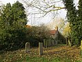 The churchyard, Barnby in the Willows - geograph.org.uk - 5598811.jpg 1,024 × 768; 287 KB
-
 The churchyard, Barnby in the Willows - geograph.org.uk - 6479060.jpg 1,024 × 768; 348 KB


_-_geograph.org.uk_-_5840043.jpg)
_-_geograph.org.uk_-_5840056.jpg)


_-_geograph.org.uk_-_4081832.jpg)


_-_geograph.org.uk_-_3084094.jpg)


_near_to_Beckingham_-_geograph.org.uk_-_4934493.jpg)
_towards_Newark_-_geograph.org.uk_-_2910055.jpg)


