Category:Barkston
Jump to navigation
Jump to search
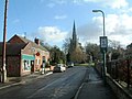
English: Barkston is a small village and civil parish lying on the A607 three miles north of Grantham in Lincolnshire, England, just south of the junction with the A153 (for Ancaster). The present route of the A607 through the village dates from the 1930s. The River Witham passes through the west of the village. It is noted for a cask ale pub called The Stag on Church Street.
Main Wikipedia article: Barkston.

village in Lincolnshire  | |||||
| Upload media | |||||
| Instance of | |||||
|---|---|---|---|---|---|
| Location | South Kesteven, Lincolnshire, East Midlands, England | ||||
 | |||||
Subcategories
This category has the following 4 subcategories, out of 4 total.
Media in category "Barkston"
The following 189 files are in this category, out of 189 total.
-
 "Combining" on Barkston Heath - geograph.org.uk - 4081944.jpg 640 × 427; 55 KB
-

-
 A607 entering Barkston - geograph.org.uk - 4217003.jpg 640 × 480; 300 KB
-
 A607, Honington Road - geograph.org.uk - 4217008.jpg 640 × 480; 246 KB
-
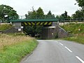
 Bailey bridge over the River Witham, Barkston - geograph.org.uk - 6129154.jpg 6,000 × 4,000; 5.78 MB
-
 Barkston - Hicksons Almshouses - geograph.org.uk - 3056440.jpg 1,600 × 1,222; 589 KB
-
 Barkston - house on south side of West Street - geograph.org.uk - 3057683.jpg 1,600 × 1,209; 663 KB
-
 Barkston - houses at east end of West Street - geograph.org.uk - 3057687.jpg 1,600 × 965; 569 KB
-
 Barkston - village hall - geograph.org.uk - 3056433.jpg 1,600 × 1,271; 475 KB
-
 Barkston and Syston cemetery - geograph.org.uk - 4801023.jpg 3,648 × 2,736; 4.55 MB
-
 Barkston East - geograph.org.uk - 423289.jpg 640 × 469; 58 KB
-
 Barkston East signal box - geograph.org.uk - 423285.jpg 640 × 475; 52 KB
-
 Barkston from the west - geograph.org.uk - 1773454.jpg 2,324 × 1,743; 1.32 MB
-
 Barkston Gorse and bridge over Honington Beck - geograph.org.uk - 3952895.jpg 1,024 × 768; 155 KB
-
 Barkston Gorse Farm - geograph.org.uk - 257103.jpg 640 × 427; 79 KB
-
 Barkston Heath - geograph.org.uk - 2158742.jpg 640 × 427; 79 KB
-
 Barkston Station site with train 1864352 0cd2fc64.jpg 640 × 306; 80 KB
-
 Barkston Village - geograph.org.uk - 123009.jpg 600 × 450; 103 KB
-
 Barkston Village Sign - geograph.org.uk - 2953454.jpg 429 × 640; 69 KB
-
 Barkston, Main Road - geograph.org.uk - 4214856.jpg 640 × 480; 239 KB
-
 Barkston, Station Road - geograph.org.uk - 4214910.jpg 640 × 480; 252 KB
-
 Beans^ - geograph.org.uk - 4644984.jpg 640 × 480; 96 KB
-
 Been some changes made on Heath Lane - geograph.org.uk - 4081943.jpg 640 × 427; 127 KB
-

-
 BP filling station and Londis store, Barkston - geograph.org.uk - 5988594.jpg 1,600 × 1,200; 839 KB
-
 Bridge ABE1-7 on Sand Lane, Barkston - geograph.org.uk - 4239008.jpg 640 × 427; 70 KB
-
 Bridge over the River Witham - geograph.org.uk - 3952810.jpg 1,024 × 768; 187 KB
-
 Bridlepath beside the River Witham, Barkston - geograph.org.uk - 6129110.jpg 6,000 × 4,000; 6.46 MB
-
 Buildings at Barkston Heath Airfield - geograph.org.uk - 5740000.jpg 800 × 533; 100 KB
-
 Cattle at Barkston Gorse Farm - geograph.org.uk - 257110.jpg 640 × 480; 99 KB
-
 Church St Barkston - geograph.org.uk - 2953489.jpg 640 × 429; 65 KB
-
 Control Tower at RAF Barkston Heath airfield - geograph.org.uk - 6260619.jpg 4,608 × 3,072; 1.92 MB
-
 Corn Chamomile (Anthemis arvensis) - geograph.org.uk - 4644999.jpg 640 × 638; 219 KB
-
 Corner of Barkston Heath RAF station - geograph.org.uk - 6188015.jpg 3,648 × 2,736; 2.69 MB
-
 Corrugated iron shed close to Honington Beck - geograph.org.uk - 6363570.jpg 1,024 × 768; 172 KB
-
 Countryside in the Witham Valley - geograph.org.uk - 255273.jpg 640 × 427; 99 KB
-
 Down Minnett's Hill - geograph.org.uk - 2624431.jpg 640 × 490; 85 KB
-
 Drift Lane - geograph.org.uk - 2158909.jpg 640 × 427; 141 KB
-
 Drift Lane - geograph.org.uk - 3952816.jpg 1,024 × 768; 145 KB
-
 Drift Lane - geograph.org.uk - 3952887.jpg 1,024 × 768; 146 KB
-
 Drift Lane - geograph.org.uk - 3952891.jpg 1,024 × 768; 170 KB
-
 Drift Lane - geograph.org.uk - 3952893.jpg 1,024 × 768; 194 KB
-
 Drift Lane - geograph.org.uk - 6253175.jpg 5,184 × 3,456; 2.56 MB
-
 Drift Lane bridge - geograph.org.uk - 3952901.jpg 1,024 × 768; 216 KB
-
 Drift Lane leading down to the River Witham - geograph.org.uk - 3969149.jpg 3,776 × 2,520; 4.26 MB
-
 Earth and sky - geograph.org.uk - 3955183.jpg 1,024 × 768; 172 KB
-
 East Coast Main Line - geograph.org.uk - 2622851.jpg 640 × 388; 56 KB
-

-
 Emergency entrance, RAF Barkston Heath - geograph.org.uk - 6313250.jpg 1,024 × 768; 153 KB
-
 End of runway 06-24, RAF Barkston Heath - geograph.org.uk - 2391708.jpg 1,024 × 681; 322 KB
-
 Ermine Street (B6403) heading north - geograph.org.uk - 3076116.jpg 640 × 480; 59 KB
-
 Farm track near Westfield Farm - geograph.org.uk - 6212676.jpg 1,024 × 768; 218 KB
-
 Farm track off Frinkley Lane - geograph.org.uk - 4644977.jpg 480 × 640; 103 KB
-
 Farm track off Frinkley Lane - geograph.org.uk - 4644988.jpg 480 × 640; 115 KB
-
 Farmland near Barkston Lodge - geograph.org.uk - 2906673.jpg 640 × 480; 54 KB
-
 Farmland near Frinkley Lane - geograph.org.uk - 4644966.jpg 480 × 640; 141 KB
-
 Farmland towards Hurn Wood - geograph.org.uk - 2922627.jpg 640 × 510; 47 KB
-
 Farmland west of Barkston - geograph.org.uk - 2922626.jpg 800 × 523; 53 KB
-
 Farmland, Barkston Heath - geograph.org.uk - 3076104.jpg 640 × 480; 87 KB
-
 Field boundary near Frinkley Farm - geograph.org.uk - 4644980.jpg 640 × 480; 113 KB
-
 Field boundary, Barkston Heath - geograph.org.uk - 6363795.jpg 1,024 × 768; 174 KB
-
 Field by Frinkley Lane - geograph.org.uk - 4644963.jpg 640 × 480; 116 KB
-
 Field by the River Witham - geograph.org.uk - 2624420.jpg 640 × 475; 91 KB
-
 Field entrance off Hough Road - geograph.org.uk - 2906684.jpg 640 × 480; 92 KB
-
 Field margin - geograph.org.uk - 4646433.jpg 480 × 640; 136 KB
-
 Field on Barkston Heath - geograph.org.uk - 208726.jpg 640 × 427; 114 KB
-
 Fields near Twelve Acre Plantation - geograph.org.uk - 2386461.jpg 1,024 × 681; 392 KB
-
 Fields north of A607 north of Barkston - geograph.org.uk - 5989379.jpg 1,600 × 805; 440 KB
-
 Ford, Stepping Stones ^ Weir on the River Witham - geograph.org.uk - 1839168.jpg 3,872 × 2,592; 2.35 MB
-
 Frinkley Lane - geograph.org.uk - 2158918.jpg 640 × 427; 82 KB
-
 Frinkley Lane - geograph.org.uk - 2159123.jpg 640 × 427; 92 KB
-
 Frinkley Lane - geograph.org.uk - 255347.jpg 640 × 427; 100 KB
-
 Frinkley Lane - geograph.org.uk - 3952819.jpg 1,024 × 768; 355 KB
-
 Frinkley Lane - geograph.org.uk - 4644969.jpg 480 × 640; 124 KB
-
 Frinkley Lane turning in to Drift Lane - geograph.org.uk - 3969143.jpg 3,776 × 2,520; 4.02 MB
-
 Grass field by the River Witham at Barkston - geograph.org.uk - 6212667.jpg 1,024 × 768; 198 KB
-
 Hambleton Hill, north of Grantham - geograph.org.uk - 2169711.jpg 1,024 × 748; 109 KB
-
 Heath Farm - geograph.org.uk - 2158761.jpg 640 × 427; 106 KB
-
 Heath Farm - geograph.org.uk - 2158790.jpg 640 × 427; 91 KB
-
 Heath Farm from Heath Lane - geograph.org.uk - 2386477.jpg 1,024 × 732; 446 KB
-
 Heath Lane (byway) - geograph.org.uk - 3076106.jpg 640 × 480; 92 KB
-
 Heath Lane - geograph.org.uk - 1982183.jpg 640 × 426; 108 KB
-
 Heath Lane - geograph.org.uk - 6188014.jpg 3,648 × 2,736; 3.3 MB
-
 Heath Lane and Minnett's Wood - geograph.org.uk - 6363578.jpg 1,024 × 768; 284 KB
-
 Heath Lane, an unclassified county road - geograph.org.uk - 3902990.jpg 4,272 × 2,848; 6.68 MB
-

-
 Hedge beside Barkston Heath RAF airfield - geograph.org.uk - 6188017.jpg 3,648 × 2,736; 3.45 MB
-
 Hickson's Almshouses - geograph.org.uk - 2158894.jpg 640 × 427; 74 KB
-
 High Dike (B6403) heading north - geograph.org.uk - 3076132.jpg 640 × 480; 66 KB
-
 Holmes Row, Barkston - geograph.org.uk - 4799809.jpg 2,376 × 3,168; 3.41 MB
-
 Holmes Row, Barkston - geograph.org.uk - 4799813.jpg 2,376 × 3,168; 3.41 MB
-
 Honington Beck bridge - geograph.org.uk - 2158906.jpg 640 × 427; 92 KB
-
 Honington Camp, aerial 2018 - geograph.org.uk - 5846359.jpg 1,024 × 683; 200 KB
-
 Honington Road (A607) - geograph.org.uk - 4217009.jpg 640 × 480; 254 KB
-
 Hough Lane Crossing - geograph.org.uk - 1286737.jpg 640 × 426; 74 KB
-
 Hough Lane Crossing - geograph.org.uk - 1286745.jpg 640 × 426; 74 KB
-
 Hough Road entering Grove Plantation - geograph.org.uk - 3952705.jpg 4,000 × 3,000; 3.66 MB
-
 Hough Road heading north - geograph.org.uk - 2906672.jpg 640 × 480; 42 KB
-
 House at Barkston - geograph.org.uk - 2624421.jpg 640 × 429; 100 KB
-
 Level crossing on Hough Road - geograph.org.uk - 2906680.jpg 640 × 480; 74 KB
-
 Level Crossing on Hough Road - geograph.org.uk - 3952693.jpg 4,000 × 3,000; 2.14 MB
-
 Looking north-east across Honington Heath - geograph.org.uk - 3890078.jpg 4,000 × 3,000; 4.52 MB
-

-
 Lush Grazing - geograph.org.uk - 476082.jpg 640 × 427; 57 KB
-
 Main Road (A607), Barkston - geograph.org.uk - 2906668.jpg 640 × 480; 56 KB
-
 Main Road, Barkston - geograph.org.uk - 4217005.jpg 640 × 480; 245 KB
-
 Main Street, Barkston - geograph.org.uk - 6245697.jpg 1,920 × 1,280; 771 KB
-
 Mill Farm - geograph.org.uk - 2158911.jpg 640 × 427; 70 KB
-
 Mind Your Head^ - geograph.org.uk - 877021.jpg 640 × 480; 138 KB
-
 More beans - geograph.org.uk - 4644986.jpg 640 × 480; 118 KB
-
 Mown field margin - geograph.org.uk - 4646420.jpg 640 × 480; 127 KB
-
 Near Westfield Farm - geograph.org.uk - 4215913.jpg 640 × 430; 42 KB
-
 Oilseed rape crop off Hough Road - geograph.org.uk - 2906670.jpg 640 × 480; 99 KB
-
 Oilseed rape on Minnett's Hill - geograph.org.uk - 6363574.jpg 1,024 × 768; 193 KB
-
 Path down - geograph.org.uk - 3955207.jpg 1,024 × 768; 189 KB
-
 Picnic table, Barkston - geograph.org.uk - 5261641.jpg 1,024 × 683; 392 KB
-
 RAF Barkston Heath - geograph.org.uk - 1982189.jpg 640 × 426; 78 KB
-
 RAF Barkston Heath - geograph.org.uk - 3076108.jpg 640 × 480; 63 KB
-
 RAF Barkston Heath - geograph.org.uk - 3076130.jpg 640 × 480; 61 KB
-

-
 Railway Bridge over Sand Lane - geograph.org.uk - 4214933.jpg 640 × 480; 315 KB
-
 Railway Bridge, Barkston South Junction - geograph.org.uk - 4214926.jpg 640 × 480; 334 KB
-
 Railway east of level crossing - geograph.org.uk - 3952697.jpg 4,000 × 3,000; 1.91 MB
-
 Redundant fence at RAF Barkston Heath - geograph.org.uk - 2391646.jpg 1,024 × 731; 364 KB
-
 River Witham in an arable landscape - geograph.org.uk - 2403970.jpg 640 × 430; 22 KB
-
 River Witham near Barkston - geograph.org.uk - 255281.jpg 640 × 427; 107 KB
-
 River Witham near Barkston - geograph.org.uk - 2906658.jpg 640 × 480; 73 KB
-
 River Witham, Barkston - geograph.org.uk - 5261645.jpg 1,024 × 683; 363 KB
-
 Sand Lane - geograph.org.uk - 2622850.jpg 640 × 462; 92 KB
-
 Sand Lane - geograph.org.uk - 4214928.jpg 640 × 480; 241 KB
-

-
 Sand Lane Railway Bridge - geograph.org.uk - 4214929.jpg 640 × 480; 277 KB
-
 Shire House - geograph.org.uk - 4214918.jpg 640 × 480; 265 KB
-
 St.Nicholas' church, Barkston, Lincs - geograph.org.uk - 6187997.jpg 2,705 × 2,944; 1.78 MB
-
 Station Road - geograph.org.uk - 4214915.jpg 640 × 480; 214 KB
-
 Station Road crosses the River Witham - geograph.org.uk - 2624422.jpg 640 × 485; 104 KB
-
 Station Road crossing the River Witham at Barkston - geograph.org.uk - 3963679.jpg 3,776 × 2,520; 3.98 MB
-
 Station Road, Barkston - geograph.org.uk - 4214911.jpg 640 × 480; 207 KB
-
 Station Road, heading west - geograph.org.uk - 2906661.jpg 640 × 480; 49 KB
-
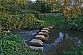
 Stepping Stones on the River Witham near Barkston - geograph.org.uk - 2136438.jpg 1,061 × 1,600; 478 KB
-
 Stepping stones over the River Witham - geograph.org.uk - 4646438.jpg 480 × 640; 154 KB
-
 T2 Hangar on Barkston Heath airfield - geograph.org.uk - 6237041.jpg 3,456 × 2,592; 3.63 MB
-

-
 The A607 entering Barkston - geograph.org.uk - 3562544.jpg 1,024 × 680; 200 KB
-
 The Bridge at Barkston - geograph.org.uk - 2953443.jpg 429 × 640; 73 KB
-
 The Junction of Drift lane and Frinkley Lane - geograph.org.uk - 3952884.jpg 1,024 × 768; 203 KB
-
 The line to Sleaford in the trees - geograph.org.uk - 2403968.jpg 640 × 430; 22 KB
-
 The River Witham - geograph.org.uk - 255275.jpg 640 × 427; 120 KB
-
 The River Witham - geograph.org.uk - 4646443.jpg 640 × 480; 149 KB
-
 The River Witham - geograph.org.uk - 4646457.jpg 640 × 480; 192 KB
-
 The river Witham looking north - geograph.org.uk - 1293736.jpg 640 × 427; 87 KB
-
 The road over the river Witham - geograph.org.uk - 1293753.jpg 640 × 427; 53 KB
-
 The Viking Way - geograph.org.uk - 2158913.jpg 640 × 427; 102 KB
-
 The Viking Way - geograph.org.uk - 2158915.jpg 640 × 427; 87 KB
-
 The Viking Way - geograph.org.uk - 255277.jpg 640 × 427; 144 KB
-
 The Viking Way - geograph.org.uk - 3955179.jpg 1,024 × 768; 170 KB
-
 The Viking Way alongside the railway - geograph.org.uk - 3954861.jpg 1,024 × 768; 249 KB
-
 The Viking Way alongside the River Witham - geograph.org.uk - 3955188.jpg 1,024 × 768; 149 KB
-

-
 The Village Green Barkston - geograph.org.uk - 2953445.jpg 640 × 429; 79 KB
-
 Through the woods - geograph.org.uk - 4646448.jpg 480 × 640; 164 KB
-
 Top of Minnett's Hill - geograph.org.uk - 6188002.jpg 3,648 × 2,736; 3.09 MB
-
 Towards Barkston from Minnett's Hill - geograph.org.uk - 2624432.jpg 640 × 443; 94 KB
-
 Track to Barkston Lodge - geograph.org.uk - 2906676.jpg 640 × 480; 74 KB
-
 Track to Heath Farm - geograph.org.uk - 2624436.jpg 640 × 491; 92 KB
-
 Track to RAF Barkston Heath control tower - geograph.org.uk - 6188018.jpg 3,589 × 2,482; 2.35 MB
-
 Trees by the railway line - geograph.org.uk - 4215919.jpg 640 × 324; 26 KB
-
 Twelve Acre Plantation - geograph.org.uk - 166802.jpg 640 × 427; 125 KB
-
 Up Minnett's Hill - geograph.org.uk - 2624433.jpg 640 × 501; 104 KB
-
 Uphill path - geograph.org.uk - 3955202.jpg 1,024 × 768; 187 KB
-
 Very old pile of rubble - geograph.org.uk - 6363792.jpg 1,024 × 768; 305 KB
-
 View to Barkston Gorse Farm - geograph.org.uk - 3955217.jpg 1,024 × 768; 143 KB
-

-
 Westbound line - geograph.org.uk - 1286753.jpg 640 × 426; 84 KB
-
 Westfield Farm - geograph.org.uk - 2364957.jpg 640 × 430; 34 KB
-
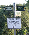 Which way now^ - geograph.org.uk - 255276.jpg 533 × 640; 122 KB
-
 Windsock, R.A.F. Barkston Heath - geograph.org.uk - 4081952.jpg 640 × 427; 33 KB
-
 Bridge No7a - geograph.org.uk - 423235.jpg 640 × 480; 80 KB
-
 Farm track near Barkston Gorse - geograph.org.uk - 257087.jpg 640 × 427; 75 KB
-
 Farmland near Barkston - geograph.org.uk - 268071.jpg 640 × 480; 108 KB
-
 Farmland near Syston and Barkston - geograph.org.uk - 268069.jpg 640 × 427; 71 KB
-
 Heath Lane near Barkston - geograph.org.uk - 255285.jpg 640 × 427; 62 KB
-
 Honington Beck - geograph.org.uk - 257078.jpg 640 × 427; 68 KB
-
 Lone toadstool, Barkston Gorse - geograph.org.uk - 257096.jpg 640 × 640; 253 KB
-
 Mute swan on the River Witham - geograph.org.uk - 257066.jpg 480 × 640; 90 KB
-
 Power to the North - geograph.org.uk - 451965.jpg 640 × 480; 57 KB
-
 River Witham - geograph.org.uk - 457319.jpg 640 × 480; 82 KB
-
 Viking way - geograph.org.uk - 375354.jpg 640 × 487; 47 KB
-
 Viking Way and Honington Beck - geograph.org.uk - 257071.jpg 640 × 427; 67 KB


_-_geograph.org.uk_-_4644999.jpg)


_heading_north_-_geograph.org.uk_-_3076116.jpg)


_-_geograph.org.uk_-_3076106.jpg)


_heading_north_-_geograph.org.uk_-_3076132.jpg)


_-_geograph.org.uk_-_4217009.jpg)


,_Barkston_-_geograph.org.uk_-_2906668.jpg)


