Category:Barham, Suffolk
Jump to navigation
Jump to search
English: Barham is a village and civil parish in the Mid Suffolk district of Suffolk, England. The village is on the River Gipping, near Great Blakenham, Coddenham and Claydon, and is on the A14 road about six miles north of Ipswich. Barham has one pub, The Sorrel Horse.
Main Wikipedia article: Barham, Suffolk.

village and civil parish in Suffolk, UK  | |||||
| Upload media | |||||
| Instance of | |||||
|---|---|---|---|---|---|
| Location | Mid Suffolk, Suffolk, East of England, England | ||||
| Population |
| ||||
 | |||||
Subcategories
This category has the following 6 subcategories, out of 6 total.
M
R
- Rede Wood (9 F)
S
- Sandy Lane Pit, Barham (1 F)
- Shrubland Park (20 F)
V
- Barham Village Sign, Suffolk (5 F)
Media in category "Barham, Suffolk"
The following 200 files are in this category, out of 300 total.
(previous page) (next page)-
 2 Phillipps Road Postbox - geograph.org.uk - 4928438.jpg 2,228 × 2,962; 3.63 MB
-
 2 Phillipps Road Postbox - geograph.org.uk - 4929261.jpg 2,181 × 2,900; 2.74 MB
-
 2 Phillipps Road Postbox ^ Telephone Box - geograph.org.uk - 4929076.jpg 3,072 × 2,304; 2.03 MB
-
 A14 Eastbound - geograph.org.uk - 4911071.jpg 3,072 × 2,304; 1.9 MB
-
 A14 from road bridge near Barham - geograph.org.uk - 551603.jpg 585 × 640; 88 KB
-
 A14 near Claydon - geograph.org.uk - 4121037.jpg 640 × 430; 55 KB
-
 A14 northbound - geograph.org.uk - 5876614.jpg 1,024 × 684; 214 KB
-
 A14 northbound - geograph.org.uk - 5876627.jpg 1,024 × 684; 237 KB
-
 A14 northbound - geograph.org.uk - 5876635.jpg 1,024 × 684; 244 KB
-
 A14 Westbound - geograph.org.uk - 4911068.jpg 3,072 × 2,304; 1.92 MB
-
 A14, Claydon - geograph.org.uk - 3853381.jpg 640 × 480; 311 KB
-
 A14, Pesthouse Lane Bridge - geograph.org.uk - 3853383.jpg 640 × 480; 259 KB
-
 Bacon Road sign - geograph.org.uk - 4929224.jpg 3,072 × 2,304; 1.95 MB
-
 Bacon Road, Barham - geograph.org.uk - 4929301.jpg 3,072 × 2,304; 2.01 MB
-
 Barham Church Lane sign - geograph.org.uk - 4580343.jpg 3,072 × 2,304; 1.93 MB
-
 Barham Church Lane, Barham - geograph.org.uk - 4580084.jpg 3,072 × 2,304; 1.72 MB
-
 Barham Church Lane, Barham - geograph.org.uk - 4580085.jpg 3,072 × 2,304; 1.88 MB
-
 Barham Church Lane, Barham - geograph.org.uk - 4580305.jpg 2,879 × 1,942; 2.19 MB
-
 Barham Church Lane, Barham - geograph.org.uk - 4580311.jpg 3,072 × 2,304; 1.78 MB
-
 Barham Church Lane, Barham - geograph.org.uk - 4580312.jpg 3,072 × 2,304; 1.81 MB
-
 Barham Church Lane, Barham - geograph.org.uk - 4580328.jpg 3,072 × 2,304; 1.85 MB
-
 Barham Common - geograph.org.uk - 4925473.jpg 3,072 × 2,304; 1.96 MB
-
 Barham Common - geograph.org.uk - 4925499.jpg 3,072 × 2,304; 2.71 MB
-
 Barham Common sign - geograph.org.uk - 4925468.jpg 2,291 × 3,046; 2.67 MB
-
 Barham Green - geograph.org.uk - 6652492.jpg 6,000 × 4,000; 6.47 MB
-
 Barham Lodge sign - geograph.org.uk - 4910607.jpg 3,072 × 2,304; 1.94 MB
-
 Barham Lodge, Shrubland Hall Estate - geograph.org.uk - 6655542.jpg 5,191 × 3,461; 3.61 MB
-
 Barham Pits sign - geograph.org.uk - 4927855.jpg 2,291 × 3,046; 2.51 MB
-
 Barham Pits sign - geograph.org.uk - 4927964.jpg 3,072 × 2,304; 1.89 MB
-
 Barham Village Name sign on Norwich Road - geograph.org.uk - 4925840.jpg 2,265 × 3,011; 3.64 MB
-
 Barham Village Name sign on Norwich Road - geograph.org.uk - 4925882.jpg 2,935 × 2,199; 2.9 MB
-
 Barham Village Notice Board - geograph.org.uk - 4925443.jpg 2,240 × 2,978; 4.71 MB
-
 Barn at Pond Farm, Barham - geograph.org.uk - 6652490.jpg 6,000 × 4,000; 6.63 MB
-
 Bell's Cross Road ^ Cross Keys Postbox - geograph.org.uk - 4921400.jpg 3,072 × 2,304; 1.93 MB
-
 Bell's Cross Road ^ Cross Keys Postbox - geograph.org.uk - 4921695.jpg 3,072 × 2,304; 1.83 MB
-
 Bell's Cross Road ^ footpath - geograph.org.uk - 4925730.jpg 3,072 × 2,237; 4.85 MB
-
 Bell's Cross Road, Barham - geograph.org.uk - 4925642.jpg 3,072 × 2,182; 1.84 MB
-
 Bell's Cross Road, Barham - geograph.org.uk - 4925735.jpg 3,033 × 2,272; 3.09 MB
-
 Bell's Cross Road, Barham - geograph.org.uk - 4925853.jpg 3,072 × 2,304; 2.37 MB
-
 Bell's Cross Road, Barham Green - geograph.org.uk - 4924723.jpg 3,072 × 2,304; 1.87 MB
-
 Bridleway near Barham Church - geograph.org.uk - 4507263.jpg 2,736 × 3,648; 2.79 MB
-
 Bridleway near Barham Church - geograph.org.uk - 4507296.jpg 3,648 × 2,736; 2.23 MB
-
 Bridleway sign off Sandy Lane - geograph.org.uk - 4926007.jpg 3,072 × 2,304; 1.91 MB
-
 Bridleway sign on the Bridleway to Sandy Lane - geograph.org.uk - 4948882.jpg 3,030 × 2,276; 3.71 MB
-
 Bridleway to Barham Church Lane - geograph.org.uk - 4910625.jpg 2,887 × 2,160; 2.27 MB
-
 Bridleway to Barham Church Lane - geograph.org.uk - 4926011.jpg 3,072 × 2,304; 2.03 MB
-
 Bridleway to Sandy Lane - geograph.org.uk - 4948885.jpg 3,072 × 2,304; 3.65 MB
-
 Bridleway ^ entrance to St.Mary ^ St.Peter's Church - geograph.org.uk - 4580076.jpg 2,304 × 3,072; 3.4 MB
-
 Bull's Road ^ footpath - geograph.org.uk - 4924725.jpg 3,072 × 2,304; 1.82 MB
-
 Bull's Road, Barham - geograph.org.uk - 4924976.jpg 3,072 × 2,304; 3.08 MB
-
 Bull's Road, Barham - geograph.org.uk - 4925479.jpg 3,072 × 2,304; 1.92 MB
-
 Bull's Road, Barham - geograph.org.uk - 4925507.jpg 3,072 × 2,304; 1.73 MB
-
 Bull's Road, Barham - geograph.org.uk - 4925656.jpg 3,007 × 2,253; 2.77 MB
-
 Bull's Road, Barham - geograph.org.uk - 4943530.jpg 3,072 × 2,304; 1.78 MB
-
 Bull's Road, Barham Green - geograph.org.uk - 4924718.jpg 3,072 × 2,304; 1.79 MB
-
 Bull's Road, Barham Green - geograph.org.uk - 4924729.jpg 3,072 × 2,304; 1.85 MB
-
 Bus Shelter on Norwich Road - geograph.org.uk - 4911302.jpg 3,072 × 2,237; 2.56 MB
-
 Church Lane sign - geograph.org.uk - 4580371.jpg 3,072 × 2,304; 1.9 MB
-
 Church Lane sign - geograph.org.uk - 4928233.jpg 3,072 × 2,304; 1.83 MB
-
 Church Lane, Barham - geograph.org.uk - 4925551.jpg 3,072 × 2,304; 1.82 MB
-
 Church Lane, Barham - geograph.org.uk - 4925555.jpg 3,072 × 2,232; 2.34 MB
-
 Church Lane, Barham - geograph.org.uk - 4925575.jpg 3,072 × 2,242; 2.96 MB
-
 Church Lane, Barham - geograph.org.uk - 4925619.jpg 3,072 × 2,304; 1.73 MB
-
 Church Lane, Barham - geograph.org.uk - 4928234.jpg 3,072 × 2,172; 2.65 MB
-
 Church Lane, Barham - geograph.org.uk - 4929333.jpg 2,842 × 1,986; 3.33 MB
-
 Church Lane, Barham - geograph.org.uk - 4949282.jpg 3,072 × 2,304; 1.86 MB
-
 Church of St. Mary, Barham - geograph.org.uk - 6652510.jpg 5,687 × 3,791; 4.4 MB
-
 Church of St. Mary, Barham - geograph.org.uk - 6652512.jpg 5,769 × 3,847; 4.07 MB
-
 Cooper's Road ^ footpath - geograph.org.uk - 4943556.jpg 3,072 × 2,304; 2.94 MB
-
 Cooper's Road ^ footpath - geograph.org.uk - 4945515.jpg 3,072 × 2,227; 3.11 MB
-
 Cooper's Road, Barham - geograph.org.uk - 4580293.jpg 1,586 × 2,206; 1.71 MB
-
 Cooper's Road, Barham - geograph.org.uk - 4580297.jpg 3,072 × 2,304; 1.82 MB
-
 Cooper's Road, Barham - geograph.org.uk - 4943511.jpg 2,935 × 2,173; 2.65 MB
-
 Cooper's Road, Barham - geograph.org.uk - 4943538.jpg 3,072 × 2,304; 1.98 MB
-
 Cooper's Road, Barham - geograph.org.uk - 4943572.jpg 3,046 × 2,206; 2.22 MB
-
 Coopers Road sign - geograph.org.uk - 4943500.jpg 3,072 × 2,304; 1.84 MB
-
 Coopers Road, Barham - geograph.org.uk - 4925623.jpg 3,072 × 2,304; 1.82 MB
-
 Cottage at Barham Green - geograph.org.uk - 5987008.jpg 4,000 × 3,000; 4.19 MB
-
 Cottage at Skeet's Green - geograph.org.uk - 5986991.jpg 4,000 × 3,000; 4.97 MB
-
 Cross Keys Postbox - geograph.org.uk - 4921406.jpg 3,072 × 2,304; 1.98 MB
-
 Cross Keys Postbox - geograph.org.uk - 4921410.jpg 3,072 × 2,304; 1.87 MB
-
 Cross Keys Postbox - geograph.org.uk - 4921413.jpg 2,228 × 2,962; 4.13 MB
-
 Cross Keys Postbox - geograph.org.uk - 4921680.jpg 2,228 × 2,962; 3.49 MB
-
 Cross Keys Postbox - geograph.org.uk - 4922192.jpg 3,072 × 2,304; 1.89 MB
-
 Cross Keys Postbox - geograph.org.uk - 4922193.jpg 2,192 × 2,914; 3.54 MB
-
 Cross Keys Postbox - geograph.org.uk - 4922194.jpg 2,304 × 3,072; 4.2 MB
-
 Eastbound A14 near Great Blakenham - geograph.org.uk - 3846057.jpg 640 × 427; 298 KB
-

-
 Entering Barham on Norwich Road - geograph.org.uk - 4925839.jpg 2,889 × 2,165; 3.26 MB
-
 Entering Barham on Norwich Road - geograph.org.uk - 4925873.jpg 3,072 × 2,304; 2.73 MB
-
 Entrance to Barham Lodge - geograph.org.uk - 4910612.jpg 3,072 × 2,304; 1.94 MB
-
 Entrance to Barham Lodge - geograph.org.uk - 4911336.jpg 3,072 × 2,304; 1.89 MB
-
 Entrance to Barham Pits - geograph.org.uk - 4927866.jpg 3,033 × 2,272; 3.54 MB
-
 Entrance to Barham Pits - geograph.org.uk - 4928010.jpg 3,072 × 2,304; 1.95 MB
-
 Entrance to Meadlands Angling Club - geograph.org.uk - 4927979.jpg 2,304 × 3,072; 4.94 MB
-
 Entrance to Meadlands Angling Club - geograph.org.uk - 4928000.jpg 2,304 × 3,072; 5.16 MB
-
 Entrance to Tarmac Barham - geograph.org.uk - 4927842.jpg 2,935 × 2,199; 3.17 MB
-
 Entry to Blakenham Lock - geograph.org.uk - 757191.jpg 640 × 427; 117 KB
-
 Farmhouse between Barham and Henley - geograph.org.uk - 933613.jpg 640 × 480; 105 KB
-
 Field barn near Hop Garden, Barham - geograph.org.uk - 6652519.jpg 6,000 × 4,000; 5.81 MB
-
 Field near Sandy Lane - geograph.org.uk - 2497592.jpg 3,648 × 2,048; 1.46 MB
-
 Fingerpost on Cooper's Road, Barham - geograph.org.uk - 4537222.jpg 1,024 × 768; 286 KB
-

-
 Footpath fingerpost at Barham, Suffolk.jpg 640 × 480; 73 KB
-
 Footpath in Shrubland Park - geograph.org.uk - 5986971.jpg 4,000 × 3,000; 4.68 MB
-
 Footpath off Bell's Cross Road - geograph.org.uk - 4925733.jpg 2,836 × 2,124; 4.6 MB
-
 Footpath off Bull's Road - geograph.org.uk - 4924739.jpg 3,072 × 2,304; 1.92 MB
-
 Footpath off Sandy Lane - geograph.org.uk - 4910616.jpg 3,072 × 2,304; 1.95 MB
-
 Footpath sign at Barham Pits - geograph.org.uk - 4928034.jpg 2,240 × 2,978; 3.94 MB
-
 Footpath sign off Norwich Road - geograph.org.uk - 4927828.jpg 2,304 × 3,072; 4.08 MB
-
 Footpath sign off Pesthouse Lane - geograph.org.uk - 4927875.jpg 2,304 × 3,072; 3.01 MB
-
 Footpath to Bull's Road - geograph.org.uk - 4911297.jpg 3,072 × 2,304; 1.8 MB
-
 Footpath to Bull's Road - geograph.org.uk - 4921118.jpg 3,072 × 2,304; 2.77 MB
-
 Footpath to Gipping Valley River - geograph.org.uk - 4911124.jpg 2,879 × 2,157; 3.8 MB
-
 Footpath to Main Road - geograph.org.uk - 4924714.jpg 3,072 × 2,304; 1.83 MB
-
 Footpath to Main Road - geograph.org.uk - 4943650.jpg 2,304 × 3,072; 4.48 MB
-
 Footpath to Rede Lane - geograph.org.uk - 4943559.jpg 3,072 × 2,304; 1.99 MB
-
 Footpath to Sandy Lane - geograph.org.uk - 4925872.jpg 3,072 × 2,304; 2 MB
-
 Footpath to Sandy Lane - geograph.org.uk - 4925874.jpg 2,216 × 2,947; 3.81 MB
-
 Footpath to Sandy Lane - geograph.org.uk - 4927814.jpg 3,072 × 2,304; 1.84 MB
-
 Footpath to Sandy Lane - geograph.org.uk - 4927823.jpg 3,072 × 2,304; 1.97 MB
-
 Footpath to Sandy Lane - geograph.org.uk - 4927837.jpg 2,304 × 3,072; 3.98 MB
-
 Footpath to Sandy Lane - geograph.org.uk - 4927850.jpg 2,304 × 3,072; 4.39 MB
-
 Green Farm Barn, Barham Green - geograph.org.uk - 6652486.jpg 6,000 × 4,000; 6.81 MB
-
 Henry VIII Farmhouse, Barham - geograph.org.uk - 6655552.jpg 6,000 × 4,000; 6.14 MB
-
 Hey ^ bale - geograph.org.uk - 242099.jpg 640 × 480; 68 KB
-
 Kirby Rise and 2 Phillipps Road Postbox - geograph.org.uk - 4928434.jpg 3,072 × 2,304; 2 MB
-
 Kirby Rise sign - geograph.org.uk - 4928266.jpg 3,072 × 2,304; 1.95 MB
-
 Kirby Rise sign - geograph.org.uk - 4928281.jpg 3,072 × 2,304; 1.77 MB
-
 Kirby Rise, Barham - geograph.org.uk - 4580309.jpg 2,693 × 2,017; 2.17 MB
-
 Kirby Rise, Barham - geograph.org.uk - 4928283.jpg 3,072 × 2,304; 1.86 MB
-
 Kirby Rise, Barham - geograph.org.uk - 4928286.jpg 3,072 × 2,304; 1.97 MB
-
 Kirby Rise, Barham - geograph.org.uk - 4929802.jpg 3,035 × 2,034; 3.77 MB
-
 Kirby Rise, Barham - geograph.org.uk - 4930052.jpg 3,072 × 2,304; 2 MB
-
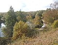 Lakes by the Gipping - geograph.org.uk - 1033058.jpg 640 × 490; 121 KB
-
 Late summer fields - geograph.org.uk - 935348.jpg 640 × 480; 109 KB
-
 Looking towards Barham Church Lane ^ Kirby Rise - geograph.org.uk - 4580324.jpg 3,072 × 2,304; 1.94 MB
-
 Looking towards Barham Hall - geograph.org.uk - 4949287.jpg 3,072 × 2,304; 2 MB
-
 Looking towards Barham Lakes - geograph.org.uk - 4911298.jpg 2,805 × 2,102; 3.74 MB
-
 Looking towards Pesthouse Lane - geograph.org.uk - 4927983.jpg 3,072 × 2,304; 1.94 MB
-
 Lower Crescent, Barham - geograph.org.uk - 4911087.jpg 3,072 × 2,304; 1.8 MB
-
 Lower Crescent, Barham - geograph.org.uk - 4927989.jpg 3,072 × 2,304; 1.78 MB
-
 Lower Crescent, Barham - geograph.org.uk - 4928003.jpg 3,072 × 2,304; 1.88 MB
-
 Lower Crescent, Barham - geograph.org.uk - 4928006.jpg 3,072 × 2,304; 1.82 MB
-
 Meadlands Angling Club Notice board - geograph.org.uk - 4927972.jpg 3,007 × 2,253; 5.04 MB
-
 Melanostoma ( probably mellinum). Female - Flickr - gailhampshire.jpg 900 × 960; 198 KB
-
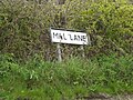 Mill Lane sign - geograph.org.uk - 4943593.jpg 3,072 × 2,304; 1.96 MB
-
 Mill Lane ^ Roadsign - geograph.org.uk - 4943590.jpg 3,072 × 2,304; 1.66 MB
-
 Mill Lane ^ The Croft The Green Postbox - geograph.org.uk - 4925459.jpg 3,072 × 2,304; 1.81 MB
-
 Mill Lane ^ The Croft The Green Postbox - geograph.org.uk - 4925515.jpg 3,072 × 1,991; 2.15 MB
-
 Mill Lane, Barham - geograph.org.uk - 4580065.jpg 3,072 × 2,304; 1.89 MB
-
 Mill Lane, Barham - geograph.org.uk - 4943467.jpg 2,970 × 2,225; 2.96 MB
-
 Mill Lane, Barham - geograph.org.uk - 4943479.jpg 2,889 × 2,165; 2.25 MB
-
 Mill Lane, Barham - geograph.org.uk - 4943599.jpg 3,072 × 2,304; 1.59 MB
-
 Mill Lane, Barham - geograph.org.uk - 4943647.jpg 3,072 × 2,304; 1.87 MB
-
 Mill Lane, Barham - geograph.org.uk - 4943651.jpg 3,072 × 2,304; 1.79 MB
-
 Mill Lane, Barhan - geograph.org.uk - 4925609.jpg 3,072 × 2,162; 2.35 MB
-
 Minor junction between Barham and Henley - geograph.org.uk - 933610.jpg 640 × 496; 116 KB
-

-
 Norwich Lane, Barham - geograph.org.uk - 4910871.jpg 3,072 × 2,304; 1.85 MB
-
 Norwich Lane, Barham - geograph.org.uk - 4911019.jpg 3,072 × 2,304; 2.29 MB
-
 Norwich Lane, Barham - geograph.org.uk - 4911309.jpg 3,072 × 2,304; 1.8 MB
-
 Norwich Road ^ footpath - geograph.org.uk - 4911293.jpg 3,072 × 2,107; 2.61 MB
-
 Norwich Road ^ footpath - geograph.org.uk - 4925869.jpg 3,072 × 2,304; 1.86 MB
-
 Norwich Road ^ footpath - geograph.org.uk - 4927808.jpg 3,072 × 2,304; 1.87 MB
-
 Norwich Road ^ footpath - geograph.org.uk - 4927811.jpg 3,072 × 2,304; 1.83 MB
-
 Norwich Road ^ footpath to Sandy Lane - geograph.org.uk - 4927821.jpg 3,072 × 2,304; 1.91 MB
-
 Norwich Road, Barham - geograph.org.uk - 4537171.jpg 1,024 × 768; 272 KB
-
 Norwich Road, Barham - geograph.org.uk - 4537186.jpg 1,024 × 768; 296 KB
-
 Norwich Road, Barham - geograph.org.uk - 4580377.jpg 3,072 × 2,304; 1.79 MB
-
 Norwich Road, Barham - geograph.org.uk - 4580378.jpg 3,072 × 2,304; 1.85 MB
-
 Norwich Road, Barham - geograph.org.uk - 4910899.jpg 3,072 × 2,304; 1.86 MB
-
 Norwich Road, Barham - geograph.org.uk - 4925836.jpg 3,072 × 2,304; 2.98 MB
-
 Norwich Road, Barham - geograph.org.uk - 4925842.jpg 3,072 × 2,304; 1.97 MB
-
 Norwich Road, Barham - geograph.org.uk - 4925998.jpg 3,072 × 2,304; 3.96 MB
-
 Norwich Road, Barham - geograph.org.uk - 4928040.jpg 3,072 × 2,304; 3.3 MB
-
 Norwich Road, Sharpstone Street, Great Blakenham - geograph.org.uk - 4925860.jpg 3,072 × 2,304; 1.83 MB
-
 Notice on Footpath Gate - geograph.org.uk - 4927817.jpg 2,304 × 3,072; 2.43 MB
-
 Old Rectory Close sign - geograph.org.uk - 4925547.jpg 3,072 × 2,304; 1.91 MB
-
 Old Rectory Close, Barham - geograph.org.uk - 4925533.jpg 2,922 × 2,307; 3.02 MB
-
 Old Rectory Close, Barham - geograph.org.uk - 4925539.jpg 3,072 × 2,304; 1.8 MB
-
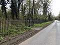
 Ordnance Survey Cut Mark - geograph.org.uk - 4454799.jpg 4,000 × 3,000; 4.21 MB
-

-
 Path to Church Lane - geograph.org.uk - 4949299.jpg 3,072 × 2,304; 1.92 MB
-
 Pesthouse Lane Bridge - geograph.org.uk - 4911048.jpg 3,072 × 2,304; 1.83 MB
-
 Pesthouse Lane Bridge - geograph.org.uk - 4911135.jpg 3,072 × 2,304; 2.3 MB
-
 Pesthouse Lane Bridge - geograph.org.uk - 4928008.jpg 3,072 × 2,304; 2.02 MB
-
 Pesthouse Lane Bridge, A14 - geograph.org.uk - 4250472.jpg 640 × 413; 35 KB
-
 Pesthouse Lane Bridge, A14 - geograph.org.uk - 4790886.jpg 640 × 409; 43 KB
-
 Pesthouse Lane sign - geograph.org.uk - 4911242.jpg 3,072 × 2,304; 1.93 MB
-
 Pesthouse Lane, Barham - geograph.org.uk - 4911023.jpg 3,072 × 2,304; 2.49 MB
-
 Pesthouse Lane, Barham - geograph.org.uk - 4911035.jpg 3,072 × 2,207; 2.2 MB
-
 Pesthouse Lane, Barham - geograph.org.uk - 4911054.jpg 3,072 × 2,304; 1.79 MB
-
 Pesthouse Lane, Barham - geograph.org.uk - 4911077.jpg 3,072 × 2,304; 1.91 MB
-
 Pesthouse Lane, Barham - geograph.org.uk - 4911093.jpg 3,072 × 2,304; 1.93 MB
-
 Pesthouse Lane, Barham - geograph.org.uk - 4911095.jpg 3,072 × 2,304; 1.88 MB
-
 Pesthouse Lane, Barham - geograph.org.uk - 4911110.jpg 3,072 × 2,212; 2.36 MB
-
 Pesthouse Lane, Barham - geograph.org.uk - 4911119.jpg 3,072 × 2,304; 1.79 MB
-
 Pesthouse Lane, Barham - geograph.org.uk - 4911228.jpg 2,857 × 2,140; 2.4 MB
-
 Pesthouse Lane, Barham - geograph.org.uk - 4911300.jpg 3,072 × 2,304; 1.81 MB


._Female_-_Flickr_-_gailhampshire.jpg)


