Category:Banbury and Cheltenham Direct Railway
Jump to navigation
Jump to search
English: The Banbury and Cheltenham Direct Railway is a former railway in the Cotswold Hills in Gloucestershire and Oxfordshire, England.

transport company | |||||
| Upload media | |||||
| Instance of | |||||
|---|---|---|---|---|---|
| Location | Oxfordshire, South East England, England | ||||
| Operator | |||||
| |||||
Subcategories
This category has the following 9 subcategories, out of 9 total.
A
- Adderbury railway station (2 F)
B
C
- Chipping Norton railway station (11 F)
K
- Kingham railway station (20 F)
S
- Sandywell Park Tunnel (1 F)
Media in category "Banbury and Cheltenham Direct Railway"
The following 35 files are in this category, out of 35 total.
-
 Aston Farm - geograph.org.uk - 1854857.jpg 4,000 × 3,000; 2.65 MB
-

-
 Bridge over disused railway line - geograph.org.uk - 407558.jpg 640 × 480; 133 KB
-

-
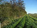
 Course of former railway line - geograph.org.uk - 322555.jpg 640 × 480; 78 KB
-
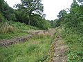
 Course of railway line - geograph.org.uk - 322514.jpg 480 × 640; 153 KB
-

-
-
 Disused railway line - geograph.org.uk - 408003.jpg 640 × 480; 177 KB
-
 East End Railway - geograph.org.uk - 202184.jpg 640 × 480; 136 KB
-

-

-
 Footpath to Bloxham - geograph.org.uk - 238487.jpg 640 × 480; 70 KB
-
 Footpath to the common - geograph.org.uk - 1737945.jpg 4,000 × 3,000; 4.29 MB
-
 Former Banbury to Cheltenham railway line - geograph.org.uk - 407560.jpg 640 × 427; 105 KB
-

-

-
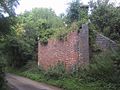
 Former Bridge - geograph.org.uk - 202180.jpg 640 × 480; 128 KB
-
 Former railway bridge at Kingham - geograph.org.uk - 215527.jpg 639 × 435; 80 KB
-
 Former railway line - geograph.org.uk - 322511.jpg 640 × 427; 114 KB
-

-

-

-
 Hook Norton Cutting - geograph.org.uk - 215453.jpg 640 × 480; 87 KB
-

-

-

-

-

-
 Road Bridge over Disused Railway - geograph.org.uk - 1515607.jpg 640 × 480; 131 KB
-

-

-

-

-