Category:Bamber Bridge
Jump to navigation
Jump to search
English: Bamber Bridge is a village to the south of Preston, Lancashire, England. The name derives from the Old English 'bēam' and 'brycg', which probably means "tree-trunk bridge". It is mentioned in an undated medieval document. The village is often referred to as "The Brig" by residents. People born in the village, are known as "Briggers".
Settlement in England  | |||||
| Upload media | |||||
| Instance of | |||||
|---|---|---|---|---|---|
| Location | South Ribble, Lancashire, North West England, England | ||||
 | |||||
Subcategories
This category has the following 3 subcategories, out of 3 total.
Media in category "Bamber Bridge"
The following 59 files are in this category, out of 59 total.
-
 66068 & 66110 1Z95.jpg 6,016 × 4,016; 20.82 MB
-
 A derelict Mill at Bamber Bridge (geograph 3332529).jpg 4,317 × 2,873; 7.04 MB
-
 B27845.jpg 3,024 × 4,032; 1.71 MB
-
 B27846.jpg 2,950 × 3,930; 4.13 MB
-
 B52575.jpg 3,024 × 4,032; 2.37 MB
-
 B52576.jpg 3,024 × 4,032; 3.78 MB
-
 B52578.jpg 3,024 × 4,032; 5.55 MB
-
 B52755.jpg 3,024 × 4,032; 4.41 MB
-
 B53219.jpg 3,024 × 4,032; 4.41 MB
-
 B53221.jpg 3,024 × 4,032; 4.27 MB
-
 B53222.jpg 3,024 × 4,032; 4.93 MB
-
 Bamber Bridge fire station - geograph.org.uk - 1393606.jpg 640 × 427; 194 KB
-
 Bamber Bridge in 1845.jpg 2,663 × 3,568; 5.07 MB
-
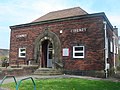 Bamber Bridge Library - geograph.org.uk - 166306.jpg 640 × 480; 106 KB
-
 Bamber Bridge Mill - geograph.org.uk - 963132.jpg 640 × 427; 67 KB
-
 Bamber Bridge old fire station - geograph.org.uk - 1393608.jpg 640 × 427; 184 KB
-
 St Aidans, Station Road, BB.JPG 1,996 × 1,503; 811 KB
-
 Bankhead Farm Bamber Bridge (geograph 2832055).jpg 2,764 × 2,074; 4.15 MB
-
 Catholic Club, Aspden Street, BB.JPG 2,237 × 1,001; 672 KB
-
 Dragonfly breeding pond - geograph.org.uk - 260596.jpg 640 × 480; 140 KB
-
 Former St Saviour's Church of England School, Bamber Bridge.jpg 4,608 × 3,456; 5.14 MB
-
 Former station building on the Up platform at Bamber Bridge railway station.jpg 1,024 × 768; 444 KB
-
 Funeral Procession (5969830903).jpg 4,166 × 2,517; 4.53 MB
-
 Higher Seed Lee Farm, Bamber Bridge.jpg 4,032 × 3,024; 4.09 MB
-
 Hobb Inn, Bamber Bridge.jpg 600 × 370; 34 KB
-
 Hospital Inn, Brindle Road, BB.jpg 600 × 362; 25 KB
-

-
 Lancs and Yorks, Bamber Bridge - geograph.org.uk - 202650.jpg 640 × 408; 61 KB
-
 Lancs ^ Yorks, Bamber Bridge - geograph.org.uk - 2820751.jpg 640 × 480; 397 KB
-
 M6 junction 29 at night - geograph.org.uk - 381060.jpg 640 × 427; 102 KB
-
 M6 Motorway, southbound - geograph.org.uk - 260504.jpg 640 × 480; 88 KB
-
 Methodist Church, Station Road, BB.JPG 2,258 × 1,045; 823 KB
-
 Motorway Bridge - geograph.org.uk - 260742.jpg 640 × 480; 71 KB
-
 Remains of Bamber Bridge Spinning & Weaving Company Mill, Wesley Street, BB.jpg 566 × 1,015; 184 KB
-
 Remains Of The Tower of Orr's Mill, School Lane, BB.JPG 1,085 × 1,550; 559 KB
-
 RV5811.jpg 3,024 × 4,032; 3.47 MB
-
 Spinners Cottages, Spinners Square, BB.JPG 1,207 × 1,535; 584 KB
-
 The Black Bull, Station Road, BB.JPG 1,383 × 1,071; 517 KB
-
 The Lancs ^ Yorks on Station Road, Bamber Bridge - geograph.org.uk - 4492235.jpg 2,000 × 1,500; 262 KB
-
 The Lancs ^ Yorks on Station Road, Bamber Bridge - geograph.org.uk - 4492242.jpg 1,500 × 2,000; 235 KB
-
 Trades Hall, Station Road, BB.JPG 1,484 × 1,001; 502 KB
-
 Weavers Cottages, Church Road, BB.JPG 1,084 × 865; 376 KB
-
 Withy Trees Mill Cottages, Withy Trees Road, BB.JPG 2,204 × 1,495; 990 KB
-
 Ye Olde Hob Inn - geograph.org.uk - 1536353.jpg 640 × 475; 104 KB
-
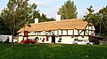 Ye Olde Hob Inn, Bamber Bridge - geograph.org.uk - 74042 (cropped).jpg 640 × 360; 115 KB
-
 Ye Olde Hob Inn, Bamber Bridge - geograph.org.uk - 74042.jpg 640 × 480; 160 KB
-
 Ye Olde Original Withy Trees, Station Road, BB.JPG 1,234 × 743; 442 KB
-
 Bamber Bridge ex Fire Station - geograph.org.uk - 166312.jpg 640 × 480; 87 KB
-
 Bamber Bridge Fire Station - geograph.org.uk - 50286.jpg 640 × 480; 129 KB
-
 BandQ Warehouse - geograph.org.uk - 415512.jpg 640 × 480; 102 KB
-
 Lane junction - geograph.org.uk - 273861.jpg 640 × 480; 151 KB
-
 M61-M6 Junction 1971 - geograph.org.uk - 704121.jpg 550 × 464; 51 KB
-
 Motorway - geograph.org.uk - 260605.jpg 640 × 480; 64 KB
-
 New houses, Leigh House Farm - geograph.org.uk - 12690.jpg 640 × 480; 93 KB
-
 Old A582 - geograph.org.uk - 415501.jpg 640 × 480; 94 KB
-
 Path - geograph.org.uk - 279629.jpg 640 × 480; 135 KB
-
 South Rings - geograph.org.uk - 415515.jpg 640 × 480; 103 KB
-
 Superstore - geograph.org.uk - 273853.jpg 640 × 480; 107 KB
-
 Woodland Path - geograph.org.uk - 279639.jpg 640 × 480; 124 KB

.jpg)


.jpg)


.jpg)


.jpg)


