Category:Ballymave
Jump to navigation
Jump to search
English: Ballymave is a townland of 441 acres in the Electoral Division of Knocknadona, in Civil Parish of Magheragall, in the Barony of Massereene Upper, in the County of Antrim
Media in category "Ballymave"
The following 7 files are in this category, out of 7 total.
-
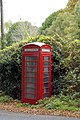 A Telephone Box - geograph.org.uk - 590183.jpg 426 × 640; 149 KB
-
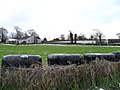
 Ballymave Townland - geograph.org.uk - 1633568.jpg 640 × 480; 124 KB
-
 Ballymave Townland - geograph.org.uk - 1633580.jpg 640 × 480; 100 KB
-
 Ballymave Townland - geograph.org.uk - 1633586.jpg 640 × 480; 110 KB
-
 Ballymave Townland - geograph.org.uk - 1633613.jpg 640 × 480; 120 KB
-
 Craneystown Road, Magheragall - geograph.org.uk - 1633571.jpg 640 × 480; 126 KB
-
 Snow on the Craneystown Road, Ballymave - geograph.org.uk - 1633615.jpg 640 × 480; 122 KB


