Category:Ballylumford power station
Jump to navigation
Jump to search
Gas-fired power station in Northern Ireland  | |||||
| Upload media | |||||
| Instance of | |||||
|---|---|---|---|---|---|
| Location | Islandmagee, County Antrim, Northern Ireland | ||||
| Service entry |
| ||||
| Nominal power capacity |
| ||||
 | |||||
Media in category "Ballylumford power station"
The following 14 files are in this category, out of 14 total.
-
 1500 ft High! above Larne Town - geograph.org.uk - 55258.jpg 640 × 426; 157 KB
-
 Ballylum 1.jpg 1,600 × 1,200; 262 KB
-

-
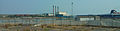
 Ballylumford power station - geograph.org.uk - 1255836.jpg 503 × 640; 54 KB
-
 Ballylumford Power Station - geograph.org.uk - 359695.jpg 640 × 426; 88 KB
-
 Ballylumford power stations, Islandmagee - geograph.org.uk - 255665.jpg 640 × 426; 123 KB
-
 Ballylumford.jpg 640 × 310; 141 KB
-
 Ballylumfordpower-glynn.jpg 3,550 × 1,580; 950 KB
-
 Ballylumfordpowerstation.jpg 3,552 × 927; 807 KB
-
 Ballymumford Power Station - geograph.org.uk - 2545203.jpg 640 × 343; 24 KB
-
 Ferris's Point - geograph.org.uk - 1255854.jpg 640 × 239; 22 KB
-
 Islandmagee - geograph-2242988-by-Albert-Bridge.jpg 640 × 405; 76 KB
-
 Larne Harbour.jpg 640 × 311; 70 KB
-
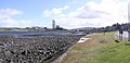
 Larne Lough - geograph.org.uk - 149006.jpg 640 × 479; 137 KB


_-_geograph.org.uk_-_1724278.jpg)


