Category:Ballybough
Jump to navigation
Jump to search
English: Ballybough is a district of north Dublin, Ireland situated northeast of Summerhill, between the Royal Canal and the River Tolka. Adjacent areas are North Strand, Fairview and Drumcondra/Clonliffe. The name derives from the Irish baile "town" and bocht "poor". The area was synomymous with being a leper colony in the 18th Century when it was then known as Mud Island, an extension of the mud flats that now form Fairview and environs.
Gaeilge: Is bruachbhaile i dtuaisceart Bhaile Átha Cliath é An Baile Bocht. Téann abhainn an Tulcha tríd an gceantar.
Polski: Ballybough ( irl. Baile Bocht) to jedna z dzielnic Dublina. Położona na północy Dublina. Administracyjnie należy do Dublin City Council.
Northern inner city district of Dublin, Ireland  | |||||
| Upload media | |||||
| Instance of | |||||
|---|---|---|---|---|---|
| Location | Dublin, Ireland | ||||
 | |||||
Subcategories
This category has the following 3 subcategories, out of 3 total.
B
- Ballybough Cemetery (9 F)
- Ballybough Road Bridge (3 F)
D
Media in category "Ballybough"
The following 10 files are in this category, out of 10 total.
-
 Ballybough .jpg 4,128 × 3,096; 2.68 MB
-

-
 Derelict house on Sackville Avenue, Ballybough 01.jpg 3,024 × 4,032; 4.21 MB
-
 Derelict house on Sackville Avenue, Ballybough 02.jpg 4,032 × 3,024; 7.84 MB
-
 Fairview Hall, Fairview - geograph.org.uk - 2219091.jpg 1,024 × 628; 93 KB
-
 Houses and shops on Fairview Road - geograph.org.uk - 2216757.jpg 1,024 × 588; 241 KB
-
 Royal-Canal-Stadion.jpg 2,560 × 1,920; 1.49 MB
-
 Sackville Gardens and Ballybough, Dublin 1.jpg 3,024 × 4,032; 4.38 MB
-

-
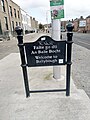 Welcome to Ballybough sign.jpg 3,024 × 4,032; 3.67 MB


-150293.jpg)
