Category:Ballyarnot
Jump to navigation
Jump to search
human settlement in Northern Ireland | |||||
| Upload media | |||||
| Instance of | |||||
|---|---|---|---|---|---|
| Location | County Antrim, Northern Ireland | ||||
 | |||||
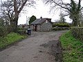
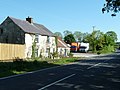
English: Ballyarnot is a townland of 322 acres in the Electoral Division of Antrim Rural, in the Civil Parish of Grange of Muckamore, in the Barony of Massereene Lower, in County Antrim.
Media in category "Ballyarnot"
The following 8 files are in this category, out of 8 total.
-
 Ballyarnot Townland - geograph.org.uk - 759118.jpg 640 × 479; 47 KB
-
 Ballyarnot Townland - geograph.org.uk - 759121.jpg 640 × 479; 64 KB
-
 Ballyarnot Townland - geograph.org.uk - 759123.jpg 640 × 479; 65 KB
-
 Ballyarnot Townland - geograph.org.uk - 759125.jpg 640 × 479; 80 KB
-
 Ballyarnot Townland - geograph.org.uk - 759129.jpg 640 × 479; 54 KB
-
 Dublin Road, Antrim - geograph.org.uk - 3510973.jpg 3,300 × 2,475; 4.7 MB
-
 Road at Ballyarnot - geograph.org.uk - 759128.jpg 640 × 479; 55 KB
-
 Trees, Ballyarnot Road - geograph.org.uk - 3508493.jpg 2,475 × 3,300; 6.4 MB


