Category:Balligan
Jump to navigation
Jump to search
English: Balliggan is a townland of 318 acres in the Electoral Division of Kircubben, in Civil Parish of Inishargy, in the Barony of Upper Ards, in the County of Down
Media in category "Balligan"
The following 8 files are in this category, out of 8 total.
-
 Balliggan Townland - geograph.org.uk - 1509830.jpg 640 × 480; 88 KB
-
 Inishargy Road near Balligan - geograph.org.uk - 806675.jpg 640 × 503; 272 KB
-
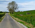
 Inishargy Road, Balliggan - geograph.org.uk - 1509814.jpg 640 × 480; 124 KB
-
 Killyvolgan Road near Balligan - geograph.org.uk - 806688.jpg 640 × 512; 278 KB
-
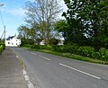 Kircubbin Road, Balligan - geograph.org.uk - 806686.jpg 640 × 522; 310 KB
-
 Kircubbin Road, Balliggan - geograph.org.uk - 1509820.jpg 640 × 480; 104 KB
-
 St Andrew's church near Ballywalter - geograph.org.uk - 530893.jpg 640 × 426; 96 KB
-
 St Andrews Church, Balligan - geograph.org.uk - 806681.jpg 525 × 640; 319 KB


