Category:Baldersby, North Yorkshire
Jump to navigation
Jump to search
village in the United Kingdom  | |||||
| Upload media | |||||
| Instance of | |||||
|---|---|---|---|---|---|
| Location | Harrogate, North Yorkshire, Yorkshire and the Humber, England | ||||
| Population |
| ||||
| Said to be the same as | Baldersby (Wikimedia duplicated page, civil parish) | ||||
 | |||||
English: Baldersby is a village and civil parish in the Harrogate district of North Yorkshire, England, about north east of Ripon on the A61. According to the 2001 census it had a population of 253.
Subcategories
This category has the following 2 subcategories, out of 2 total.
B
Media in category "Baldersby, North Yorkshire"
The following 125 files are in this category, out of 125 total.
-
 A field next to Hollins Lane - geograph.org.uk - 312261.jpg 640 × 480; 111 KB
-
 A ripening crop - geograph.org.uk - 2000642.jpg 3,296 × 2,472; 1.9 MB
-
 A1 near Baldersby - geograph.org.uk - 356968.jpg 640 × 480; 79 KB
-
 A1 Railway Bridge - geograph.org.uk - 1807847.jpg 640 × 356; 54 KB
-
 A1(M) north of Baldersby Interchange - geograph.org.uk - 6401679.jpg 800 × 533; 176 KB
-
 A1(M) northbound - geograph.org.uk - 6670612.jpg 640 × 406; 29 KB
-
 A1(M) northbound - geograph.org.uk - 6670616.jpg 640 × 408; 31 KB
-
 A1(M) northbound near Baldersby - geograph.org.uk - 5824539.jpg 1,024 × 742; 79 KB
-
 A1(M), North Yorkshire - geograph.org.uk - 6401798.jpg 800 × 533; 160 KB
-
 A61 - Hergill Lane junction - geograph.org.uk - 2293281.jpg 3,193 × 1,632; 865 KB
-
 A61 approaching Junction 50, A1(M) - geograph.org.uk - 6603544.jpg 640 × 429; 51 KB
-
 A61 at Baldersby - geograph.org.uk - 3145906.jpg 3,264 × 2,448; 2.44 MB
-
 A61 at Ward's Corner - geograph.org.uk - 4730822.jpg 640 × 480; 21 KB
-

-
 A61, Ward's Corner - geograph.org.uk - 6603537.jpg 1,024 × 768; 134 KB
-
 A61-A1 - geograph.org.uk - 269422.jpg 640 × 426; 78 KB
-
 Access Lane to Howefield - geograph.org.uk - 4248599.jpg 5,184 × 3,456; 7.43 MB
-
 Across the Swale to Maiden Lands - geograph.org.uk - 5872139.jpg 4,320 × 2,887; 2.96 MB
-
 Approaching Baldersby St. James - geograph.org.uk - 4248735.jpg 5,184 × 3,456; 5.39 MB
-
 B6267 towards Ainderby Quernhow - geograph.org.uk - 5629607.jpg 640 × 463; 71 KB
-
 Baldersby (1) - geograph.org.uk - 4717602.jpg 1,600 × 1,067; 645 KB
-
 Baldersby (2) - geograph.org.uk - 4717609.jpg 1,600 × 1,067; 627 KB
-
 Baldersby , A1(M) - geograph.org.uk - 6635146.jpg 6,000 × 4,000; 7.2 MB
-
 Baldersby , A1(M) - geograph.org.uk - 6639475.jpg 6,000 × 4,000; 6.43 MB
-
 Baldersby , A1(M) - geograph.org.uk - 6639477.jpg 6,000 × 4,000; 6.84 MB
-
 Baldersby , A1(M) - geograph.org.uk - 6639479.jpg 6,000 × 4,000; 6.47 MB
-
 Baldersby , A1(M) - geograph.org.uk - 6639480.jpg 6,000 × 4,000; 6.97 MB
-
 Baldersby Cricket Pavilion - geograph.org.uk - 1807813.jpg 640 × 436; 97 KB
-
 Baldersby Farm Shop - geograph.org.uk - 356959.jpg 640 × 480; 67 KB
-
 Baldersby Garth, Baldersby - geograph.org.uk - 6603534.jpg 1,024 × 768; 149 KB
-
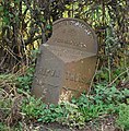 Baldersby Milestone - geograph.org.uk - 1058624.jpg 627 × 640; 180 KB
-
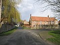
 Baldersby Village - geograph.org.uk - 851014.jpg 640 × 480; 99 KB
-
 'Retired' Road near Baldersby. - geograph.org.uk - 356972.jpg 640 × 480; 91 KB
-
 Baldersby.jpg 640 × 480; 196 KB
-
 Baling in a harvested field - geograph.org.uk - 3635597.jpg 3,872 × 2,592; 3.85 MB
-
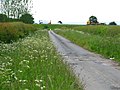
 Bridleway to Baldersby - geograph.org.uk - 3635527.jpg 640 × 428; 67 KB
-
 Brookside, Baldersby - geograph.org.uk - 3635489.jpg 3,872 × 2,592; 4.14 MB
-

-
 Bus shelter at Ward's Corner - geograph.org.uk - 3636781.jpg 3,872 × 2,592; 2.52 MB
-
 Cottage, Baldersby - geograph.org.uk - 6603532.jpg 1,024 × 697; 187 KB
-
 Country junction - geograph.org.uk - 318665.jpg 640 × 480; 171 KB
-
 Estate cottages, Baldersby - geograph.org.uk - 356962.jpg 640 × 480; 75 KB
-
 Farm access road with public footpath - geograph.org.uk - 5693973.jpg 1,390 × 1,600; 737 KB
-
 Farm buildings at Skipton Grange - geograph.org.uk - 402029.jpg 640 × 480; 68 KB
-
 Farm buildings north of Baldersby St James - geograph.org.uk - 3531703.jpg 1,600 × 1,200; 421 KB
-
 Farm track north of Baldersby - geograph.org.uk - 3635499.jpg 640 × 428; 69 KB
-
 Farm track off Wide Howe Lane - geograph.org.uk - 3636828.jpg 3,872 × 2,592; 3.07 MB
-
 Field and trees - geograph.org.uk - 371668.jpg 640 × 480; 172 KB
-

-
 Fields and woods - geograph.org.uk - 318672.jpg 640 × 480; 224 KB
-
 Footpath at Baldersby St James - geograph.org.uk - 3145892.jpg 2,448 × 3,264; 1.86 MB
-
 Footpath at Farmery Brooms - geograph.org.uk - 3531710.jpg 1,600 × 1,200; 534 KB
-
 Footpath leading from Baldersby St. James - geograph.org.uk - 4248745.jpg 5,179 × 3,451; 5.97 MB
-
 Footpath slightly wet - geograph.org.uk - 2259582.jpg 2,731 × 1,632; 710 KB
-
 Footpath south of Marlpit Lane - geograph.org.uk - 3531700.jpg 1,600 × 1,200; 703 KB
-
 Footpath, Farmery Brooms - geograph.org.uk - 4248739.jpg 5,179 × 3,451; 5.44 MB
-
 Grazing by the Swale - geograph.org.uk - 2552249.jpg 1,024 × 768; 228 KB
-
 Grazing, Bridge End Farm - geograph.org.uk - 5630060.jpg 640 × 420; 71 KB
-
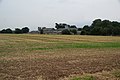
 Harvested field below Howefield Farm - geograph.org.uk - 3636804.jpg 3,872 × 2,592; 3.8 MB
-
 Harvested field by the A1(M) - geograph.org.uk - 3636735.jpg 3,872 × 2,592; 3.54 MB
-
 Harvested field near Northend farm - geograph.org.uk - 3635542.jpg 640 × 428; 91 KB
-
 Harvested field near Northend Farm - geograph.org.uk - 3635552.jpg 640 × 428; 82 KB
-
 Harvested field near Ward's Corner - geograph.org.uk - 3636794.jpg 3,872 × 2,592; 4.37 MB
-
 Harvested field north of Baldersby - geograph.org.uk - 3635504.jpg 640 × 428; 67 KB
-

-
 Hergill Lane - geograph.org.uk - 1353955.jpg 640 × 480; 96 KB
-
 Houses in Baldersby - geograph.org.uk - 6603533.jpg 1,024 × 695; 144 KB
-
 Howefield Farm - geograph.org.uk - 3636763.jpg 3,872 × 2,592; 4.9 MB
-
 Humphrey Balk Lane - geograph.org.uk - 6603535.jpg 1,024 × 768; 166 KB
-

-
 Keep off my land - geograph.org.uk - 3531694.jpg 1,600 × 1,200; 580 KB
-
 Lane to Howefield House - geograph.org.uk - 5814209.jpg 1,600 × 1,200; 610 KB
-
 Lay-by on the A61 towards Ripon - geograph.org.uk - 6603539.jpg 640 × 416; 42 KB
-
 Line of old railway at Baldersby - geograph.org.uk - 2293275.jpg 2,176 × 1,632; 650 KB
-
 Line of Ragwort - geograph.org.uk - 2552253.jpg 1,024 × 768; 327 KB
-
 Little used bridleway at The Maske - geograph.org.uk - 3531682.jpg 1,600 × 1,200; 555 KB
-
 Marlpit Lane, Baldersby - geograph.org.uk - 1807819.jpg 3,464 × 2,360; 4.18 MB
-
 Marlpit Lane, Baldersby - geograph.org.uk - 1807824.jpg 3,648 × 2,736; 3.72 MB
-
 Marlpit Lane, Baldersby - geograph.org.uk - 2044609.jpg 3,610 × 2,344; 5.05 MB
-
 Melmerby to Thirsk Branch Line - geograph.org.uk - 1807830.jpg 3,648 × 2,736; 4.19 MB
-
 Melmerby to Thirsk Branch Line - geograph.org.uk - 1807837.jpg 3,292 × 2,056; 4.81 MB
-
 Melmerby to Thirsk Branch Line - geograph.org.uk - 1807856.jpg 3,648 × 2,736; 7.16 MB
-
 North Whin - geograph.org.uk - 6252780.jpg 800 × 450; 96 KB
-
 Northend Farm - geograph.org.uk - 3635563.jpg 640 × 428; 60 KB
-
 Old Willow - geograph.org.uk - 850989.jpg 640 × 480; 99 KB
-
 Open Air Polytunnels - geograph.org.uk - 1353950.jpg 640 × 378; 88 KB
-
 Part of the old route of the A61 - geograph.org.uk - 3636747.jpg 3,872 × 2,592; 3.22 MB
-
 Pea crop ready for harvest - geograph.org.uk - 3635607.jpg 3,872 × 2,592; 3.67 MB
-
 Potato fields near Baldersby St James - geograph.org.uk - 3636866.jpg 3,872 × 2,592; 4.48 MB
-
 River Swale from Skipton Bridge - geograph.org.uk - 4717760.jpg 1,600 × 1,067; 719 KB
-
 River Swale, Skipton-on-Swale - geograph.org.uk - 5629603.jpg 640 × 480; 65 KB
-
 Skipton bridge after repairs (2) - geograph.org.uk - 2259557.jpg 2,443 × 2,735; 1.2 MB
-
 Skipton bridge after repairs - geograph.org.uk - 2259565.jpg 3,236 × 1,977; 1.28 MB
-
 Skipton On Swale Bridge Closed - geograph.org.uk - 2216537.jpg 1,024 × 561; 121 KB
-
 Stopped for roadworks on the A61 - geograph.org.uk - 3628403.jpg 3,872 × 2,592; 3.03 MB
-
 The A61 on Skipton Bridge - geograph.org.uk - 3635419.jpg 640 × 428; 64 KB
-
 The A61 through Baldersby - geograph.org.uk - 3635428.jpg 640 × 428; 62 KB
-
 The lights on Skipton Bridge - geograph.org.uk - 2552241.jpg 640 × 480; 116 KB
-
 The River North of Skipton-on-Swale - geograph.org.uk - 4908191.jpg 1,600 × 1,067; 368 KB
-
 The River Swale from Skipton Bridge - geograph.org.uk - 3635411.jpg 3,872 × 2,592; 3.93 MB
-
 The Smithy farm shop, Baldersby - geograph.org.uk - 3531688.jpg 1,600 × 1,200; 431 KB
-
 The Swale at Catton - geograph.org.uk - 5872161.jpg 4,320 × 3,240; 4.73 MB
-
 The Swale below Skipton - geograph.org.uk - 2259598.jpg 3,166 × 1,632; 927 KB
-
 The swollen Swale - geograph.org.uk - 2259576.jpg 3,225 × 1,999; 1.53 MB
-
 Tree shadow cast across crop - geograph.org.uk - 5693981.jpg 1,487 × 1,600; 1,017 KB
-
 Trees close to hedge at end of field - geograph.org.uk - 5692953.jpg 1,500 × 972; 1.06 MB
-
 Vehicle tracks on a harvested field - geograph.org.uk - 3635533.jpg 640 × 428; 63 KB
-
 View towards North Whin - geograph.org.uk - 4717747.jpg 1,600 × 1,067; 657 KB
-
 Wide Howe Lane - geograph.org.uk - 3145929.jpg 1,633 × 2,177; 1.01 MB
-
 Wide Howe Lane entering Baldersby St James - geograph.org.uk - 3636841.jpg 3,872 × 2,592; 4.88 MB
-
 Wide Howe Lane heading towards Baldersby St James - geograph.org.uk - 5863729.jpg 4,000 × 3,000; 3.83 MB
-
 Wide Howe Lane heading towards Ward's Corner - geograph.org.uk - 5863726.jpg 4,000 × 3,000; 3.69 MB
-

-

-
 Barn, Catton Moor - geograph.org.uk - 356900.jpg 640 × 480; 80 KB
-
 Bridleway and farm road at Catton - geograph.org.uk - 356954.jpg 640 × 480; 114 KB
-
 Busby Stoop Inn - geograph.org.uk - 138128.jpg 470 × 315; 24 KB
-
 Busby Stoop Inn and garage - geograph.org.uk - 659493.jpg 640 × 426; 52 KB
-
 Catton Moor Lane - geograph.org.uk - 356892.jpg 640 × 480; 99 KB
-
 Hidden Bridge - geograph.org.uk - 686236.jpg 640 × 480; 115 KB
-
 Huts by the side of the A61 - geograph.org.uk - 68772.jpg 640 × 480; 88 KB
-

-
 Road Junction near Catton - geograph.org.uk - 356920.jpg 640 × 480; 79 KB
-
 Waymarker Post Between Crop Fields - geograph.org.uk - 686168.jpg 640 × 480; 113 KB
-
 Young Crops - geograph.org.uk - 179080.jpg 640 × 427; 95 KB


_north_of_Baldersby_Interchange_-_geograph.org.uk_-_6401679.jpg)
_northbound_-_geograph.org.uk_-_6670612.jpg)
_northbound_-_geograph.org.uk_-_6670616.jpg)
_northbound_near_Baldersby_-_geograph.org.uk_-_5824539.jpg)
,_North_Yorkshire_-_geograph.org.uk_-_6401798.jpg)

_-_geograph.org.uk_-_6603544.jpg)


_-_geograph.org.uk_-_4717602.jpg)
_-_geograph.org.uk_-_4717609.jpg)
_-_geograph.org.uk_-_6635146.jpg)
_-_geograph.org.uk_-_6639475.jpg)
_-_geograph.org.uk_-_6639477.jpg)
_-_geograph.org.uk_-_6639479.jpg)
_-_geograph.org.uk_-_6639480.jpg)


_-_geograph.org.uk_-_3636735.jpg)


_-_geograph.org.uk_-_2259557.jpg)


