Category:Bahnhof Schönfließ
Jump to navigation
Jump to search
| Object location | | View all coordinates using: OpenStreetMap |
|---|

railway station  .jpg) | |||||
| Upload media | |||||
| Instance of | |||||
|---|---|---|---|---|---|
| Part of | |||||
| Named after | |||||
| Location | Schönfließ, Mühlenbecker Land, Mühlenbecker Land, Oberhavel District, Brandenburg, Germany | ||||
| Transport network | |||||
| Operator | |||||
| Date of official opening |
| ||||
| Connecting line | |||||
| Adjacent station | |||||
| official website | |||||
 | |||||
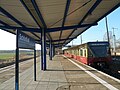
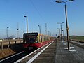
Deutsch: Ansichten des Bahnhofs in Schönfließ, Gemeinde Mühlenbecker Land, Landkreis Oberhavel, Land Brandenburg, Deutschland.
English: Pictures of the train station in Schönfließ, Mühlenbecker Land municipality, Oberhavel district, Brandenburg state, Germany
Français : Photos de la gare à Schönfließ, commune de Mühlenbecker Land, arrondissement de Oberhavel, état fédéral de Brandebourg, Allemagne
Media in category "Bahnhof Schönfließ"
The following 18 files are in this category, out of 18 total.
-
 Bahnhof Schönfließ 2016 SW.jpg 6,693 × 3,144; 6.49 MB
-
 Bahnhof Schönfließ 2016 W.jpg 6,709 × 3,468; 6.26 MB
-
 Berlin S-Bahn Bhf Schönfließ (S08 0146).jpg 5,884 × 3,923; 7.29 MB
-
 BfSchoenfliess.JPG 2,560 × 1,920; 2.94 MB
-
 BfSchoenfliessBstg.JPG 2,560 × 1,920; 2.85 MB
-
 BfSchoenfliessBstg2.JPG 2,560 × 1,920; 2.74 MB
-
 BfSchoenfliessFernbstg.JPG 2,560 × 1,920; 2.9 MB
-
 BfSchoenfliessOsten1.JPG 2,560 × 1,920; 2.87 MB
-
 BfSchoenfliessOsten2.JPG 2,560 × 1,920; 2.98 MB
-
 BfSchoenfliessPassimeter.JPG 2,560 × 1,920; 2.86 MB
-
 BfSchoenfliessSBahn.JPG 2,560 × 1,920; 2.76 MB
-
 BfSchoenfliessStellwerk.JPG 2,560 × 1,920; 2.71 MB
-
 BfSchoenfliessVorplatz.JPG 2,560 × 1,920; 2.89 MB
-
 BfSchoenfliessWesten1.JPG 2,560 × 1,920; 3.03 MB
-
 BfSchoenfliessWesten2.JPG 2,560 × 1,920; 2.88 MB
-
 BR 480 im Bahnhof Schönfließ.jpg 4,128 × 3,096; 3.5 MB
-
 S-Bahnhof Schönfließ.jpeg 4,096 × 1,116; 990 KB
-
 Stellwerk Schönfließ 2019 SSW.jpg 4,864 × 3,648; 6.89 MB


