Category:Bahnhof Eichstätt Stadt
Jump to navigation
Jump to search
| Object location | | View all coordinates using: OpenStreetMap |
|---|

railway halt in the district of Eichstätt, Upper Bavaria, Germany  | |||||
| Upload media | |||||
| Instance of |
| ||||
|---|---|---|---|---|---|
| Named after |
| ||||
| Location | Eichstätt, Upper Bavaria, Bavaria, Germany | ||||
| Owned by | |||||
| Operator | |||||
| Service entry |
| ||||
| Elevation above sea level |
| ||||
| Connecting line |
| ||||
| Adjacent station | |||||
| official website | |||||
 | |||||
Deutsch: Haltepunkt an der Bahnstrecke Eichstätt–Beilngries.
Subcategories
This category has the following 3 subcategories, out of 3 total.
B
- Bahnhofplatz 17 (Eichstätt) (17 F)
E
Media in category "Bahnhof Eichstätt Stadt"
The following 13 files are in this category, out of 13 total.
-
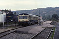 23.09.91 Eichstätt Stadt 627.101 (12952185223).jpg 1,268 × 830; 937 KB
-
 AaIMG 1217 Eichstätt Zug.jpg 2,592 × 1,630; 552 KB
-
 Bahnhof Eichstätt Stadt -2017-08.jpg 1,536 × 2,048; 1.73 MB
-
 Bahnhof Eichstätt Stadt -Neugestaltung Bahnsteig 2018-08.jpg 1,536 × 2,048; 997 KB
-
 GER Eichstätt, Bahnhof Eichstätt-Stadt 001.jpg 4,032 × 3,024; 1.81 MB
-
 GER Eichstätt, Bahnhof Eichstätt-Stadt 002.jpg 4,032 × 3,024; 1.55 MB
-
 GER Eichstätt, Bahnhof Eichstätt-Stadt 003.jpg 4,032 × 3,024; 2.07 MB
-
 GER Eichstätt, Bahnhof Eichstätt-Stadt 007.jpg 4,032 × 3,024; 1.92 MB
-
 GER Eichstätt, Bahnhof Eichstätt-Stadt 008.jpg 3,897 × 2,922; 1.64 MB
-
 GER Eichstätt, Bahnhof Eichstätt-Stadt 009.jpg 3,834 × 2,875; 2.07 MB
-
 GER Eichstätt, Bahnhof Eichstätt-Stadt 010.jpg 3,929 × 2,947; 2.04 MB
-
 GER Eichstätt, Bahnhof Eichstätt-Stadt 011.jpg 4,032 × 3,024; 1.67 MB
-
 Rot, weil gleich kommt der Zug.. - panoramio.jpg 682 × 1,559; 243 KB
.jpg)


