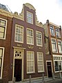
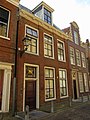
Category:Bagijnestraat 52, Leeuwarden
Jump to navigation
Jump to search
| Object location | | View all coordinates using: OpenStreetMap |
|---|
 | |||||
| Upload media | |||||
| Instance of |
| ||||
|---|---|---|---|---|---|
| Location | Leeuwarden, Friesland, Netherlands | ||||
| Street address |
| ||||
| Located on street | |||||
| Heritage designation |
| ||||
 | |||||
|
This is a category about rijksmonument number 24100
|
| Address |
|
Media in category "Bagijnestraat 52, Leeuwarden"
The following 6 files are in this category, out of 6 total.
-
 2023 Ljouwert, Beginestrjitte 52.jpg 1,958 × 2,716; 1.56 MB
-
 Leeuwarden Bagijnestraat 52.jpg 3,000 × 4,000; 1,021 KB
-
 Leeuwarden Bagijnestraat 54.jpg 3,000 × 4,000; 1.24 MB
-
 Overzicht Bagijnestraat - Leeuwarden - 20130490 - RCE.jpg 1,200 × 1,197; 320 KB
-
 Overzicht Bagijnestraat - Leeuwarden - 20130491 - RCE.jpg 1,185 × 1,200; 307 KB
-
 Voorgevels - Leeuwarden - 20132237 - RCE.jpg 810 × 1,200; 201 KB


