Category:Badley
Jump to navigation
Jump to search
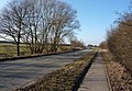
English: Badley is a village and civil parish in Suffolk, England. It is located between Stowmarket and Needham Market, in the Mid Suffolk district. With an electorate of less than 100, it has an infrequent parish meeting rather than a parish council.
village in the United Kingdom | |||||
| Upload media | |||||
| Instance of | |||||
|---|---|---|---|---|---|
| Location | Mid Suffolk, Suffolk, East of England, England | ||||
| Population |
| ||||
 | |||||
Subcategories
This category has the following 2 subcategories, out of 2 total.
H
- Badley Hall (3 F)
M
- St Mary, Badley (11 F)
Media in category "Badley"
The following 63 files are in this category, out of 63 total.
-
 B1113 Stowmarket Road and Bus Stop - geograph.org.uk - 4513343.jpg 3,072 × 2,304; 1.84 MB
-
 B1113 Stowmarket Road ^ Bus Stop - geograph.org.uk - 4513384.jpg 3,072 × 2,304; 1.81 MB
-
 B1113 Stowmarket Road, Badley - geograph.org.uk - 4976687.jpg 3,072 × 2,175; 2.43 MB
-
 B1113 Stowmarket Road, Creeting St Mary - geograph.org.uk - 4513337.jpg 3,072 × 2,304; 1.77 MB
-
 B1113 Stowmarket Road, Creeting St Mary - geograph.org.uk - 4513379.jpg 3,072 × 2,304; 1.73 MB
-
 B1113 towards Stowmarket - geograph.org.uk - 1715314.jpg 1,024 × 711; 513 KB
-
 Badley church across a ploughed field - geograph.org.uk - 6609540.jpg 4,032 × 3,024; 2.91 MB
-
 Badley church interior - geograph.org.uk - 6609541.jpg 4,032 × 3,024; 2.06 MB
-
 Badley Church, Badley - geograph.org.uk - 4976745.jpg 3,072 × 2,304; 1.78 MB
-
 Badley Church, Badley - geograph.org.uk - 4976748.jpg 2,304 × 3,072; 1.85 MB
-
 Badley Church, Badley - geograph.org.uk - 4976763.jpg 3,072 × 2,304; 1.86 MB
-
 Badley Church, Badley - geograph.org.uk - 4976791.jpg 3,072 × 2,304; 1.8 MB
-
 Badley Green Farm - geograph.org.uk - 6062927.jpg 6,777 × 4,517; 6.94 MB
-
 Badley Hall farm - geograph.org.uk - 6722952.jpg 800 × 533; 187 KB
-
 Badley Lane Bridleway, Badley - geograph.org.uk - 4976698.jpg 3,072 × 2,304; 2.71 MB
-
 Badley Lane Bridleway, Badley - geograph.org.uk - 4976704.jpg 3,072 × 2,304; 1.68 MB
-
 Badley Lane Bridleway, Badley - geograph.org.uk - 4976739.jpg 3,072 × 2,304; 1.98 MB
-
 Badley Lane Bridleway, Badley - geograph.org.uk - 4976781.jpg 3,072 × 2,142; 1.98 MB
-
 Badley Lane footpath - geograph.org.uk - 4976776.jpg 3,072 × 2,304; 1.92 MB
-
 Badley walk and Badley Walk Postbox - geograph.org.uk - 4513401.jpg 3,072 × 2,304; 1.88 MB
-
 Badley Walk and Badley Walk Postbox - geograph.org.uk - 4513409.jpg 3,072 × 2,304; 1.94 MB
-
 Badley Walk footpath - geograph.org.uk - 4513376.jpg 2,240 × 2,978; 1.99 MB
-
 Badley Walk footpath - geograph.org.uk - 4976850.jpg 2,304 × 3,072; 4.05 MB
-

-
 Badley Walk Postbox - geograph.org.uk - 4513364.jpg 3,072 × 2,304; 1.98 MB
-
 Badley Walk Postbox - geograph.org.uk - 4513411.jpg 2,291 × 3,046; 4.58 MB
-
 Badley Walk Postbox - geograph.org.uk - 4976836.jpg 3,072 × 2,304; 1.96 MB
-
 Badley Walk Postbox - geograph.org.uk - 4976840.jpg 3,072 × 2,304; 1.85 MB
-
 Badley Walk Postbox - geograph.org.uk - 4976843.jpg 2,304 × 3,072; 4.5 MB
-
 Badley Walk Postbox - geograph.org.uk - 4976846.jpg 2,227 × 2,956; 3.17 MB
-
 Badley Walk Postbox - geograph.org.uk - 4976871.jpg 2,304 × 3,072; 4.14 MB
-
 Badley Walk sign - geograph.org.uk - 4513371.jpg 3,007 × 2,253; 3.2 MB
-
 Badley Walk sign - geograph.org.uk - 4976870.jpg 2,912 × 2,181; 3.62 MB
-
 Bridlepath Sign - geograph.org.uk - 1766070.jpg 1,200 × 1,600; 663 KB
-
 Bridleway sign on Badley Hill - geograph.org.uk - 4976788.jpg 2,218 × 2,967; 3.72 MB
-
 Bus Stop sign on the B1113 Stowmarket Road - geograph.org.uk - 4513348.jpg 2,304 × 3,072; 2.9 MB
-
 Cut Mark Badley St Marys Church - geograph.org.uk - 5487820.jpg 1,284 × 1,600; 833 KB
-
 Farmland towards woodland - geograph.org.uk - 4483581.jpg 640 × 390; 47 KB
-
 Fields and woodland, Badley - geograph.org.uk - 2471997.jpg 3,648 × 2,048; 2.32 MB
-
 Follow The Country Code - geograph.org.uk - 1766051.jpg 1,600 × 1,200; 683 KB
-
 Footpath and cottage - geograph.org.uk - 1763939.jpg 1,600 × 1,200; 610 KB
-
 Footpath sign on Badley Walk - geograph.org.uk - 4513405.jpg 2,265 × 3,011; 2.3 MB
-
 Footpath sign on Badley walk footpath - geograph.org.uk - 4976857.jpg 2,253 × 2,995; 4.66 MB
-
 Grave of Francis Gordon Haydon - geograph.org.uk - 6571161.jpg 1,873 × 2,290; 1.93 MB
-
 Grazing near Cherry Tree Farm - geograph.org.uk - 4483585.jpg 640 × 434; 57 KB
-
 Grazing near the River Gipping - geograph.org.uk - 4483587.jpg 640 × 472; 58 KB
-

-
 Map on the footpath sign - geograph.org.uk - 4976863.jpg 3,072 × 2,304; 1.92 MB
-
 Nr Battisford, Badley Lane - geograph.org.uk - 6062933.jpg 6,075 × 4,050; 6.72 MB
-
 Nr Battisford, Small pond in Badley Lane - geograph.org.uk - 6062934.jpg 6,729 × 4,486; 6.86 MB
-
 Peep past roadside trees - geograph.org.uk - 995195.jpg 640 × 454; 119 KB
-
 Ploughed fields near Badley - geograph.org.uk - 6609547.jpg 4,032 × 3,024; 3.53 MB
-
 Porch of Badley Church - geograph.org.uk - 4976754.jpg 2,304 × 3,072; 1.83 MB
-
 Power lines from the track to Badley Church - geograph.org.uk - 2471957.jpg 3,648 × 2,048; 1.93 MB
-
 Pylons - geograph.org.uk - 1766040.jpg 1,200 × 1,600; 397 KB
-

-
 Roadsign on Badley Lane - geograph.org.uk - 4976790.jpg 2,277 × 3,039; 3.5 MB
-
 Stowmarket Road, Badley - geograph.org.uk - 2472028.jpg 3,648 × 2,736; 2.97 MB
-
 Track from Badley church in the snow - geograph.org.uk - 1144795.jpg 470 × 640; 62 KB
-

-
 Track to Badley Church - geograph.org.uk - 2471988.jpg 3,648 × 2,736; 2.45 MB
-
 View SSE from Badley track - geograph.org.uk - 613864.jpg 640 × 514; 76 KB
-


